

 Home
HomeGeographical Surveying
In order to completely solve the pain points of traditional satellites and manned SAR, such as poor timeliness, insufficient flexibility, and high cost, the YunInsar airborne dual band interferometric SAR system has emerged, integrating dual band, high-precision interferometric measurement, and lightweight body to create an efficient and flexible high-precision ground observation solution.
1、 Dual band collaboration: combination of X-band and P-band
Airborne SAR can be divided into short bands (such as X-band and C-band) and long bands (such as L-band and P-band) based on the differences in operating bands. Short band SAR is good at capturing surface details; Long band SAR can penetrate vegetation and surface cover layers. YunInsar's core advantage lies in combining the two into one.
X-band (9.6GHz)
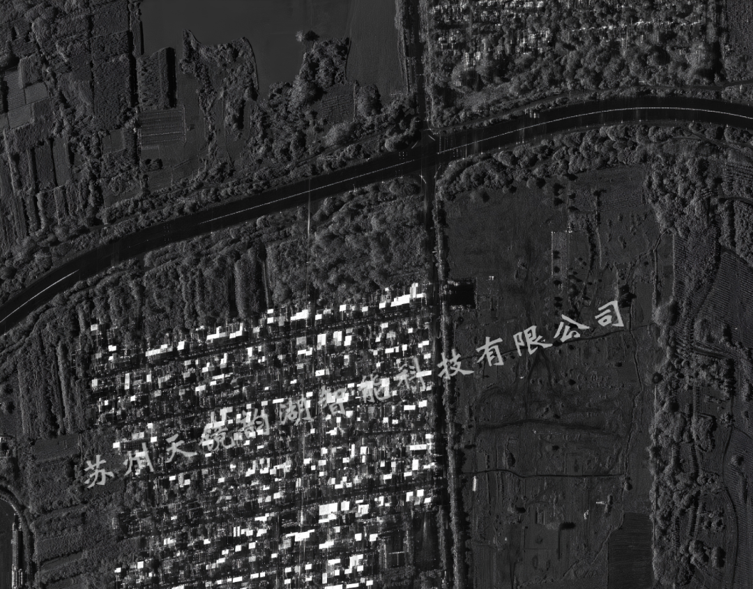
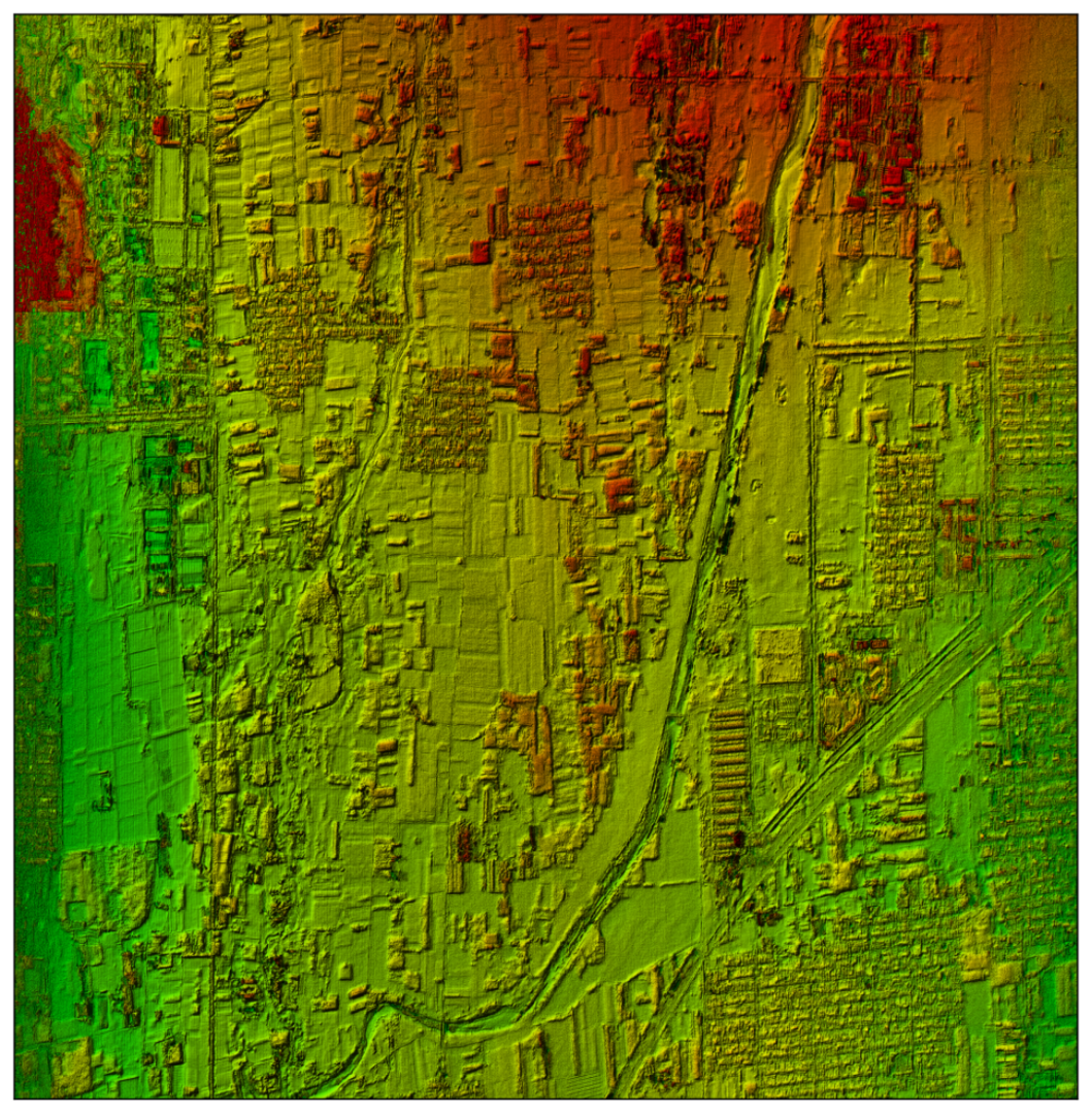
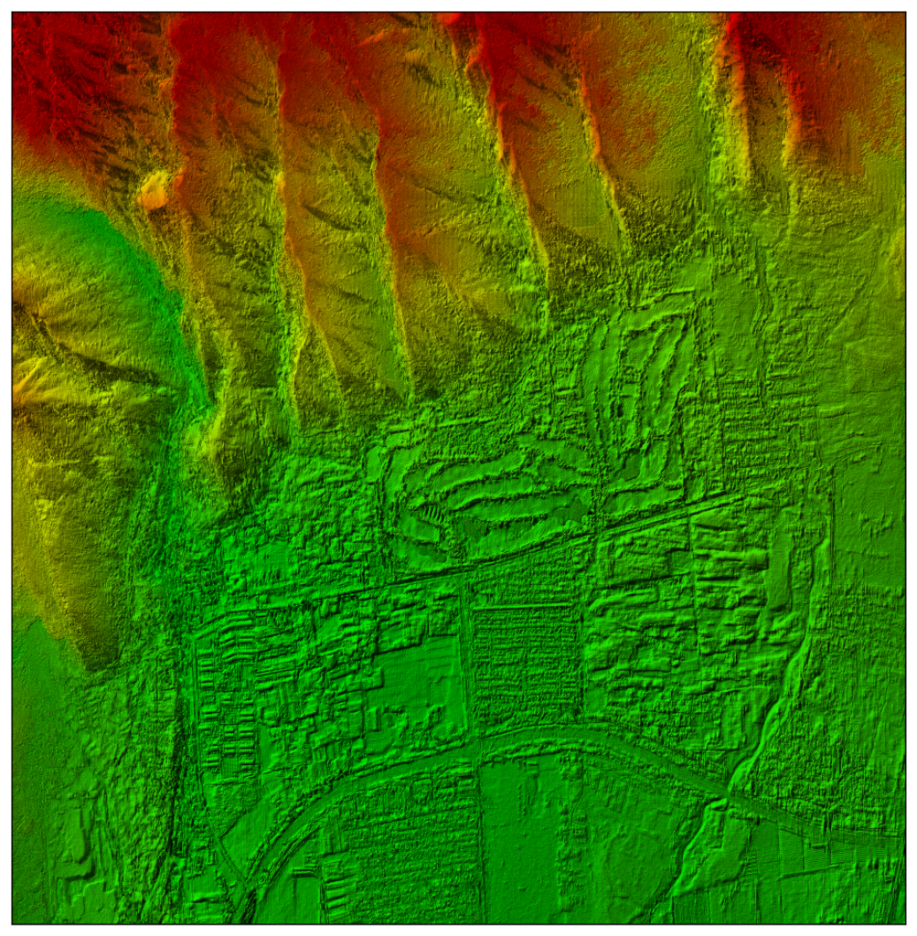
Short wave high-resolution, with a planar resolution of 0.25m, accurately reproduces the contours of buildings, roads, and subtle gaps in bridges, and produces high-precision digital terrain models (DSM).
P-band (600MHz)
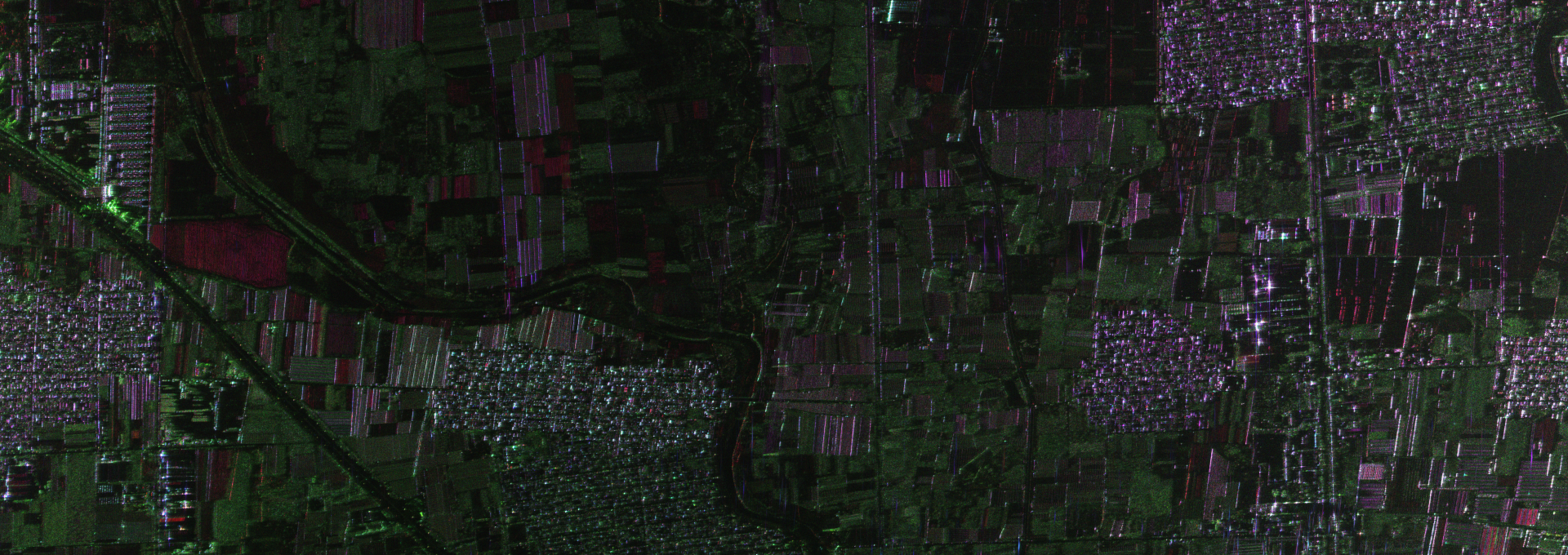
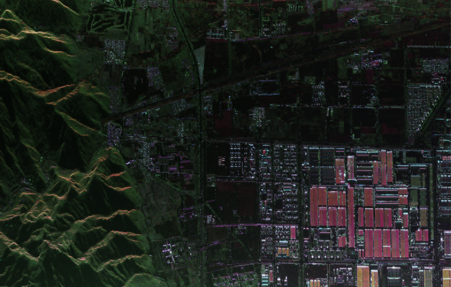
Long wave strong penetrability, can penetrate vegetation canopy and dry soil, extract real terrain under forests, support fully polarized land classification, and restore underground landforms that are "invisible" to optical radar.
|
|
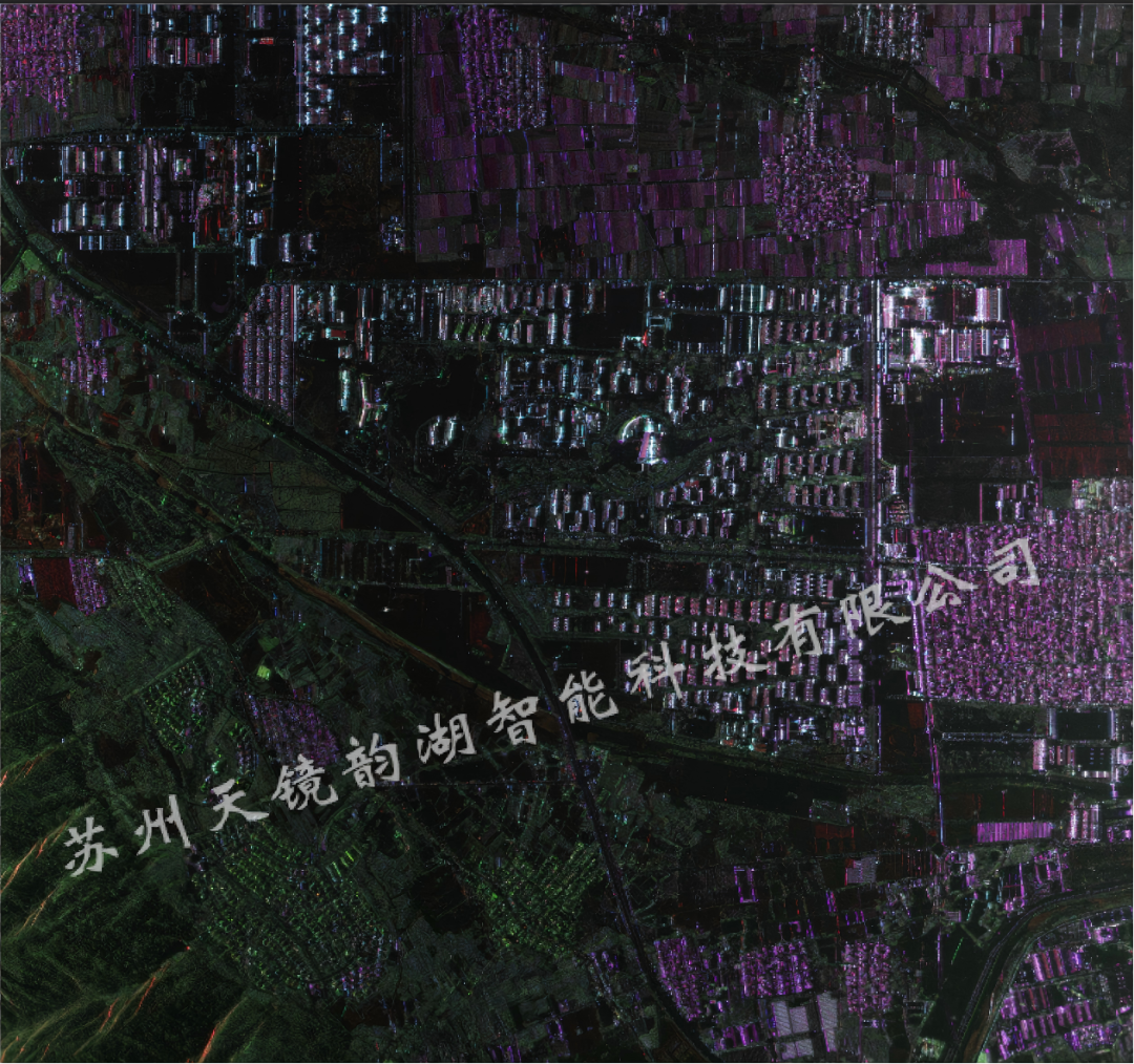 |
| X-band DOM | P-band fully polarimetric imaging results |
Dual band parallel operation, synchronized with single flight to obtain surface details and deep terrain data, with industry-leading technological advantages.
2、 Four core innovative technologies to strengthen the foundation of high-precision surveying and mapping
1. Dual band integrated high-density integration
The weight of the entire equipment is ≤ 150kg, the power consumption is ≤ 3kW, and it is suitable for unmanned aerial vehicles with a maximum altitude of 7000m and a flight speed of 70-140m/s; Modular disassembly of RF, antenna, power supply, etc. for easy maintenance and upgrading.
2. Layout of long baseline cross track interference antenna
Optimize antenna baseline design to ensure high coherence of interference phase, with elevation accuracy better than 0.5 meters at 5000m altitude.
3. Second level echo motion compensation algorithm
To address the issues of airflow disturbance and irregular trajectory of unmanned aerial vehicles, eliminate platform motion errors, and stabilize imaging and interference accuracy.
4. Full polarization high-precision calibration
Strictly control polarization amplitude and phase errors, accurately extract multi polarization data, and support ground object identification and classification.
3、 Hardcore test performance, all indicators meet or even exceed expectations
|
Indicator Category |
Specific Indicators |
Design Requirements |
Measured Results |
Evaluation |
|
Resolution |
X band interferometric planar resolution |
≤ 0.25m |
0.25m |
Compliant |
|
P band polarimetric planar resolution |
≤ 0.8m |
0.8m |
Compliant |
|
|
Accuracy Indicator |
X band elevation accuracy (@5000m) |
≤ 0.5m |
≤ 0.5m |
Compliant |
|
X band planar accuracy (CE90) |
≤ 1.5m |
1.5m |
Compliant |
|
|
Mapping Capability |
Operating range |
≥ 25km |
25km+ |
Better than expected |
|
Single-side swath width (@5000m) |
≥ 4km |
4km+ |
Better than expected |
|
|
Dual-side swathwidth (@5000m) |
≥ 8km |
8km+ |
Better than expected |
|
|
Platform Performance |
Equipment weight |
≤ 150kg |
150kg |
Compliant |
|
System power consumption |
≤ 3kW |
≤ 3kW |
Compliant |
|
|
Continuous operation time |
≥ 6hour |
6hour+ |
Better than expected |
|
|
Data Quality |
Polarimetric calibration accuracy |
Amplitude imbalance ≤ 0.5dB, phase imbalance ≤ 10 °, isolation ≤ -25dB |
All Compliant |
Compliant |
|
Mapping Specifications |
Geometric measurement accuracy |
Meets the requirements for 1:2000/1:5000/1:10000 scales |
Satisfied |
Compliant |
The planar resolution of 0.25 m in the X-band has reached the level of high-resolution observation and can clearly identify fine ground targets; The resolution of 0.8 m in the P-band is also in a leading position in long band SAR. The elevation accuracy is better than 0.5 meters, which can meet the mapping specification requirements of 1:2000 to 1:10000 scale.
4、 Multi domain landing application scenarios
1. High precision terrain mapping
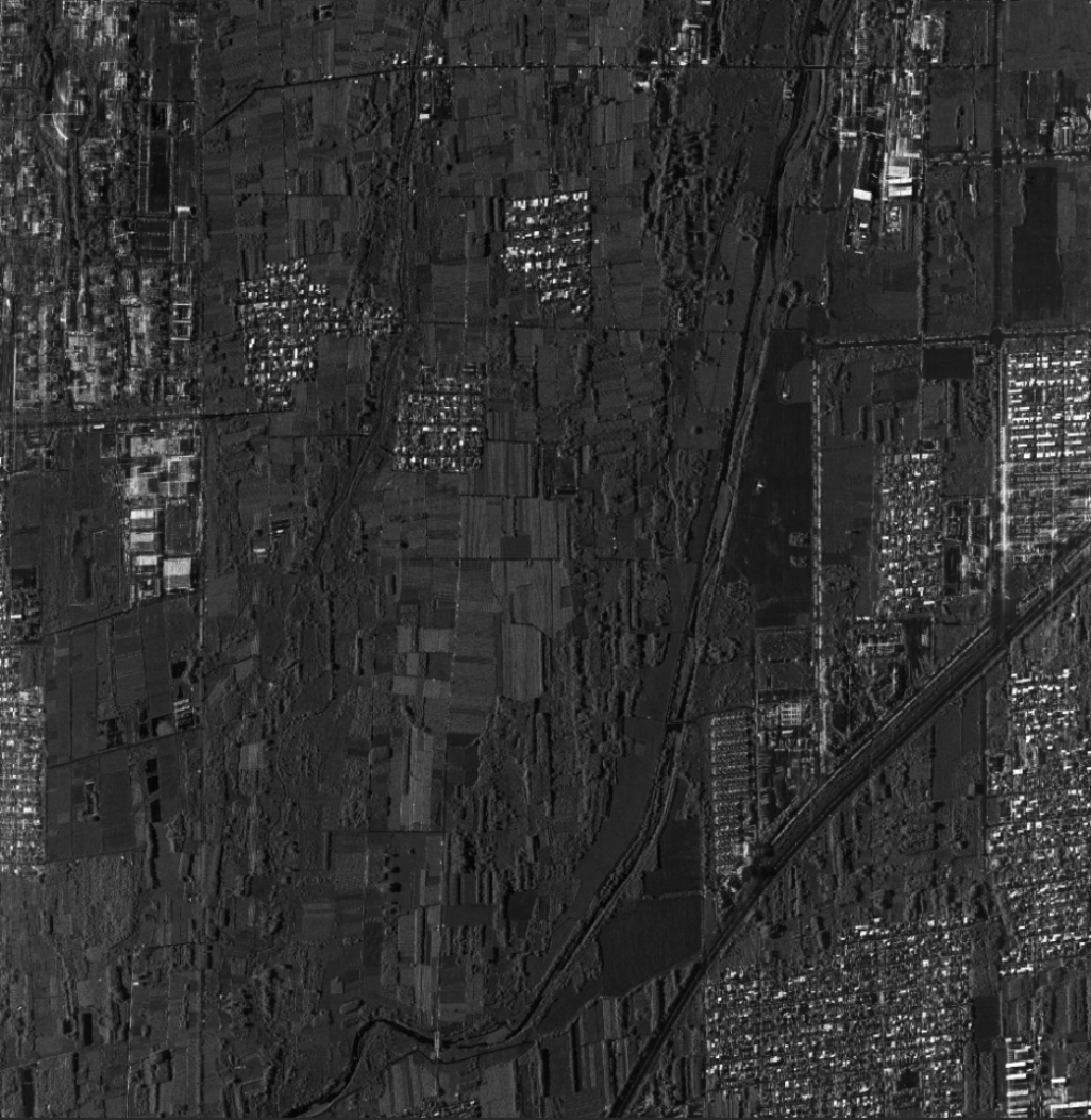
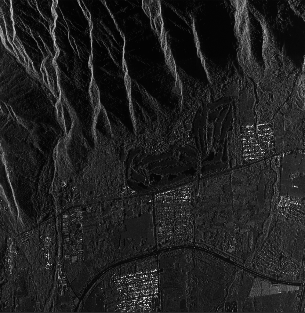
Fearless of clouds, mist, and rain, it can quickly produce large-scale DEM/DSM in a single flight, suitable for areas with multiple rain and fog where optical remote sensing cannot operate.
 |
 |
 |
 |
2. Investigation of Forestry Resources
P-band penetrates through trees to obtain understory terrain, supporting forest stock volume statistics and forest carbon sink calculations.
3. Emergency rescue and disaster relief
Drones are quickly deployed, providing all-weather imaging to obtain comprehensive disaster images in the first time after a disaster, assisting in rescue command and decision-making.
5、 Achievements and Future Prospects
After multiple rounds of flight testing, all core performance indicators of YunInsar have reached or even exceeded the design standards, and it has the capability for large-scale engineering applications. We will continue to iterate imaging algorithms and conduct multi scenario test flights to provide stronger high-precision remote sensing technology support for industries such as surveying, forestry, geological exploration, and emergency disaster prevention.


