Synthetic Aperture Radar (SAR) is an advanced radar technology capable of penetrating darkness and fog to acquire high-resolution images of the Earth's surface. It transmits pulse signals from airborne or ground-based platforms and analyzes the reflected phase and amplitude information to construct detailed ground images. SAR is widely used in remote sensing mapping, geological exploration, disaster monitoring, and national defense.
In recent years, with the leap in performance of UAV platforms and breakthroughs in the miniaturization of micro SAR systems, integrating lightweight SAR payloads into industrial-grade UAVs has become an important trend in the practical application of remote sensing technology. Based on the superior performance of DJI's new generation industrial UAV, the M400, our company has launched an airborne MiniSAR system that is deeply adapted to it. This article will analyze the practical value of this combination, focusing on its technical compatibility, imaging performance, and core application scenarios.
I. Platform Performance Matching
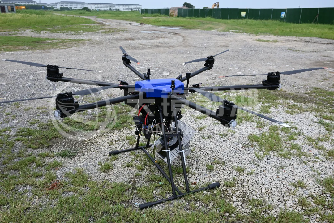
The DJI M400, designed for industrial-grade missions, boasts a maximum payload capacity of 6kg, a 59-minute unloaded flight time, and maintains an effective operational window of over 30 minutes even under full load. Coupled with its IP55 protection rating and level 6 wind resistance, it demonstrates exceptional flight stability even in complex weather conditions such as rain, snow, and strong winds.
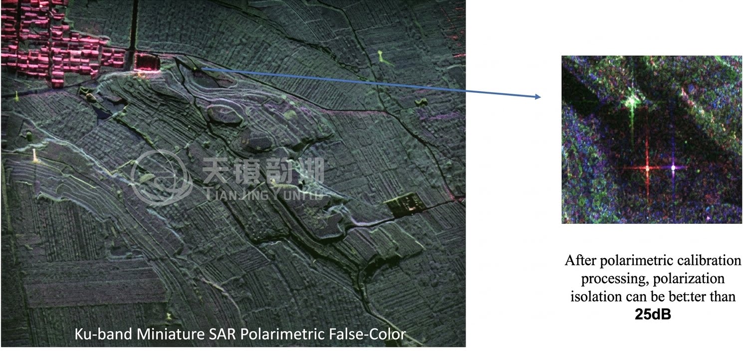
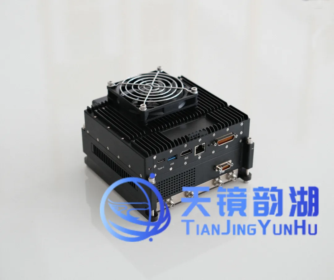
Our LingYun System LY1B airborne MiniSAR system weighs under 2.7kg, with its core advantages of low SWaP (small size, light weight, and low power consumption), perfectly matching the M400's payload margin and power budget. The system supports multiple imaging modes, including single polarization, full polarization, stripmap, and spotlight, and possesses real-time image processing capabilities, laying a solid foundation for high-frequency, high-precision routine operations.
II. System Integration Space
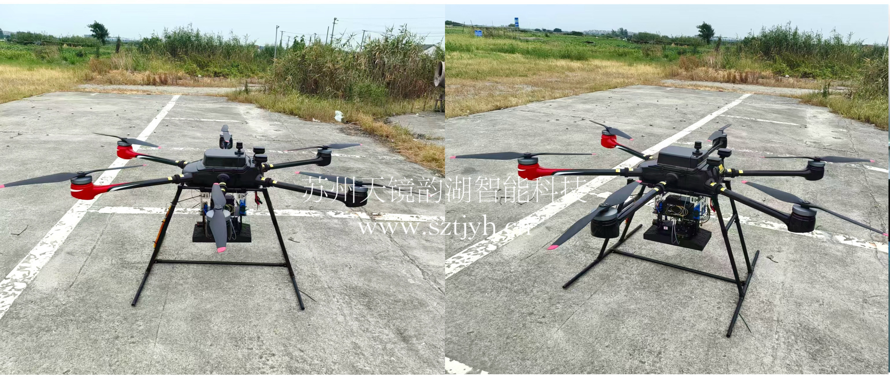
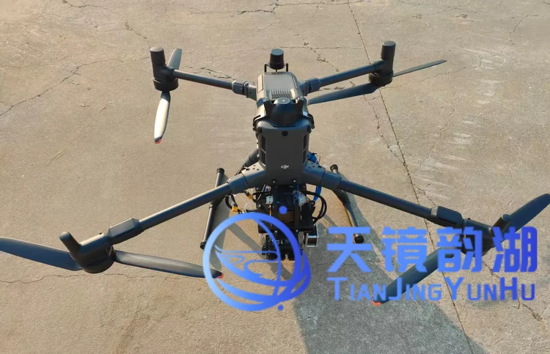
The M400 fuselage is reserved for abundant expansion interfaces and gimbal mounting positions, and its open architecture makes SAR payload integration more efficient. Our micro MiniSAR can be quickly installed on the gimbal position on the belly of the drone through a customized vibration-absorbing pylon, and achieves seamless connection between power supply and data transmission through a universal bus link.
After this system has been verified by field flights on multiple sorties and subjects, the flight attitude control of the entire system has not been significantly affected by the addition of micro MiniSAR. The stability fully meets the operational standards of surveying, mapping, emergency response, inspection and other industries, verifying the stability and feasibility of this system.
III. Imaging Effect
Unlike optical and infrared sensors, SAR technology relies on microwave imaging, which possesses inherent penetrating power. Even under extreme conditions where optical methods fail, such as rain, snow, fog, haze, and nighttime, the miniaturized MiniSAR system can still operate stably.
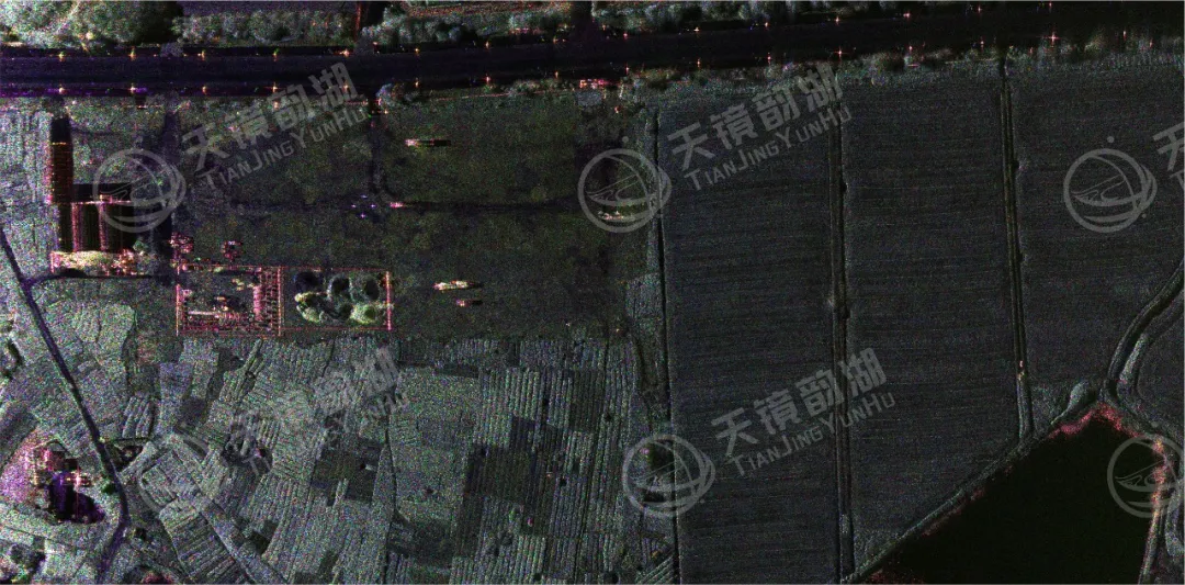
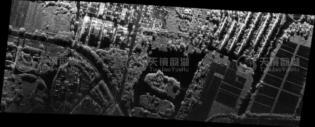
Field test data shows that the weight-reduced MiniSAR system mounted on the M400 can output high-resolution images with clear textures and excellent contrast for ground vehicle targets, vegetation-covered areas, and building-covered areas, truly achieving "imaging in flight, usable immediately upon imaging," providing users with timely intelligence support around the clock and in all weather conditions.
IV. Core Technological Advantages
Lightweight Design, Flexible Platform Adaptation
The miniature SAR system adopts a highly integrated design, with a compact size and a weight as low as 2.7kg. It can be flexibly mounted on drones, satellites, vehicles, and even handheld terminals, significantly lowering the deployment threshold and enabling rapid "plug-and-play" operation.
All-Weather Operation, Overcoming Environmental Limitations
SAR actively emits microwave signals, unaffected by light, clouds, fog, rain, snow, or other weather conditions. It possesses the ability to penetrate clouds, smoke, and sparse vegetation, truly achieving stable imaging around the clock and in all weather conditions.
High-Resolution Imaging, Precise Detail Representation
Actual imaging results can clearly identify minute deformations of buildings, texture features of crops, and vehicle outlines, meeting the needs of refined monitoring and identification.
V. Core Application Scenarios
The combination of the miniature MiniSAR and the M400 pushes mobility and sensing capabilities to new heights. The system can penetrate deep into areas inaccessible to personnel, such as forests, mountains, and coastlines, performing penetrating detection and refined observation. In emergency rescue, facility inspection, and other scenarios, this combination has demonstrated irreplaceable value:
1. Surveying and Resource Exploration
High-precision topographic mapping
Geological and mineral exploration
Urban planning and monitoring
2. Infrastructure Inspection
Power line inspection
Oil and gas pipeline monitoring
Transportation infrastructure monitoring
3. Disaster Assessment and Early Warning
Flood disaster assessment
Forest fire monitoring
Landslide and earthquake monitoring
SAR technology endows UAVs with "all-day, all-weather" observation capabilities, while the DJI M400 provides stable, long-endurance, and highly scalable flight capabilities. This high degree of integration not only lowers the barrier to entry for high-performance radar remote sensing but also signifies that all-weather, all-terrain data acquisition capabilities are becoming commonplace.
Suzhou Tianjing Yunhu Intelligent Technology Co., Ltd. focuses on the research and application of miniature synthetic aperture radar (SAR). Founded by senior SAR professionals from renowned domestic universities and research institutions such as the Chinese Academy of Sciences, the team possesses years of R&D experience and extensive market resources in the field of synthetic aperture radar. The company boasts a product portfolio including Lingyun, Xiangyun, Yunying, and Yunyuan, covering the entire spectrum of P, L, S, C, X, Ku, Ka, and W bands. It is compatible with various technologies such as real-time imaging, moving target detection (GMTI), active phased array, and differential interferometric imaging (DInSAR), achieving resolutions up to the centimeter level. The products are characterized by lightweight design, multi-mode operation, high performance, and low power consumption, reaching industry-leading levels. They are specifically designed for various types of UAVs and low-altitude work platforms.