Tianjing Yunhu | P-band Airborne SAR Radar System

Browse: 107 Time: 2026-08-26

Low-frequency radars (such as P-band and L-band radars) can "see farther and see more clearly" because of their longer wavelengths, lower attenuation, and reduced sensitivity to stealth coatings. In modern air defense systems, they are key to anti-stealth radars. They can penetrate 1-meter-thick camouflage netting and 3-meter-thick bushes to identify hidden tanks and radar stations, and are less likely to trigger enemy warning systems, demonstrating significant advantages in covert detection.
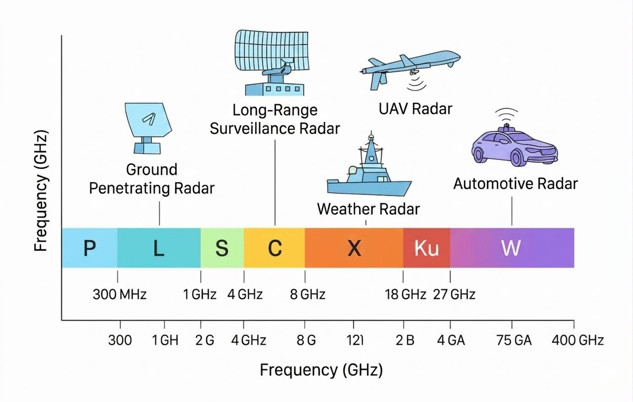
Radar frequency diagram

Basic Characteristics of P-Band Radar

P-band radar typically operates in the frequency range of 300MHz to 1GHz. This band is like a long-distance runner in the field of radio: it has higher resolution than low-frequency radar and stronger penetration than high-frequency radar. Its typical characteristics include:

Wavelength range: 30cm to 1m;

Atmospheric attenuation: Approximately 0.01dB/km attenuation in rain;

Common applications: Hydrological research, archaeology, and underground exploration.

Unique advantages in penetration ability

P-band radar can penetrate vegetation and shallow ground surfaces, mainly due to:

Medium penetration: It can penetrate several meters of dry sand;

Leaf penetration: It can penetrate up to 80% of the tree height in broad-leaved forests;

Interference resistance: It is only 1/5 as susceptible to atmospheric turbulence as the X-band.

Typical Applications of P-Band Radar

Numerous international test cases exist, such as:

A 2018 helicopter-borne test in the Moroccan desert (450/860 MHz) verified the performance and underground detection capabilities of the P-band;

In geological exploration in the Inner Mongolian grasslands of my country, P-band SAR penetrated a 3-meter-thick layer of dry clay, discovering an underground coal seam outcrop;

MetaSensing's MetaSAR-P airborne multi-channel SAR, operating in the P-band, also explicitly claims sand penetration capability.

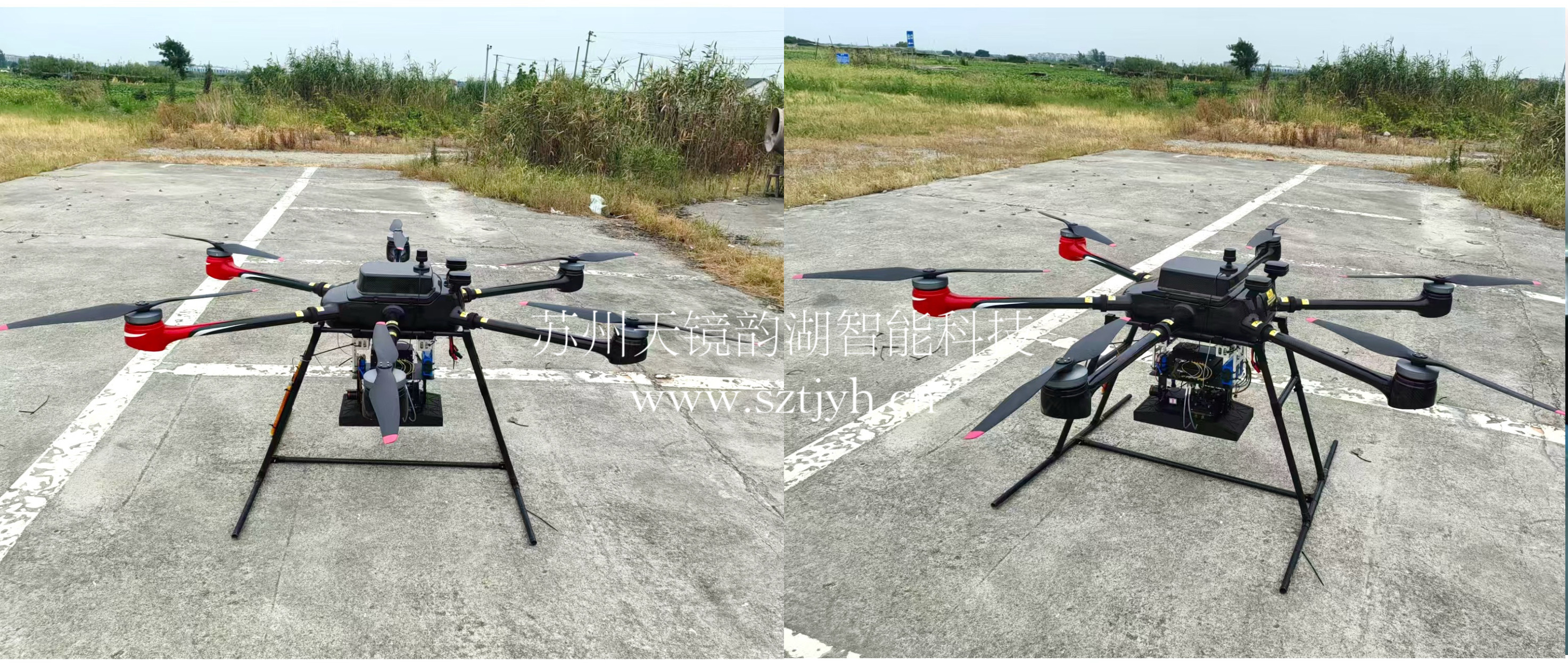
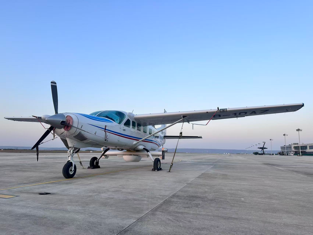
The P-band airborne synthetic aperture radar system developed by Tianjing Yunhu features long operating range, high resolution, and low power consumption. This system has undergone multiple flight tests and can be flexibly mounted on various platforms such as UAVs and helicopters to achieve rapid, large-scale data acquisition. The structural design employs a quick-release architecture, allowing for rapid installation on the underside of UAVs without specialized tools, significantly improving the efficiency of field operations.
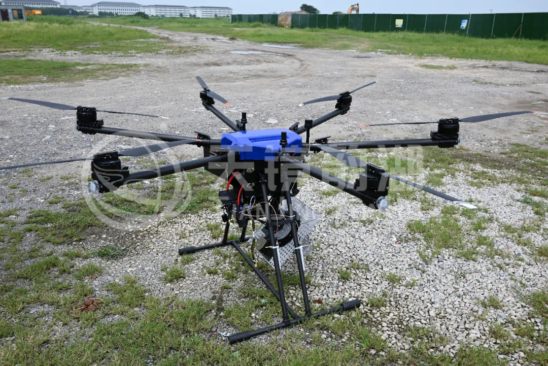
System installation diagram
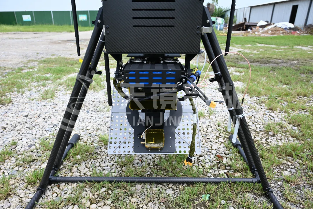
                                            System installation diagram

P-band radar, with its powerful penetrating capabilities, offers significant advantages in information acquisition during archaeological explorations involving shallow burial sites, small scales, and inconspicuous differences in physical properties. This technology requires no excavation or contact with the artifact itself, aligning with the "minimum intervention principle" of cultural heritage protection, and is particularly suitable for the protective exploration of immovable artifacts and fragile sites.

It is worth mentioning that Tianjing Yunhu previously successfully completed a P-band airborne radar underground structure information acquisition project in Minqin, Gansu, obtaining relatively ideal imaging results. In actual operation, the system not only boasts fast data acquisition speed but also the ability to process and generate real-time data on-site, fully verifying its feasibility and effectiveness in real-world archaeological scenarios.
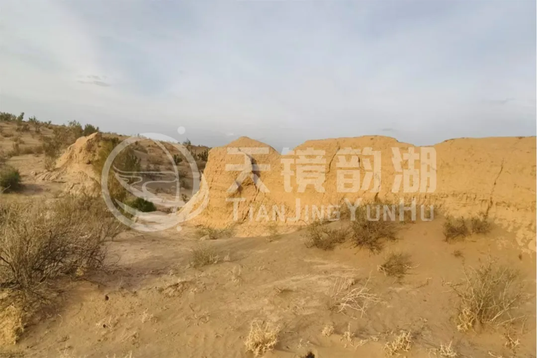
Test environment
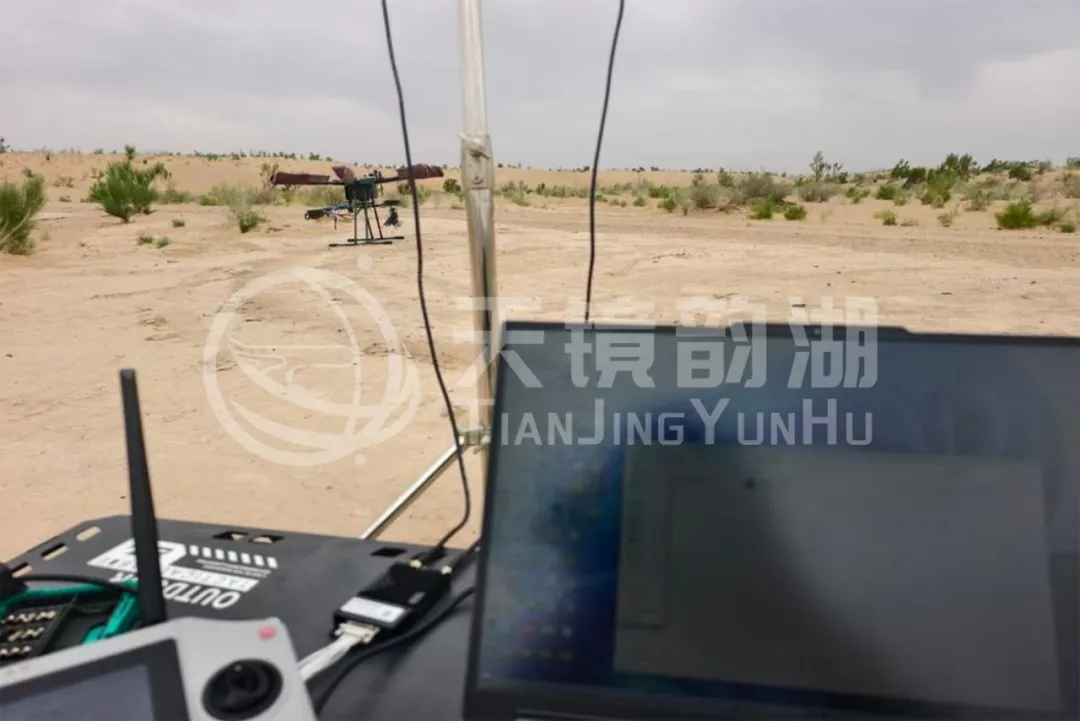
                                                 Test environment

The flight path is designed for unilateral flight, and data collection is performed using an automatic flight path mode. The flight altitude is 300m, the downward angle is 50 degrees, and the flight path is quadrilateral.
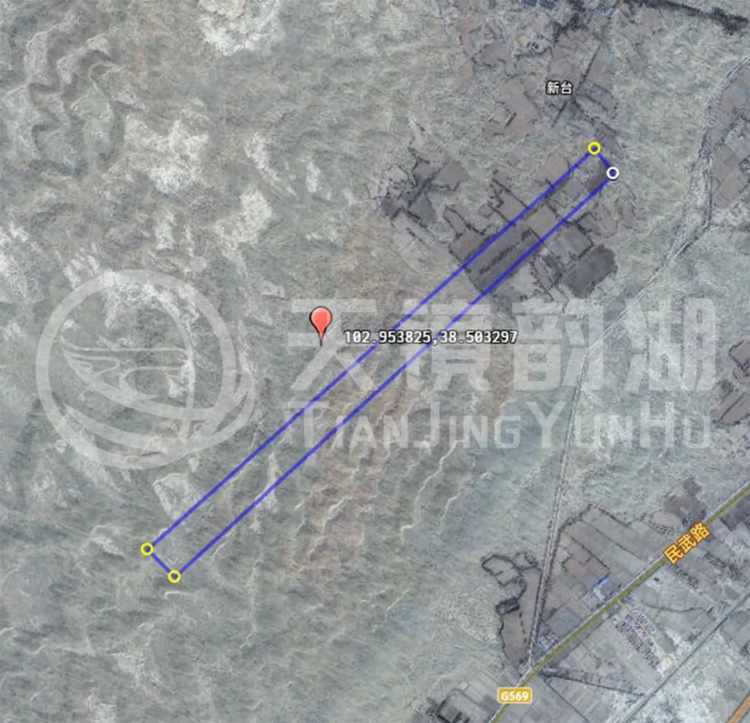
Route planning
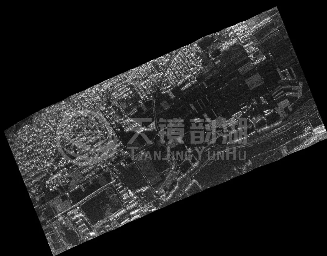
                                               Imaging effect

P-band radar, acting as a "X-ray vision" for acquiring underground information, has enabled a shift from "passive protection" to "active exploration" in fields such as archaeological discoveries, architectural preservation, and cultural relic detection through non-destructive detection technology. It not only provides solid support for the scientific protection of cultural heritage but also opens new paths for understanding the spatial forms and evolution of human history and civilization. In the future, with the development of intelligent and integrated technologies, P-band radar will play a crucial role in even more application scenarios.

Related Information

Related Information
2026.08.28

Tianjing Yunhu | MiniSAR: Full Polarimetric Imaging Capability

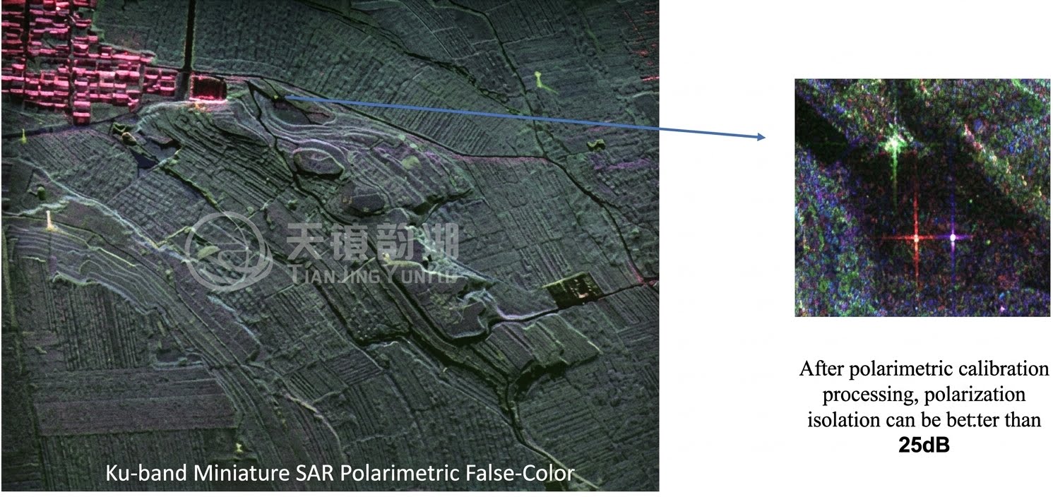
In the field of remote sensing today, synthetic aperture radar (SAR), visible light, and infrared together form a multi-layered observation system. Visible light remote sensing is intuitive and clear, while infrared remote sensing excels at thermal sensing. However, both are passive detection methods, heavily reliant on sunlight or the target's own thermal radiation. Once they encounter cloud cover, nightfall, or rainy/foggy weather, their detection capabilities are significantly reduced or even completely lost.
2026.08.21

Tianjing Yunhu | Miniature SAR Vehicle Target Dataset

Synthetic Aperture Radar (SAR) target detection datasets are a core foundation for training and evaluating deep learning models. These datasets cover various target types, including ships, aircraft, vehicles, bridges, and oil tanks, and are applicable to multiple fields such as military reconnaissance, maritime monitoring, and traffic management. They not only provide high-resolution SAR images but also contain precise annotation information (category, location, size, etc.), ensuring improved algorithm performance.
2026.08.17

Tianjing Yunhu | Miniature SAR Equipped with Fixed-Wing UAV

Today's main focus is on the CW-25E VTOL fixed-wing UAV and the Tianjing Yunhu XiangYun System pulse MiniSAR.

The CW-25E is a pure electric VTOL fixed-wing UAV designed specifically for large-area missions. It has a fuselage length of 2.08 meters, a wingspan of 4.35 meters, and features a twin-boom fused inverted V-tail design, resulting in a compact structure and excellent aerodynamic performance.

The CW-25E has a maximum takeoff weight of 31.58 kg and a payload capacity of 6.6 kg, capable of simultaneously carrying various mission equipment such as SAR, lidar, and electro-optical pods. It boasts a maximum endurance of 150 to 240 minutes, a service ceiling of 6000 meters, a maximum takeoff altitude of 4000 meters, and wind resistance up to level 7. It can stably perform patrol missions in complex terrain and high-altitude areas.
2026.07.18

Tianjing Yunhu | Airborne SAR (Synthetic Aperture Radar) Calibration Capability

Airborne SAR (Synthetic Aperture Radar) calibration refers to the calibration of various parameters of an airborne SAR system using specific methods to eliminate systematic and environmental errors, thereby ensuring the quality of SAR images, positioning accuracy, and the accuracy of inversion parameters. Airborne SAR calibration is mainly divided into three categories: geometric calibration, radiometric calibration, and polarimetric calibration.
2026.07.13

UAV L-band Heavy Orbit Interferometric SAR System: Airborne Verification for Millimeter-Level Deformation Monitoring

Synthetic Aperture Radar Interferometry (InSAR) technology, with its all-weather, 24/7 capability and high sensitivity to surface deformation, has become an important tool for geological hazard monitoring, ground subsidence investigation, and infrastructure health diagnosis. Integrating InSAR technology onto unmanned aerial vehicle (UAV) platforms further overcomes the limitations of long satellite revisit cycles, insufficient maneuverability, and high costs associated with manned operations, providing a new approach for regional, high-frequency, and high-precision deformation monitoring. However, the small size and susceptibility of UAV platforms to airflow disturbances make it difficult to maintain consistent flight paths during repeated flights, posing a significant challenge to double-track interferometry processing.
2026.07.10

Tianjing Yunhu: YunInsar Airborne Dual-Band Interferometric SAR System

Synthetic Aperture Radar (SAR), as an active microwave remote sensing system, can actively transmit microwaves and receive echoes reflected from targets, unaffected by lighting or weather conditions, enabling rapid imaging in all weather conditions and at all times. When SAR technology is deeply integrated with UAV platforms, it overcomes many limitations of traditional satellite and manned aircraft SAR in terms of timeliness, flexibility, and cost.
Tianjing Yunhu: YunInsar Airborne Dual-Band Interferometric SAR System

Online Message

Company Address

Company Address

Room 801, Building 14, No. 135 Zhangji Road, Kunshan Development ZoneView the map
Emaile

Email

tjyh888@139.com
Postal Code

Postal Code

215300
Sales contact information

Sales contact information

  • Sales 1:18252999418 (same WeChat)
  • Sales 2:13126758269 (same WeChat/Whatsapp)
  • Sales 3:15862678208 (same WeChat)
  • Sales 4:15895462772 (same WeChat/Whatsapp)
验证码
Submit

Contact Us

关注我们
关注我们