In the field of remote sensing today, synthetic aperture radar (SAR), visible light, and infrared together form a multi-layered observation system. Visible light remote sensing is intuitive and clear, while infrared remote sensing excels at thermal sensing. However, both are passive detection methods, heavily reliant on sunlight or the target's own thermal radiation. Once they encounter cloud cover, nightfall, or rainy/foggy weather, their detection capabilities are significantly reduced or even completely lost.

Synthetic Aperture Radar (SAR) completely breaks through these physical constraints. As an active microwave imaging system, SAR actively emits electromagnetic waves and receives echo signals, relying on no external light source and unaffected by weather conditions. Whether in pitch-black night, thick clouds, or pervasive rain and fog, SAR can stably output high-resolution images, making it a reliable pillar for all-weather, all-day Earth observation.
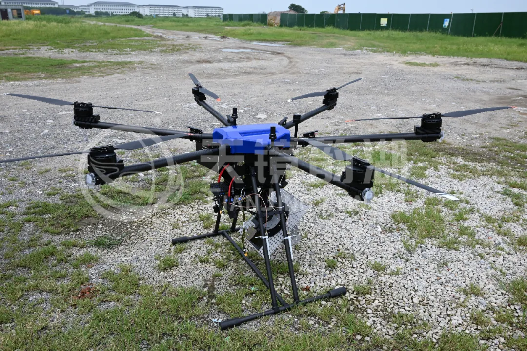
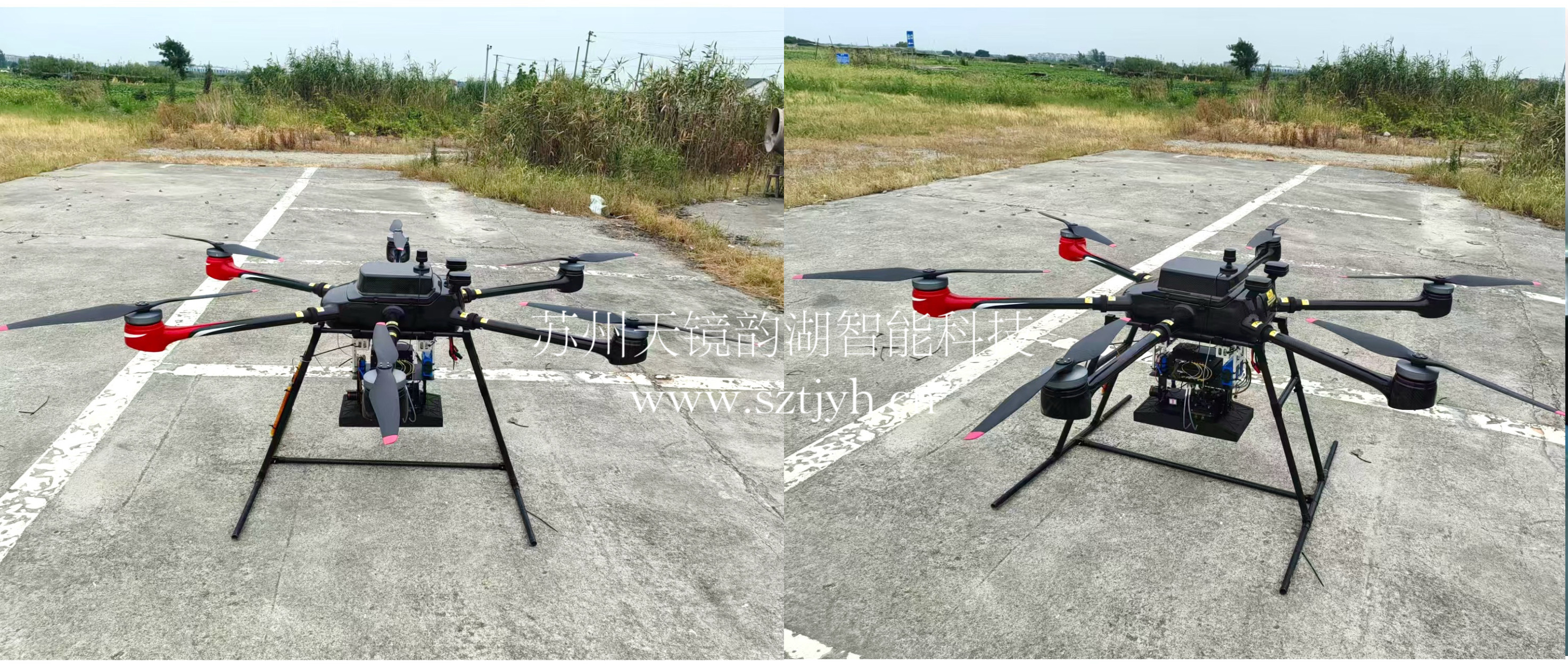
Targeting the core advantages of synthetic aperture radar in remote sensing and measurement, we have launched a frequency-modulated continuous wave miniature SAR system that is perfectly compatible with the DJI M400 multi-rotor drone and has undergone multiple verifications in projects.
 Miniature SAR + UAV
The M400 is DJI's latest flagship multi-rotor drone for Enterprise. When unfolded, it measures approximately 98 cm in length, 76 cm in width, and 48 cm in height; when folded, it's only 49 cm, easily fitting into a car trunk. Compared to the M350, the M400 boasts a maximum payload capacity of 6 kg, meaning it can simultaneously carry radar, cameras, and other equipment, enabling multiple missions in a single takeoff.
Equipped with the M400 is the LingYun System frequency-modulated continuous wave (FMCW) micro SAR, developed by Suzhou Tianjing Yunhu Intelligent Technology Co., Ltd. This is a micro synthetic aperture radar specifically designed for lightweight drone platforms.
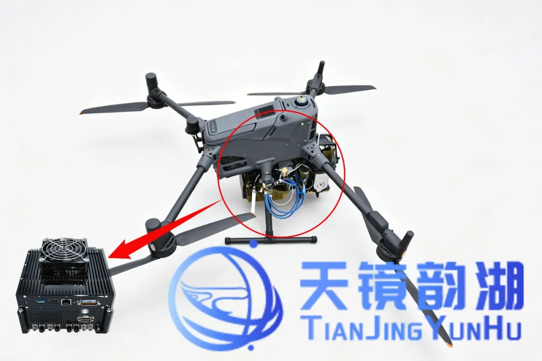
How lightweight is the Lingyun series micro SAR? For example, the LingYun 1B-Ku weighs only 2 kg, roughly equivalent to the weight of a typical laptop. With a power consumption of less than 120W, it puts minimal strain on the drone's battery and doesn't significantly impact flight time. The system utilizes an FMCW system, covering multiple bands including X, Ku, Ka, C, and W. The system supports multiple operating modes, including strip imaging and spotlight imaging, and can acquire data using single polarization or full polarization. More importantly, the Lingyun miniature SAR has real-time onboard imaging capabilities, allowing ground personnel to simultaneously view radar images while the aircraft is still in flight.
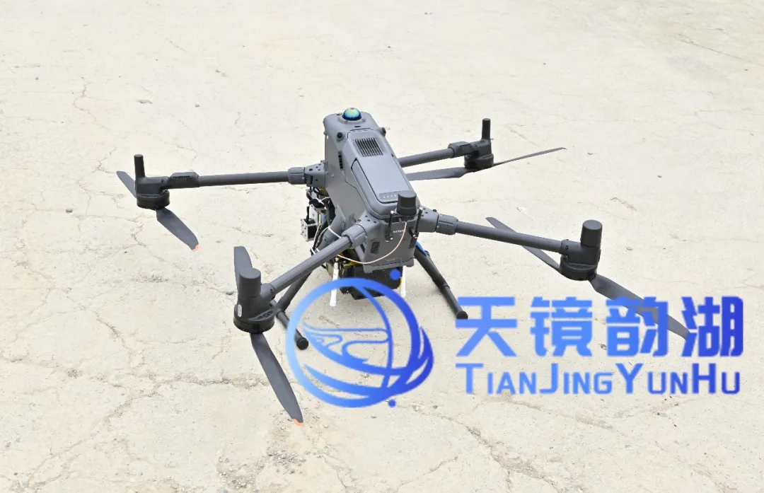 Installation effect diagram
Core Advantages:
All-weather, 24/7 Operation, Unaffected by Extreme Environments
Unaffected by smoke, fog, or poor lighting, it consistently outputs high-quality imagery even at night and in adverse weather conditions such as rain, snow, and haze. This effectively compensates for the limitations of visible light and lidar in complex environments, truly achieving "always ready and instantly usable."
Lightweight Design, Flexible Adaptation to Low-Altitude Platforms
Breaking through the traditional multi-channel SAR hardware architecture, integration is significantly improved, while size, weight, and power consumption are significantly reduced. The entire unit can weigh as little as 2kg, allowing for quick mounting on various small and lightweight UAVs to meet the needs of mobile and flexible field operations.
Easier Deployment, Efficient Balance Between Performance and Cost
The system adopts a quick-release structural design, allowing for installation without special tools. A single operator can quickly mount it to a UAV platform. While ensuring high-resolution continuous imaging, it effectively controls payload cost and system complexity, achieving a balanced optimization of performance, power consumption, and deployment efficiency.
High Reliability Guarantees Safety for Low-Altitude Flight
The system features automatic flight path capability, effectively reducing blind spots and providing stable and reliable radar data support for UAVs' autonomous obstacle avoidance, path planning, and situational awareness, comprehensively improving the safety and success rate of low-altitude operations.
The following are X-band single-polarization and full-polarization imaging results obtained by the Tianjing Yunhu team in real airspace in Kunshan. The payload used was an X-band frequency-modulated continuous wave miniature SAR, mounted on a DJI M400 UAV. In this test, the radar successfully completed the full verification of the full-polarization operating mode, simultaneously acquiring HH, HV, VH, and VV polarization images in a single flight.
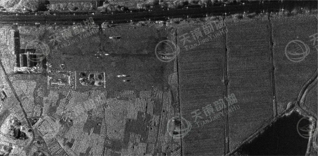
Single-polarization imaging results
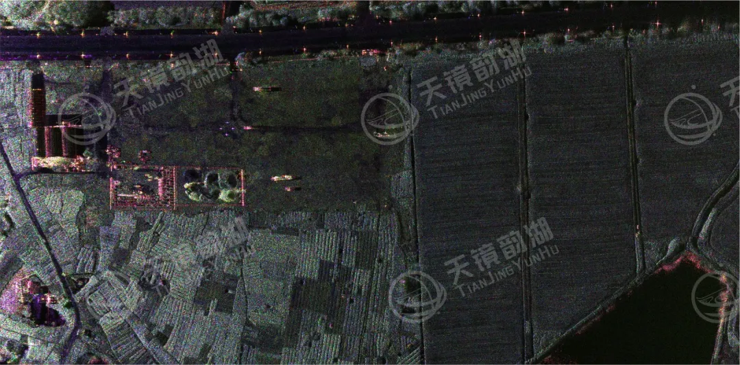
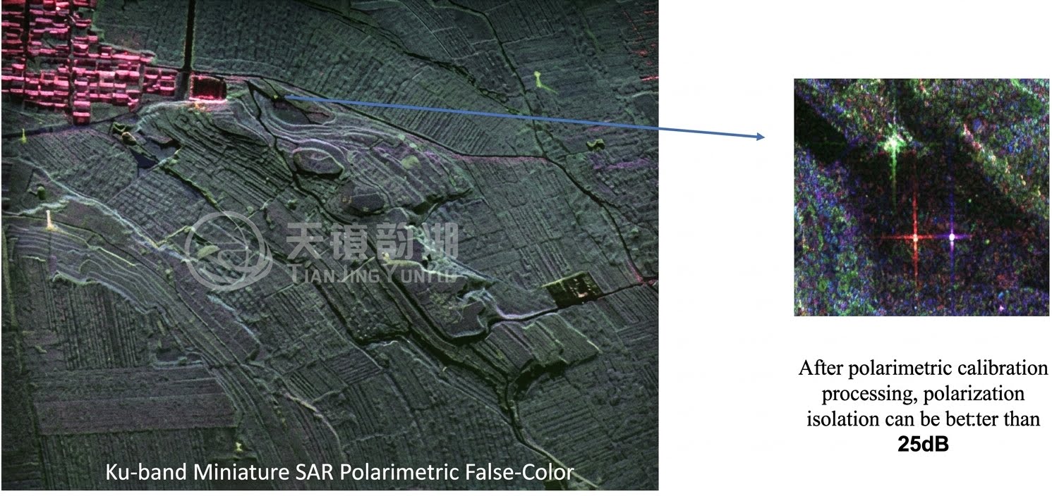
Full polarization imaging results
The SAR images show clear ground targets with good focusing and imaging quality. In the fully polarimetric pseudo-color image, the backscattering characteristics of buildings, roads, vegetation, and metal structures are significant, and the distinction between different ground feature types is clear. The resolution, verified through calibration, reaches an accuracy level better than 0.2 meters, enabling precise identification of the structural outlines and texture details of ground targets, meeting the application requirements of various high-precision remote sensing observations.
We focus on the research and development and solution provision of miniature synthetic aperture radar (SAR) systems. From core algorithms to overall system integration, from lightweight design to multi-platform adaptation, we consistently adhere to independent innovation, committed to making miniature SAR lighter, clearer, and more accurate. Currently, our products are widely used in maritime monitoring, topographic mapping, disaster monitoring, and border patrol, with tens of thousands of flights completed, serving numerous industry users and research institutions. We are dedicated to promoting the widespread adoption of domestically produced SAR, making synthetic aperture radar a truly accessible, efficient, and reliable tool for Earth perception!