Synthetic Aperture Radar (SAR), as an active microwave remote sensing system, can actively transmit microwaves and receive echoes reflected from targets, unaffected by lighting or weather conditions, enabling rapid imaging in all weather conditions and at all times. When SAR technology is deeply integrated with UAV platforms, it overcomes many limitations of traditional satellite and manned aircraft SAR in terms of timeliness, flexibility, and cost.
YunInsar is an airborne SAR interferometry system developed to meet this need. It integrates dual-band integration, high-precision interferometric measurement, and lightweight UAV adaptation, aiming to provide users with efficient, flexible, and high-precision Earth observation solutions.
I. Dual-band synergy: Combination of X-band and P-band
Airborne SAR can be divided into short-band (such as X-band and C-band) and long-band (such as L-band and P-band) based on their operating frequency bands. Short-band SAR excels at capturing surface details; long-band SAR can penetrate vegetation and surface cover. YunInsar's core advantage lies in combining the two.
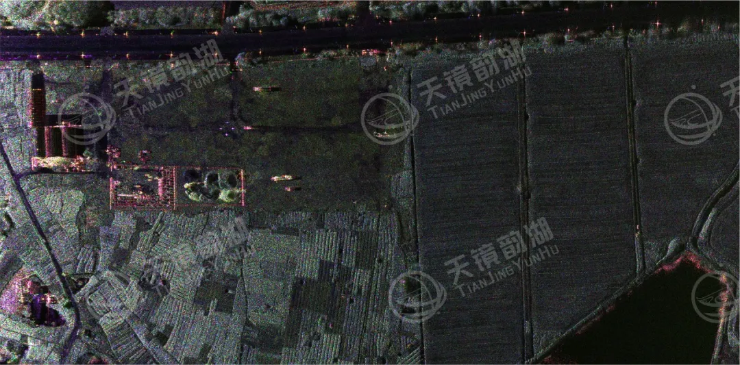
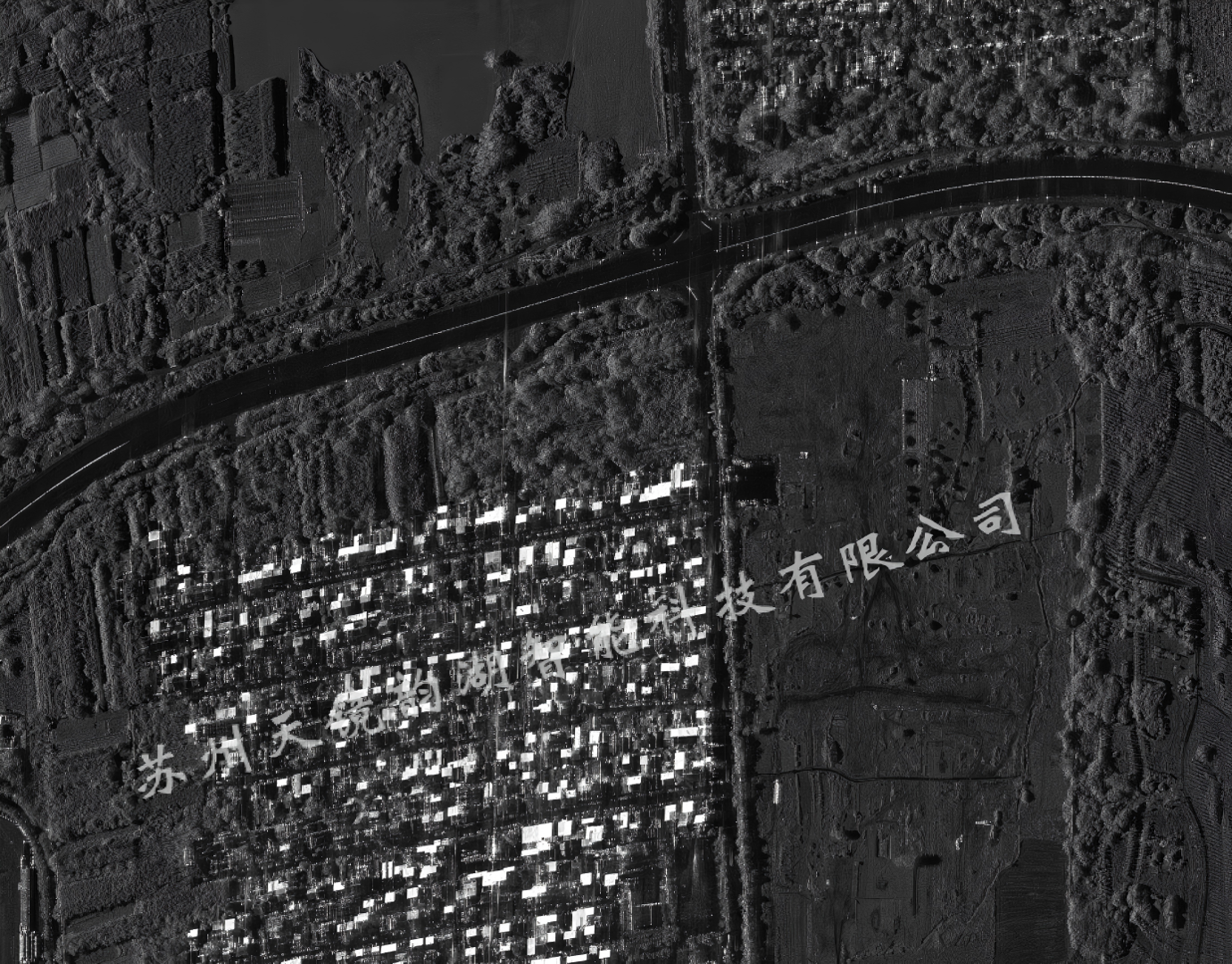
X-band (9.6 GHz): Short wavelength, extremely high resolution, responsible for high-resolution interferometric imaging, capable of acquiring high-precision digital surface models (DSMs), finely capturing the outlines of surface buildings, road boundaries, and even the minute structures of bridge expansion joints.
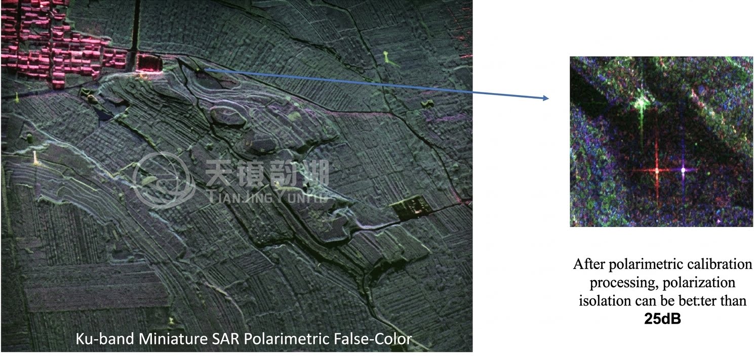
P-band (600 MHz): Longer wavelength, extremely strong penetrating power—the P-band can penetrate vegetation canopies, dry soil, and other cover materials, enabling the extraction of subvegetated terrain and full polarization classification, revealing the "invisible terrain."
 |
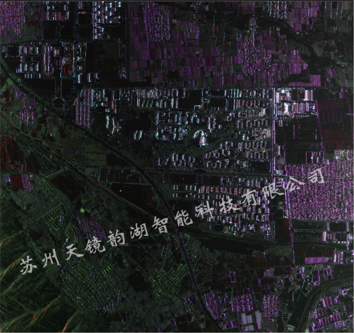 |
| X-band DOM | P-band fully polarimetric imaging results |
The dual-band parallel operation enables the system to acquire both fine surface structure information and deep topographic information in a single flight, giving it a significant technical advantage over similar systems both domestically and internationally.
II. Four Major Innovative Technologies
Innovation 1: Dual-band integrated high-density technology
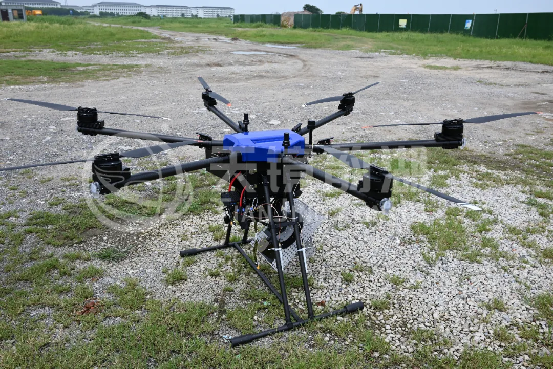
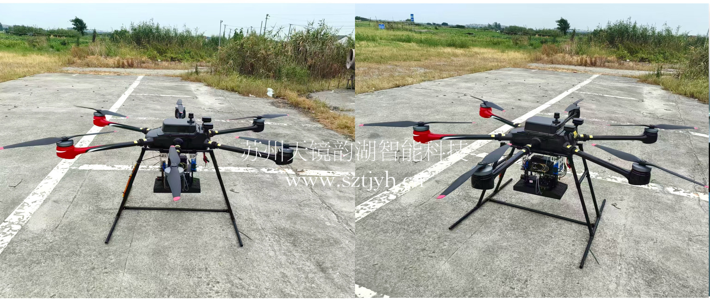
The X-band and P-band SAR systems are integrated into a single lightweight platform, with a total system weight of ≤150 kg and power consumption of ≤3 kW. It is compatible with various UAV platforms with a maximum operating altitude of 7000 m and flight speeds of 70~140 m/s. The modular design allows for independence between RF, digital, antenna, and power supply modules, facilitating maintenance and upgrades.

System integration photos
Innovation 2: Long-baseline cross-track interferometric antenna layout scheme
By optimizing the antenna layout and baseline design, high coherence of the interferometric phase is ensured, providing a hardware foundation for elevation accuracy better than 0.5 m (5000 m flight altitude).
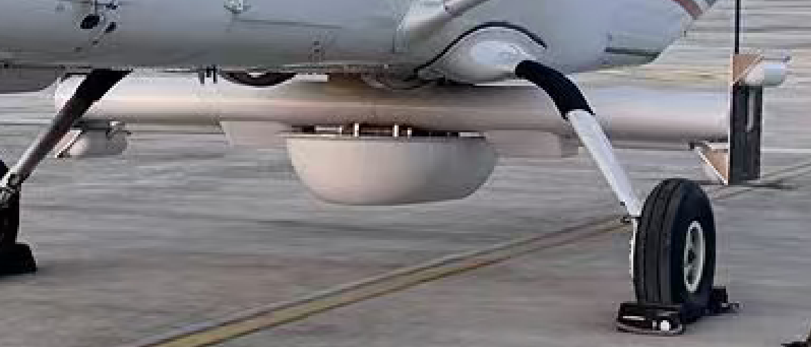
Antenna layout diagram
Innovation 3: A two-stage motion compensation algorithm based on echo data
Unmanned aerial vehicle (UAV) platforms are small and lightweight, making them susceptible to airflow disturbances, resulting in nonlinear and non-parallel flight paths. YunInsar effectively eliminates the impact of platform motion errors on imaging quality through a two-level motion compensation algorithm based on echo data, ensuring high-precision interferometric processing.
Innovation 4: Fully Polarized High-Precision Calibration and Adjustment Technology
It supports full polarization data acquisition and ensures accurate extraction of multipolar information through high-precision calibration and adjustment, providing reliable data support for land cover classification and identification.
III. Core Performance Indicators:
|
Metrics Category |
Specific Metrics |
Design Requirements |
Measured Results |
Evaluation |
|
Resolution |
X-band Interference Plane Resolution |
≤ 0.25m |
0.25m |
Qualified |
|
P-band Polarization Plane Resolution |
≤ 0.8m |
0.8m |
Qualified |
|
|
Accuracy Metrics |
X-band Elevation Accuracy (@5000m) |
≤ 0.5m |
≤0.5m |
Qualified |
|
X-band Planimetric Accuracy (CE90) |
≤ 1.5m |
1.5m |
Qualified |
|
|
Mapping Capability |
Operating Range |
≥ 25km |
25km+ |
Better than Expected |
|
Single-side Swath Width (@5000m) |
≥ 4km |
4km+ |
Better than Expected |
|
|
Dual-side Swath Width (@5000m) |
≥ 8km |
8km+ |
Better than Expected |
|
|
Platform Performance |
Equipment Weight |
≤ 150kg |
150kg |
Qualified |
|
System Power Consumption |
≤ 3kW |
≤3kW |
Qualified |
|
|
Continuous Operation Time |
≥ 6小时 |
6 hours+ |
Better than Expected |
|
|
Data Quality |
Polarimetric Calibration Accuracy |
Amplitude Imbalance≤0.5dB, Phase Imbalance≤10°, Isolation≤-25dB |
All Compliant |
Qualified |
|
Mapping Specifications |
Geometric Measurement Accuracy |
Meets 1:2000/1:5000/1:10000 Scale Requirements |
Met |
Qualified |
The X-band's 0.25 m planar resolution has reached the level of high-resolution observation, enabling clear identification of fine ground targets; the P-band's 0.8 m resolution is also among the best in long-band SAR. The elevation accuracy is better than 0.5 m, meeting the mapping specifications for scales from 1:2000 to 1:10000.
IV. Application Scenarios
High-precision topographic mapping: A single flight can acquire large-area, high-precision DEM and DSM, which is particularly suitable for areas covered by rain, fog, and clouds all year round that are difficult to cover by optical remote sensing.
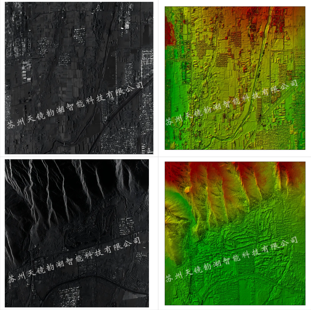
Forestry and Vegetation Area Surveys: The strong penetrating power of the P-band allows it to penetrate the vegetation canopy and acquire understory topographic information, providing data support for forest volume surveys and carbon sequestration estimations.
Emergency Relief and Disaster Relief: The rapid deployment capability of UAV platforms combined with the all-weather imaging capabilities of SAR can acquire images of disaster areas immediately after a disaster occurs, providing timely information support for rescue decision-making.
VI. Achievements and Prospects
YunInsar combines the high resolution of the X-band with the strong penetration of the P-band, utilizing a lightweight UAV platform to achieve high-precision, high-efficiency, all-weather terrain mapping and surface monitoring capabilities. Real-world testing data shows that all core performance indicators have met or exceeded design requirements, and the system is ready for engineering applications.
In the future, with continuous algorithm optimization and in-depth flight testing, YunInsar will provide stronger technical support for numerous fields such as surveying, forestry, geology, and emergency response.