Tianjing Yunhu | UAV-borne MiniSAR Technology

Browse: 121 Time: 2026-07-23

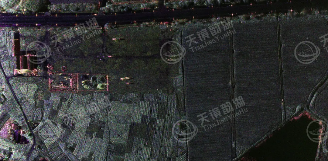
Synthetic aperture radar (SAR) is one of the core technologies in the field of remote sensing and measurement. SAR is an active Earth observation system. Because it operates in the microwave band, SAR images are not affected by weather conditions such as clouds, rain, and snow, and can acquire clear surface information in various complex environments. It has important application value in civilian and military fields.
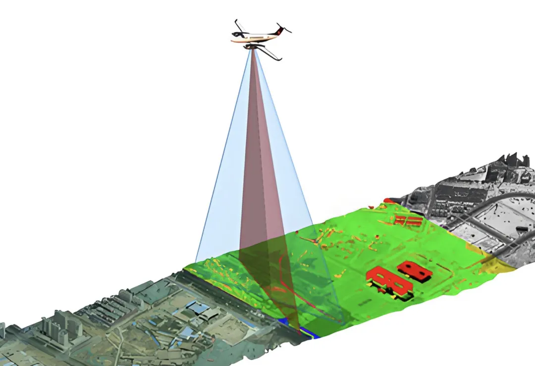
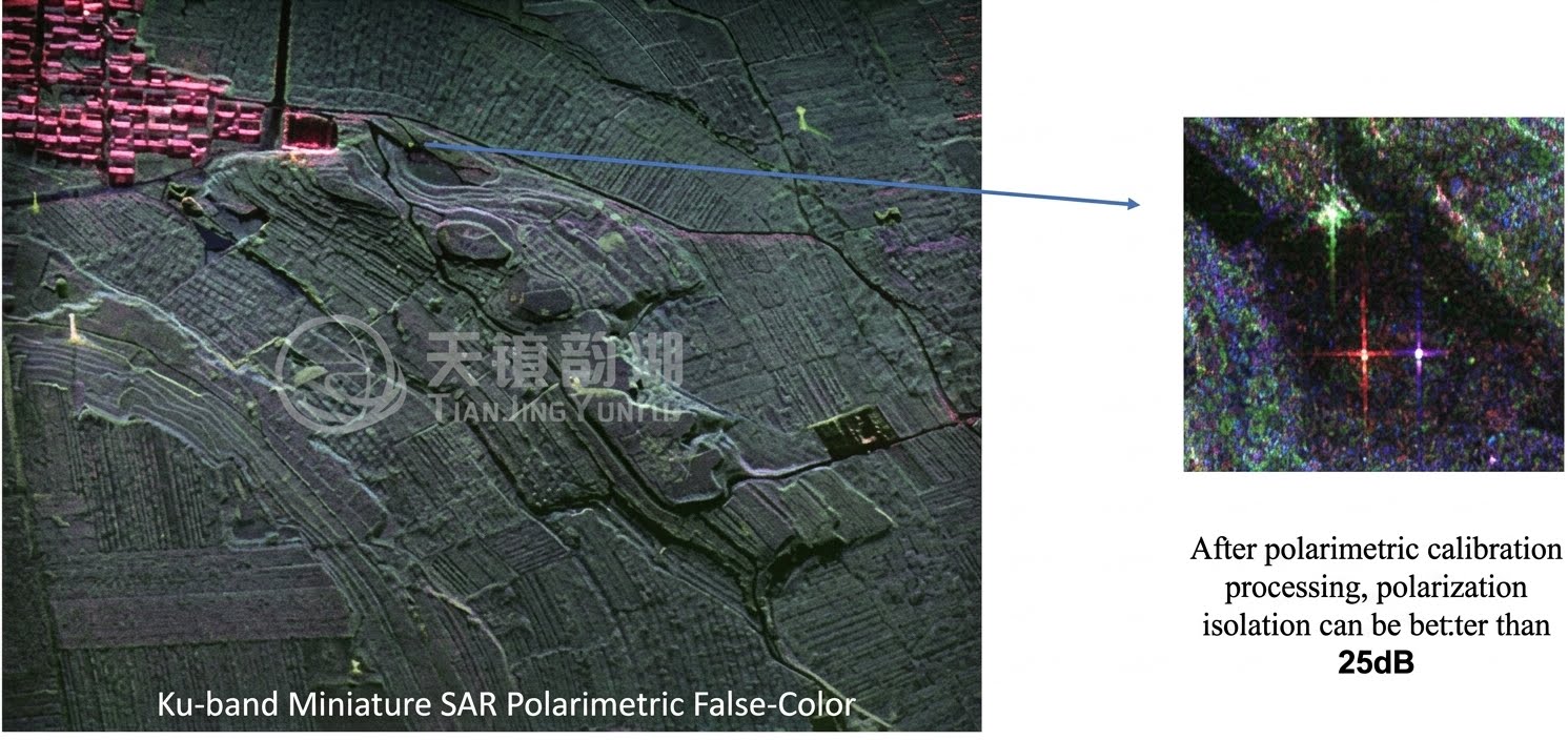
Looking back at the more than 70-year development history of airborne SAR technology, from the introduction of the synthetic aperture radar concept in 1951 to China's first acquisition of SAR images in 1979, and then to the continuous innovation of miniaturization technology, Tianjing Yunhu has taken over the baton of technological inheritance and innovation. Based on the efforts of the founders and the R&D team, we have successfully developed a new lightweight MiniSAR system, pushing the technical indicators to new heights—0.05m ultra-high resolution, ≤2.7kg lightweight design, ≤120W low power consumption operation, and the ability to operate in multiple modes such as strip imaging and spotlight imaging, completely breaking the limitations of traditional SAR systems that are "heavy, large, and expensive".
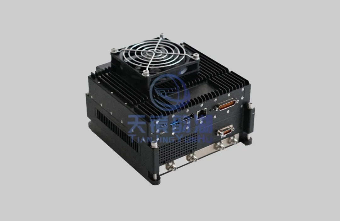
MiniSAR weighing ≤2.7kg

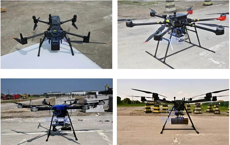
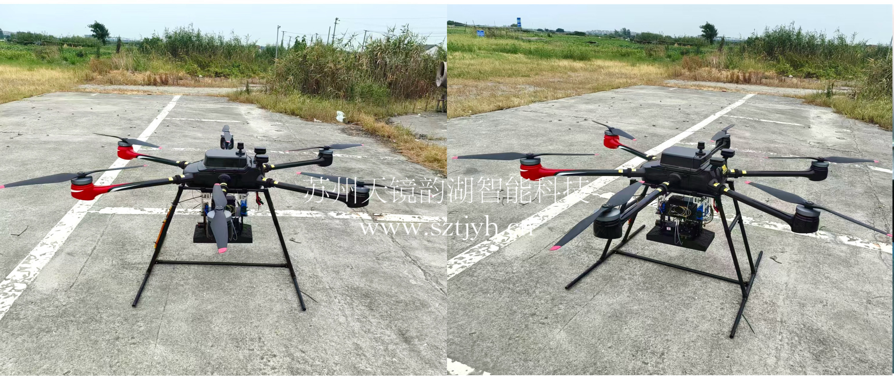
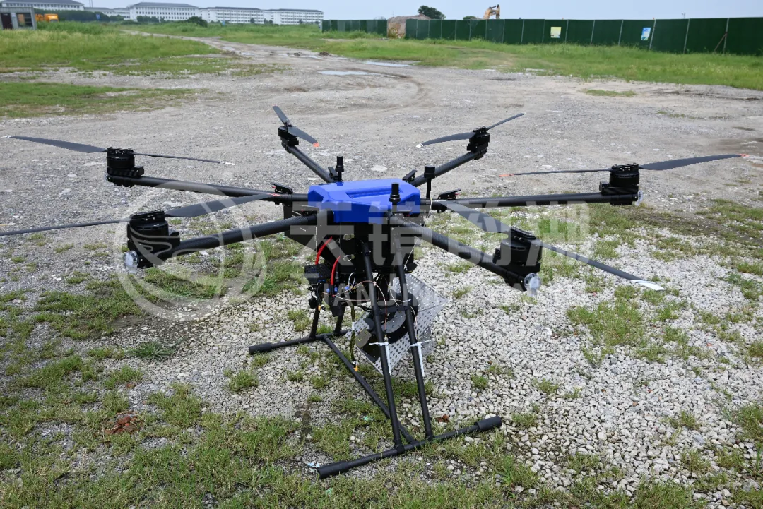
The MiniSAR system at Tianjing Yunhu is compatible with a full spectrum of flight platforms, including multi-rotor, fixed-wing, and manned aircraft. It has completed integrated flight tests on several mainstream platforms, such as the KWT X6L, HY 1800Pro, DJI M350/M400/FlyCart30, and  CW15/CW25E/CW30/CW40/CW100, covering flight tests in different scenarios.
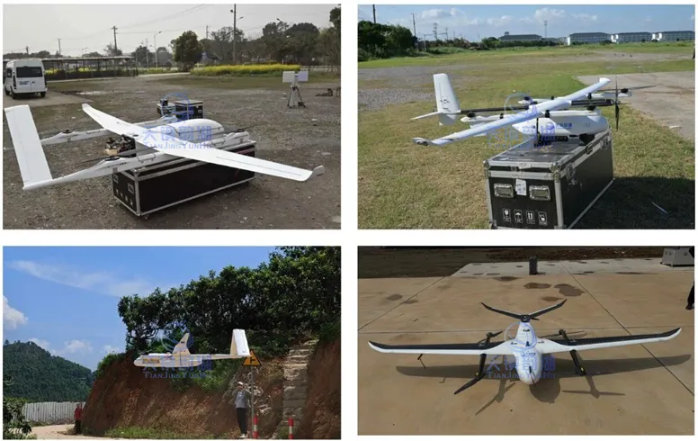
Fixed-wing UAV mounting diagram Multi-rotor UAV mounting diagram

Application Areas:

1. Geological Exploration: SAR technology can detect underground geological structures and rock strata distribution, aiding in the exploration and development of mineral resources.

2. Deformation Monitoring: SAR technology can monitor surface deformation in real time, used for monitoring and early warning of natural disasters such as earthquakes and volcanoes. InSAR technology can measure minute surface deformations, providing crucial data for disaster early warning and risk assessment.

3. Marine Monitoring: SAR technology can detect phenomena such as ocean waves and sea ice, significant for marine meteorology and maritime safety. It can also be used to monitor marine pollution and marine resource distribution.

4. Agricultural Monitoring: SAR technology can monitor crop growth and soil moisture, providing guidance for agricultural production and resource management. Polarimetric SAR technology can distinguish different types of crops and assess their growth and yield.

5. Urban Planning: SAR technology can provide information on urban land use and road traffic, offering data support for urban planning and management. SAR imagery provides a clear understanding of urban spatial layout and traffic conditions, offering a scientific basis for urban planning.

6. Environmental Protection: SAR technology can be used to monitor ecological and environmental information such as forest cover and wetland changes, providing data support for environmental protection and ecological restoration. Simultaneously, SAR technology can also be used to monitor global climate change phenomena such as glacial melting and sea-level rise.
Related Information

Related Information
2026.08.28

Tianjing Yunhu | MiniSAR: Full Polarimetric Imaging Capability

In the field of remote sensing today, synthetic aperture radar (SAR), visible light, and infrared together form a multi-layered observation system. Visible light remote sensing is intuitive and clear, while infrared remote sensing excels at thermal sensing. However, both are passive detection methods, heavily reliant on sunlight or the target's own thermal radiation. Once they encounter cloud cover, nightfall, or rainy/foggy weather, their detection capabilities are significantly reduced or even completely lost.
2026.08.26

Tianjing Yunhu | P-band Airborne SAR Radar System

Low-frequency radars (such as P-band and L-band radars) can "see farther and see more clearly" because of their longer wavelengths, lower attenuation, and reduced sensitivity to stealth coatings. In modern air defense systems, they are key to anti-stealth radars. They can penetrate 1-meter-thick camouflage netting and 3-meter-thick bushes to identify hidden tanks and radar stations, and are less likely to trigger enemy warning systems, demonstrating significant advantages in covert detection.
2026.08.21

Tianjing Yunhu | Miniature SAR Vehicle Target Dataset

Synthetic Aperture Radar (SAR) target detection datasets are a core foundation for training and evaluating deep learning models. These datasets cover various target types, including ships, aircraft, vehicles, bridges, and oil tanks, and are applicable to multiple fields such as military reconnaissance, maritime monitoring, and traffic management. They not only provide high-resolution SAR images but also contain precise annotation information (category, location, size, etc.), ensuring improved algorithm performance.
2026.08.17

Tianjing Yunhu | Miniature SAR Equipped with Fixed-Wing UAV

Today's main focus is on the CW-25E VTOL fixed-wing UAV and the Tianjing Yunhu XiangYun System pulse MiniSAR.

The CW-25E is a pure electric VTOL fixed-wing UAV designed specifically for large-area missions. It has a fuselage length of 2.08 meters, a wingspan of 4.35 meters, and features a twin-boom fused inverted V-tail design, resulting in a compact structure and excellent aerodynamic performance.

The CW-25E has a maximum takeoff weight of 31.58 kg and a payload capacity of 6.6 kg, capable of simultaneously carrying various mission equipment such as SAR, lidar, and electro-optical pods. It boasts a maximum endurance of 150 to 240 minutes, a service ceiling of 6000 meters, a maximum takeoff altitude of 4000 meters, and wind resistance up to level 7. It can stably perform patrol missions in complex terrain and high-altitude areas.
2026.07.18

Tianjing Yunhu | Airborne SAR (Synthetic Aperture Radar) Calibration Capability

Airborne SAR (Synthetic Aperture Radar) calibration refers to the calibration of various parameters of an airborne SAR system using specific methods to eliminate systematic and environmental errors, thereby ensuring the quality of SAR images, positioning accuracy, and the accuracy of inversion parameters. Airborne SAR calibration is mainly divided into three categories: geometric calibration, radiometric calibration, and polarimetric calibration.
2026.07.13

无人机L波段重轨干涉SAR系统:毫米级形变监测的机载验证

合成孔径雷达干涉测量(InSAR)技术凭借其全天时、全天候的工作能力以及对地表形变的高灵敏度,已成为地质灾害监测、地面沉降调查与基础设施健康诊断的重要手段。将InSAR技术搭载于无人机平台,进一步突破了卫星重访周期长、机动性不足以及有人机作业成本高的局限,为区域性、高频率、高精度的形变监测提供了全新路径。然而,无人机平台轻小、易受气流扰动,其重复飞行航迹难以保持一致,这给重轨干涉处理带来了严峻挑战。

Online Message

Company Address

Company Address

Room 801, Building 14, No. 135 Zhangji Road, Kunshan Development ZoneView the map
Emaile

Email

tjyh888@139.com
Postal Code

Postal Code

215300
Sales contact information

Sales contact information

  • Sales 1:18252999418 (same WeChat)
  • Sales 2:13126758269 (same WeChat/Whatsapp)
  • Sales 3:15862678208 (same WeChat)
  • Sales 4:15895462772 (same WeChat/Whatsapp)
验证码
Submit

Contact Us

关注我们
关注我们