

I. L-band SAR Applications in Ocean Monitoring
On the vast ocean, swells, as long-distance propagating wave phenomena, not only affect maritime navigation safety and port facility construction, but are also closely related to the global ocean energy cycle. How to accurately capture these hidden movement trajectories beneath the sea surface? L-band synthetic aperture radar (SAR) is becoming a "space-based eye" for monitoring ocean swells, thanks to its unique advantages.

Synthetic Aperture Radar (SAR) is an active remote sensing technology unaffected by weather or day/night cycles. By transmitting microwave signals and receiving reflected waves from the sea surface, it can clearly capture subtle changes on the ocean surface. Compared to C-band and X-band SAR, L-band SAR has a longer wavelength, stronger penetration, and less atmospheric interference, making it particularly suitable for detecting long-period swells near the coast. Spaceborne phased array L-band SAR (PALSAR) has an observation swath of 40-70 kilometers, with azimuth and slant range resolutions of 17.8 meters and 4.68 meters, respectively, providing large-scale, high-resolution observation data.
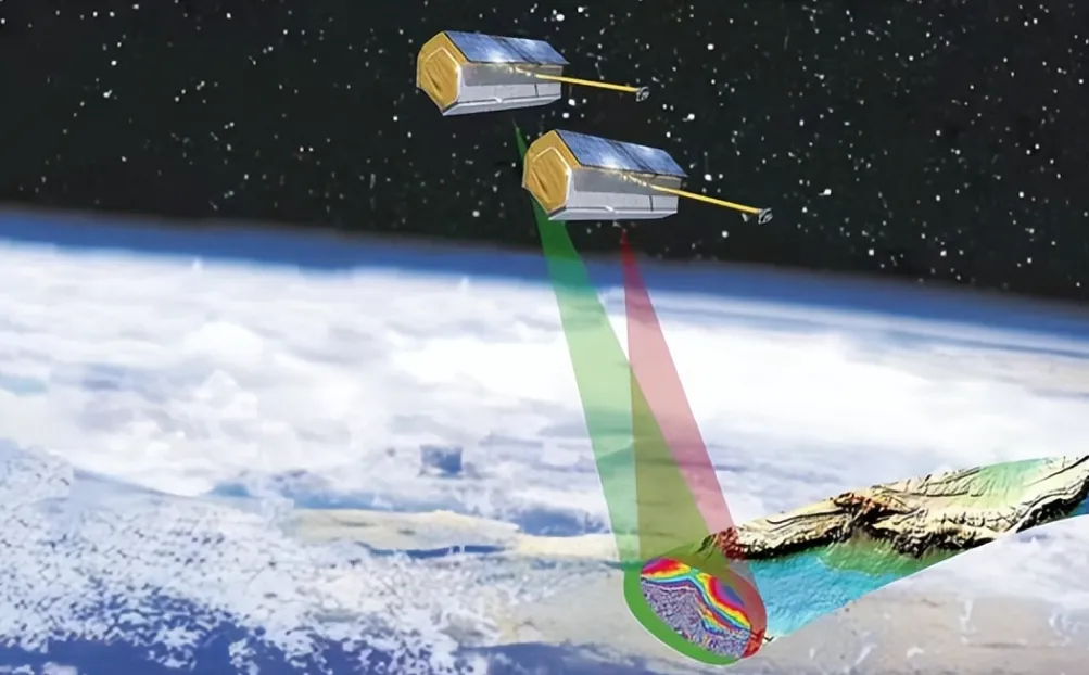
The emergence of miniature L-band SAR has further expanded the boundaries of technological applications. The biggest advantages of miniature SAR lie in its lightweight and low cost; its size is typically only a fraction of that of traditional SAR, and its weight can be kept to within a few kilograms, allowing for deployment without large carriers. This enables it to be flexibly mounted on platforms such as small UAVs and light aircraft, achieving rapid response observations with "deployment on demand." At the same time, the research and development and operation costs of miniature SAR are significantly reduced, breaking down the high barriers to entry of traditional SAR technology and allowing more research institutions and coastal management departments to conduct targeted observations. Furthermore, miniature SAR has lower power consumption and longer endurance, enabling continuous monitoring over long periods and at close range. It is particularly suitable for detailed observation of specific near-shore areas, ports, and waterways, compensating for the shortcomings of spaceborne SAR, such as long revisit cycles and insufficient detailed observation.

Airborne L-band SAR combines the wide-area observation capabilities of spaceborne SAR with the flexibility of miniature SAR, forming unique technological advantages. First, the flight altitude of the airborne platform can be flexibly adjusted, enabling detailed observations of near-shore shallow waters at centimeter resolution from altitudes of hundreds of meters, capturing details of the interaction between swells and seabed topography, while also achieving wide-area coverage of hundreds of kilometers from altitudes of thousands of meters, quickly grasping the regional wavefield distribution. Second, airborne SAR offers extremely high observation timeliness, allowing for observations to be conducted at any time according to needs such as marine disaster early warning and emergency rescue, without being constrained by satellite orbits, and acquiring swell parameters of the target area in a short time, providing real-time data support for decision-making. Third, the observation environment of airborne L-band SAR is more stable, with further reduced atmospheric interference, and by adjusting the flight path, it can avoid local interference areas such as clouds and rainfall, ensuring image data quality. Simultaneously, the airborne platform can easily carry more auxiliary equipment, allowing simultaneous operation with on-site observation instruments, achieving real-time matching and verification of remote sensing data and measured data, improving the accuracy of inversion results.
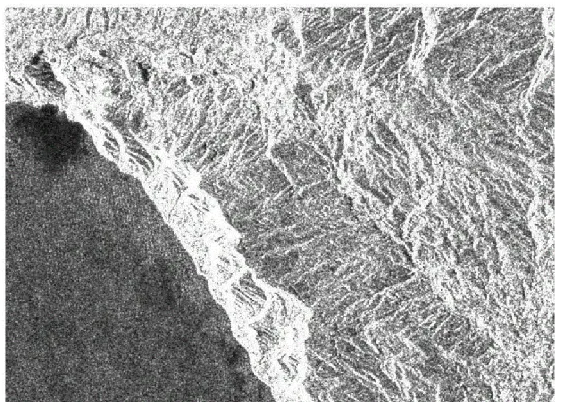
The core principle of L-band SAR monitoring of swells is based on the assumption of a "linear imaging mechanism." As long-period waves, swells experience minimal energy loss during propagation and have relatively stable surface morphology. They can modulate small-scale Bragg waves on the sea surface, forming clear wave stripes on SAR images. Researchers perform a series of processing steps on the SAR images, including radiometric correction and Gaussian high-pass filtering, and then use two-dimensional fast Fourier transform (2-D FFT) to extract the SAR image spectrum. The wavelength and propagation direction of the swell are then calculated from the spectral peak positions.
To verify the accuracy of the inversion results, researchers compared L-band SAR observation data with field observation data from the Japanese National Port and Harbor Ocean Wave Information Network. Long-term recording of ocean wave parameters using equipment such as ultrasonic wave meters and Doppler wave postmeters deployed on the seabed provides reliable ground-based verification data for remote sensing. The comparison results show that the wave wavelength deviation retrieved by L-band SAR is only -10.5 meters, with a standard deviation of 18.3 meters and a correlation coefficient as high as 0.94; the wave direction deviation is -1.3°, with a standard deviation of 15.5° and a correlation coefficient of 0.94, fully demonstrating the reliability of the technology.
Currently, L-band SAR plays an important role in nearshore marine monitoring, maritime traffic safety assurance, and coastal engineering planning. However, its application in marine observation is still expanding. With continuous technological advancements, in the future, by accumulating more matching data and improving imaging mechanism models, L-band SAR will be able to provide more comprehensive wave parameters, providing stronger technical support for marine disaster early warning and marine resource development, allowing this "space-based eye" to continue to safeguard humanity's exploration of the ocean's mysteries.
II. Airborne Miniature SAR System
Suzhou Tianjing Yunhu Intelligent Technology Co., Ltd. (hereinafter referred to as Tianjing Yunhu) is committed to becoming a leading global synthetic aperture radar solution provider, offering users customized radar equipment, SAR data acquisition services, and radar data products. With years of R&D experience and professional technical accumulation, Tianjing Yunhu has launched SAR products with multiple bands and various capabilities, including frequency-modulated continuous wave and pulse systems. Currently, Tianjing Yunhu provides coverage across multiple bands such as X, Ku, K, Ka, C, W, and L. Its product systems support single-polarization, full-polarization, strip, spotlight, interferometric, and single-pulse search modes, and feature real-time imaging, GMTI, and deformation monitoring. Tianjing Yunhu SAR products can be deployed on multi-rotor/fixed-wing UAVs, manned aircraft, satellites, and vehicle-mounted platforms.








