I. Core Performance of L-band
In synthetic aperture radar (SAR), the L-band has a frequency range of 1 GHz to 2 GHz and a wavelength of 15 to 30 cm, making it the longest wavelength band in radar. Therefore, compared to other bands, the L-band has stronger penetration and better environmental adaptability, giving it unique advantages in deep soil measurement and long-distance inspection. It is the preferred band for agricultural soil moisture monitoring, pipeline leakage detection, forestry surveys, and large-scale surface surveys.
II. Tianjing Yunhu L-band SAR: Self-developed core technology, industry-leading imaging quality
(I) Enterprise R&D Strength
Suzhou Tianjing Yunhu Intelligent Technology Co., Ltd. (hereinafter referred to as "Tianjing Yunhu") is a pioneer in the field of micro SAR in China. Founded by some of the earliest professionals engaged in micro SAR R&D in China, it possesses leading R&D technology and product service capabilities in the micro SAR industry. Supported by digital radar technology, the company has developed two series and multiple types of micro SAR products: frequency-modulated continuous wave and pulse, achieving comprehensive coverage of multiple bands including X, Ku, K, Ka, C, W, L, and S. Its products have been widely used in various fields such as agriculture, water conservancy, power, surveying and mapping, resource exploration, military applications, deformation monitoring, and disaster assessment.
(II) Product Performance Advantages
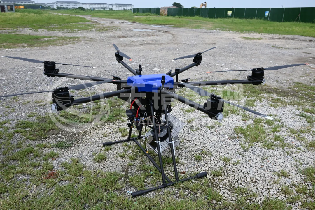
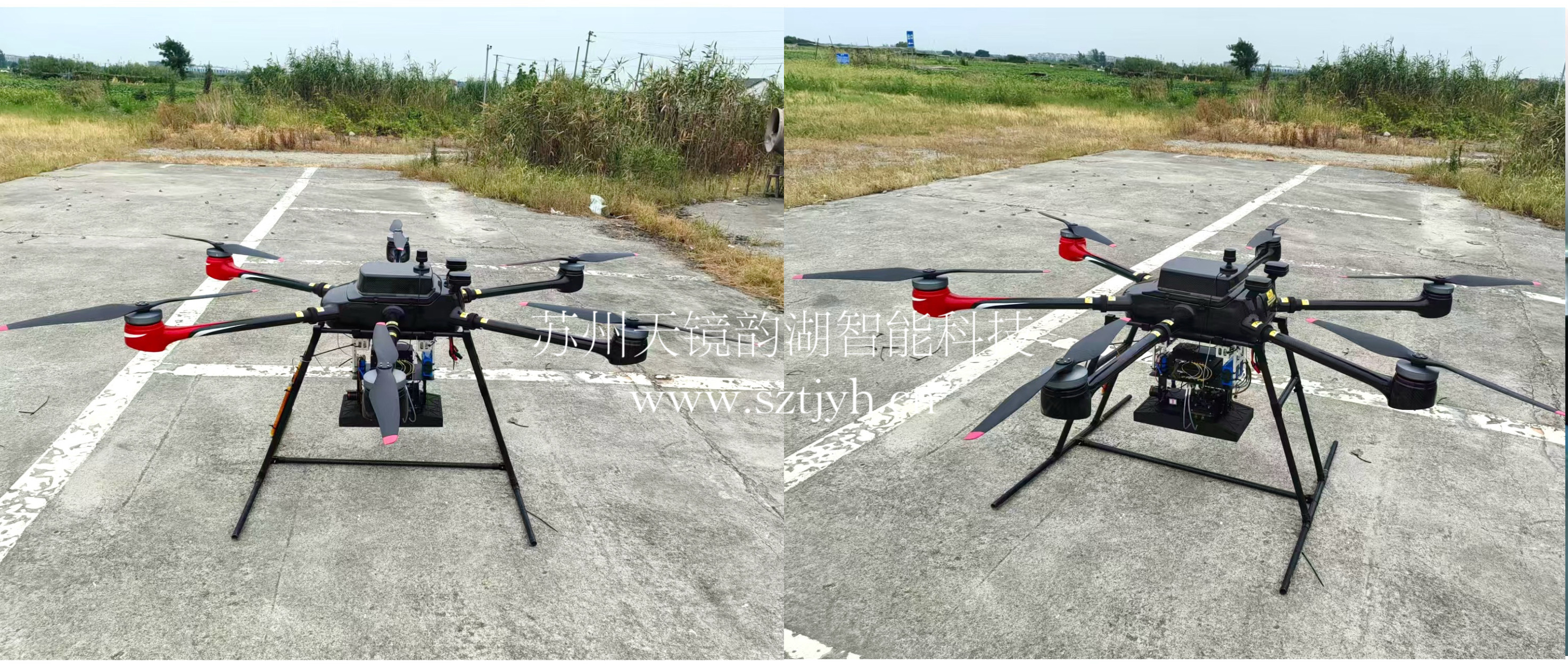
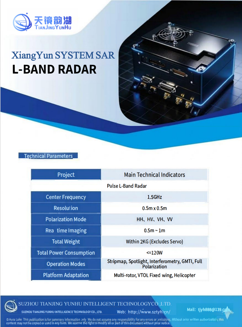
The Tianjingyunhu L-band SAR adopts an advanced pulse system, with high-definition, stable, and accurate imaging as its core design goal, boasting industry-leading performance indicators. Simultaneously, its lightweight design allows it to be mounted on multi-rotor, VTOL fixed-wing, and helicopter platforms, enabling it to output high-quality SAR images under various operating conditions. The following are some core specifications of the Tianjingyunhu L-band SAR system:
(III) Product Maturity
Currently, the Tianjing Yunhu L-band SAR has reached a mature product level, having undergone multiple rounds of flight testing and rigorous verification:
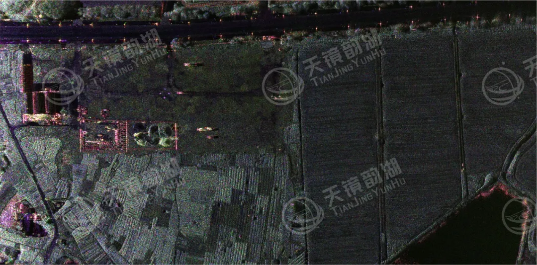
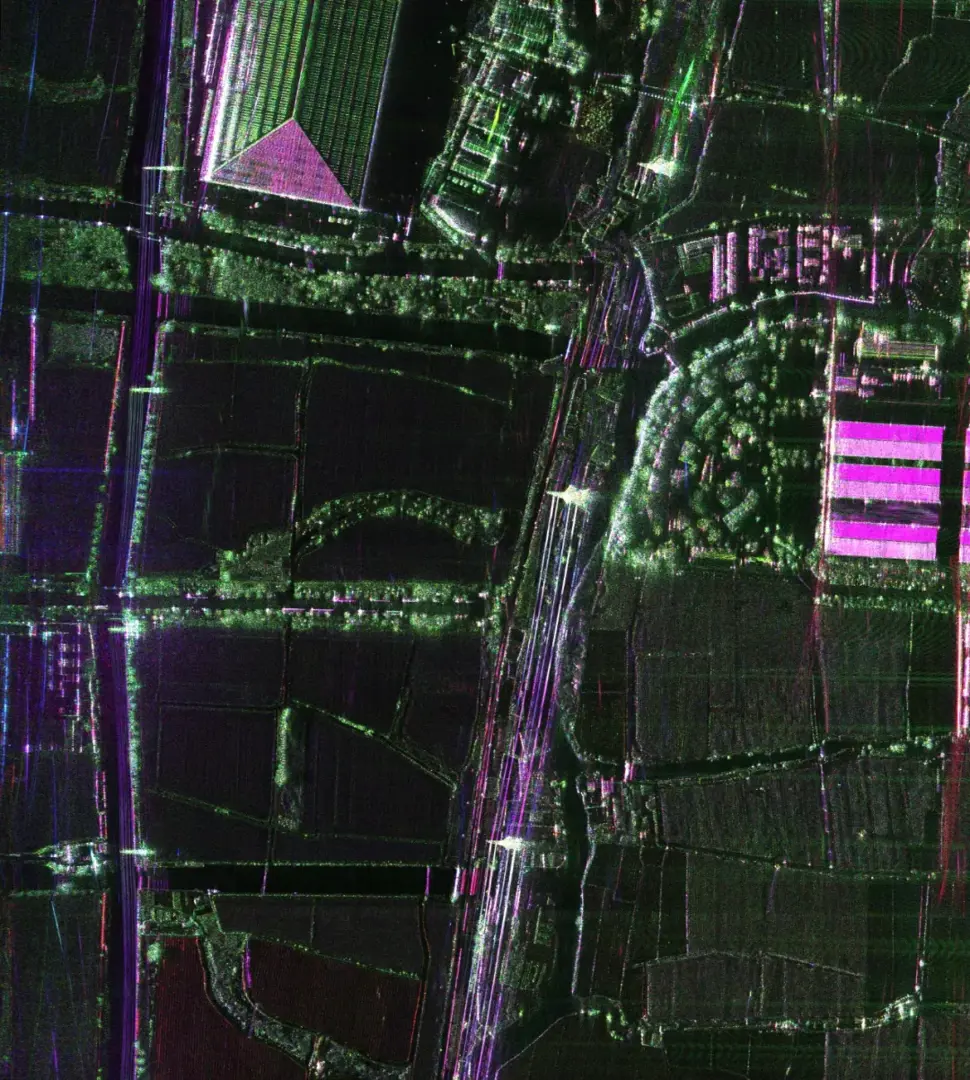
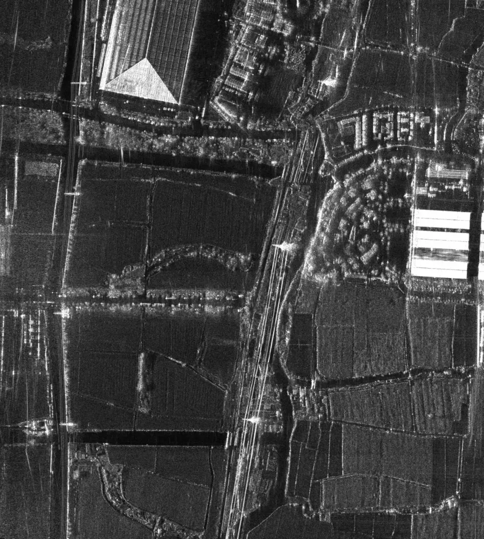
The system exhibits stable and excellent imaging quality, with a high signal-to-noise ratio, distortion-free edges, and clear ground feature outlines;
It can quickly acquire large-area, high-definition, and high-precision SAR images, with reliable and usable data;
It has been applied in scenarios such as agriculture, pipeline leakage detection, and soil detection, and its imaging performance has been highly recognized by users;
Long-term cooperation has been established with military branches, universities, research institutes, and industry enterprises to provide high-quality radar imaging services to meet the needs of professional fields.
|
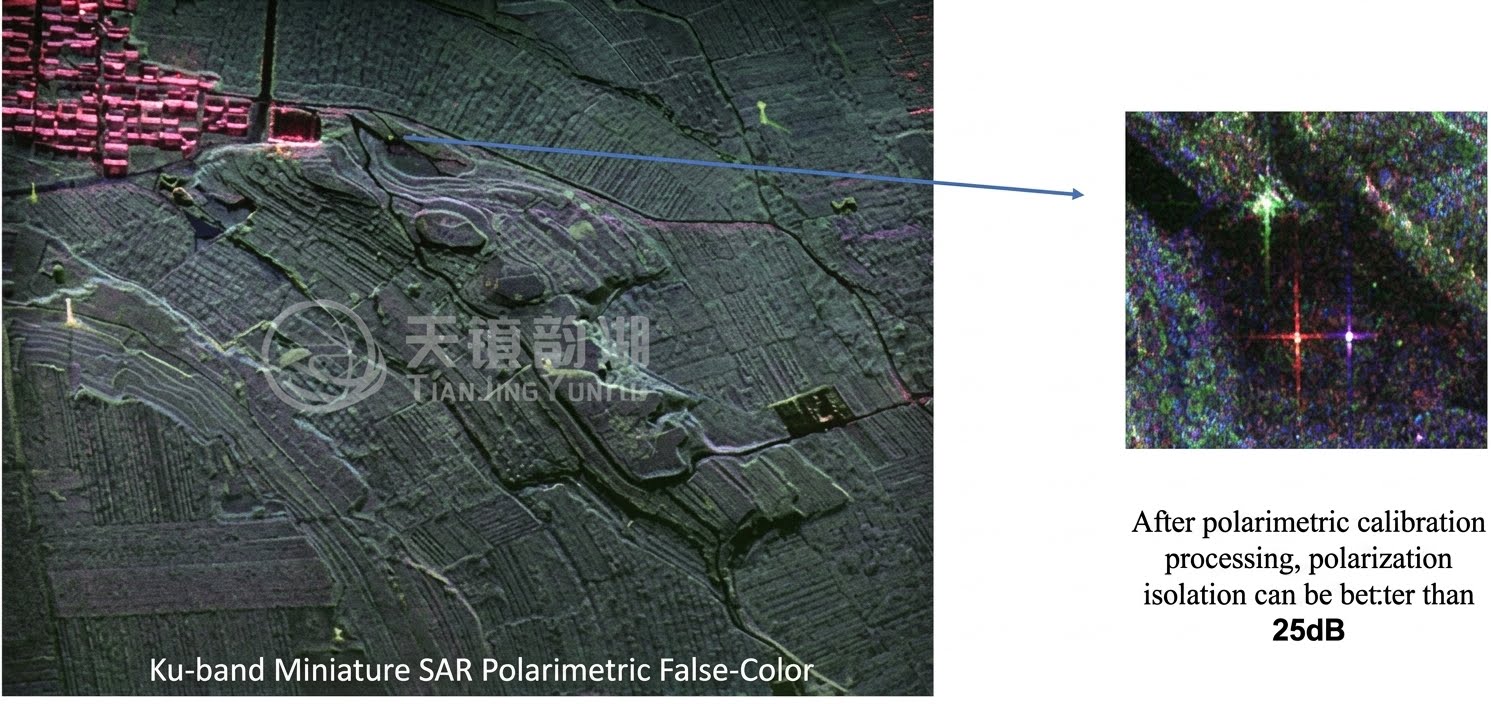
L-band fully polarized image of Tianjing Yunhu |
L-band single-polarization imaging image of Tianjing Yunhu |
III. Core Application Scenarios
(I) Urban Monitoring: Utilizing its penetrating power to monitor minute surface deformations, it can assess ground subsidence, building and subway tunnel structural health.
(II) Water Conservancy: Primarily used for long-distance water pipeline leakage detection, monitoring dam deformation and seepage, wetland monitoring and flood inundation mapping, and ancient river channel exploration.
(III) Geological Disasters: The core application is monitoring landslides, earthquake deformation, glacial movement, and ground subsidence. It can penetrate vegetation to capture millimeter-level micro-deformation signs, enabling early identification of potential hazards.
(IV) Agricultural Monitoring: Accurately inverting soil moisture (suitable for field management and drought early warning), distinguishing different crop types, and assessing their growth.
(V) Forestry Monitoring: It can penetrate the canopy to estimate forest biomass and carbon storage, map understory topography, and be used for biodiversity monitoring.
(VI) Military Reconnaissance: Penetrating vegetation for reconnaissance, it can detect tanks and other equipment hidden in forest areas or under camouflage nets, enabling camouflage assessment.
IV. Case Studies of Tianjing Yunhu L-band SAR Products
(I) L-band Soil Penetration Test at a University
By burying corner reflectors at different depths underground and using Tianjing Yunhu L-band SAR for imaging simulation, the deep penetration capability of the soil was verified. The imaging results were clear and the positioning was accurate, providing key technical support for underground target detection.
(II) Pipeline Leakage Monitoring in a Certain Area
A leakage scenario was simulated around the pipeline in the test area. Using Tianjing Yunhu L-band SAR imaging detection, the leakage area was identified. The imaging results highly matched the actual leakage location, verifying the practicality and reliability of pipeline leakage inspection.