

In a dangerous section of the middle reaches of the Yangtze River, night fell over the surging waters, and continuous torrential rain rendered traditional optical monitoring methods nearly ineffective. At this critical moment, several drones equipped with synthetic aperture radar (SAR) silently took off, piercing the thick rain curtain to perform millimeter-level precision "scans" of the riverbanks stretching dozens of kilometers below. Hours later, a precise deformation analysis report was delivered to the flood control headquarters, clearly identifying two potential seepage points. The emergency response team then deployed precisely, averting a possible dike breach. This is not science fiction, but a revolutionary change brought about by the integration of low-altitude economics and advanced remote sensing technology to the ancient field of riverbank monitoring.
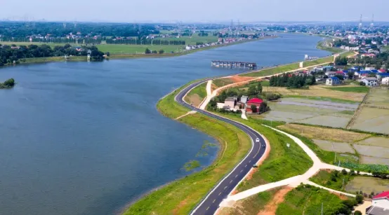
I. The Traditional Dilemma: Bottlenecks and Contemporary Challenges in River Embankment Monitoring
River embankments, as the lifeline for resisting river floods and ensuring the safety of people's lives and property, have always been a top priority in water conservancy work for monitoring their health. However, traditional monitoring methods are facing increasingly severe challenges:
**Limitations of Manual Patrols:** Relying on manual patrols on foot, by vehicle, or by boat is not only inefficient and has limited coverage, but it also struggles to cope with severe weather and nighttime conditions, and lacks the ability to detect internal hazards and minor deformations within the embankment.
**Dilemmas of Fixed-Point Sensor Networks:** Deploying sensors such as settlement piles, inclinometers, and piezometers can provide continuous data at fixed points, but they are costly, have limited coverage density, and are difficult to use for large-scale, comprehensive assessments. Furthermore, installation and maintenance may affect the embankment structure.
**Difficulties in Aerial Remote Sensing:** While satellite remote sensing has wide coverage, its long revisit cycle (usually several days to weeks) makes it difficult to meet the high-frequency monitoring needs during the flood season; resolution and accuracy are sometimes insufficient, and it is also affected by clouds and rain. Manned aerial photography is costly, involves complex airspace applications, and lacks flexibility.
At the same time, global climate change has led to more frequent extreme hydrological events, placing higher demands on the safety of river embankments. my country has a dike system stretching hundreds of thousands of kilometers, many of which are aging, making the need for digital, intelligent, and precise monitoring urgent.
II. Technological Integration: A Perfect Match Between Low-Altitude Economy and SAR
The booming development of the low-altitude economy and the maturity of SAR technology have timely provided a new solution to the challenges of riverbank monitoring.
The platform advantages of the low-altitude economy refer to the economic activities of low-altitude (usually below 3000 meters) aircraft and related industries. Unmanned aerial vehicles (UAVs), especially medium-sized long-endurance UAVs and vertical take-off and landing fixed-wing UAVs, serve as the core carriers, possessing flexibility and mobility (capable of taking off at any time and flying along the embankment), low cost (compared to satellites and manned aircraft), high-frequency operation (capable of monitoring daily or even every few hours as needed), and high-resolution data acquisition capabilities. They can easily reach dangerous sections of the riverbank that are difficult for personnel to access, achieving refined inspections combining "points, lines, and areas."
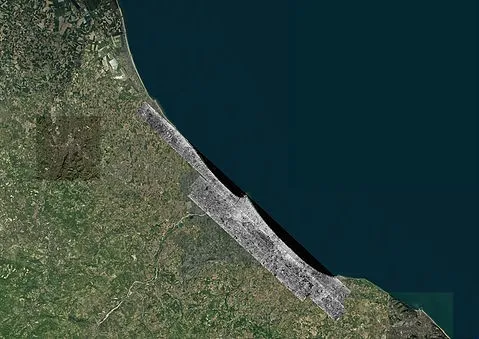
The Penetrating Eye of SAR Technology: Synthetic Aperture Radar (SAR) is an active microwave remote sensing device. Its core advantages are:
1. All-weather, 24/7 Operation: Independent of ambient light, it can penetrate clouds, rain, fog, and smog, achieving true 24/7 monitoring and perfectly coping with severe weather during the flood season.
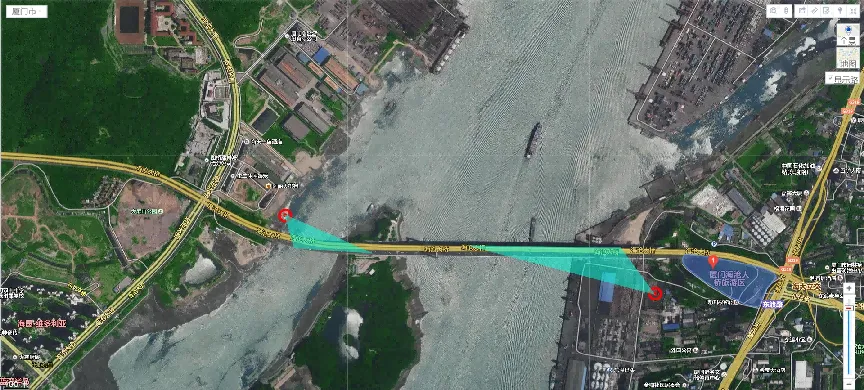
2. Millimeter-Level Deformation Detection: Through interferometric SAR (InSAR), especially differential interferometric SAR (D-InSAR) technology, by comparing the phase information of radar images acquired at different times, it can accurately detect millimeter-level or even sub-millimeter-level minute deformations of the ground surface or dikes. This is crucial for detecting early signs of dangers such as piping, seepage, and landslides.
3. Certain Penetration Capability: Microwaves have a certain penetrating power through dry surface vegetation and sand, helping to detect abnormal humidity changes at a certain depth below the dike surface.
III. Airborne Miniature SAR System
Suzhou Tianjing Yunhu Intelligent Technology Co., Ltd. (hereinafter referred to as Tianjing Yunhu) is committed to becoming a leading global provider of synthetic aperture radar solutions, offering users customized radar equipment, SAR data acquisition services, and radar data products. With years of R&D experience and professional technical accumulation, Tianjing Yunhu has launched SAR products with multiple bands and various capabilities, including frequency-modulated continuous wave and pulse systems. Currently, Tianjing Yunhu provides coverage across multiple bands such as X, Ku, K, Ka, C, W, and L. Its product systems support single-polarization, full-polarization, strip, spotlight, interferometric, and single-pulse search modes, and feature real-time imaging, GMTI, and deformation monitoring. Tianjing Yunhu SAR products can be deployed on multi-rotor/fixed-wing UAVs, manned aircraft, satellites, and vehicle-mounted platforms.








