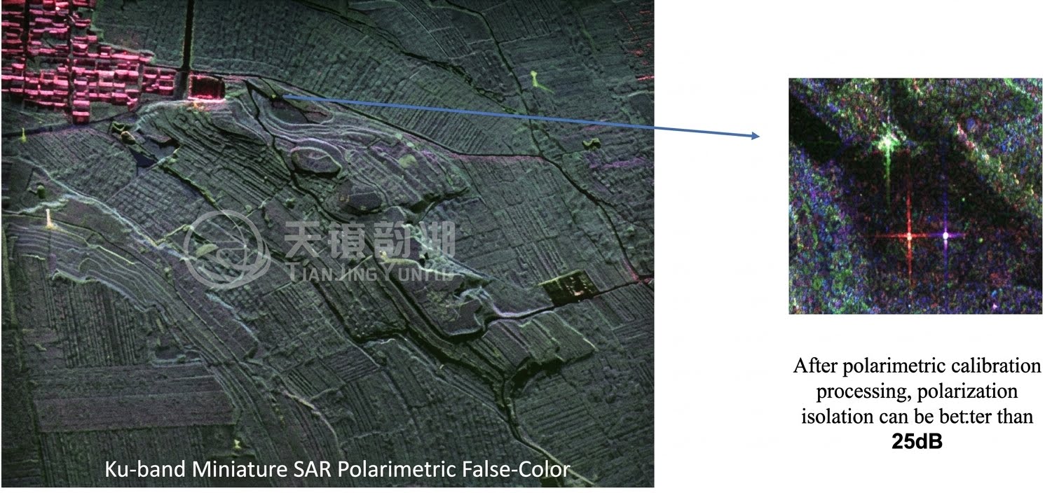
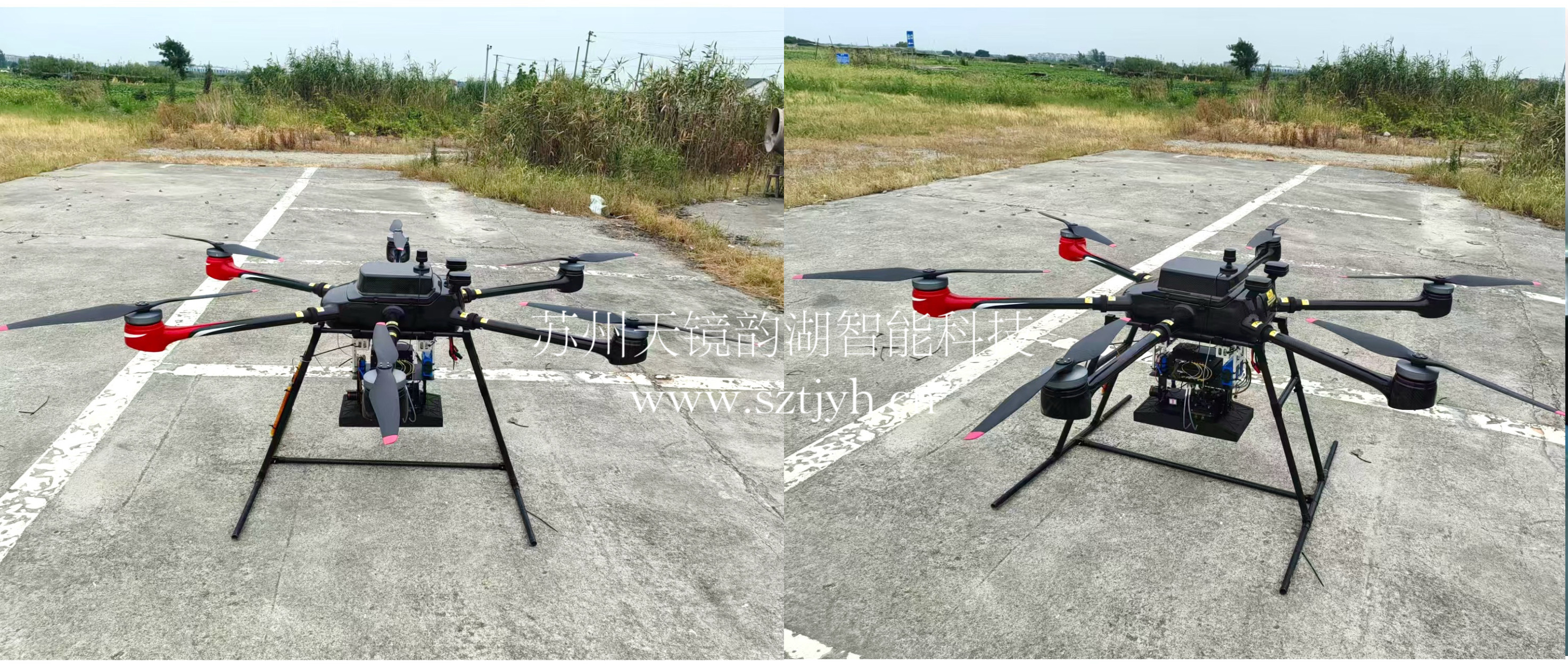
Breaking free from the shackles of light and shadow! The Tianjing Yunhu series of miniature SARs ushers in a new era of all-weather sensing.

Browse: 82 Time: 2026-04-09

In the field of low-altitude remote sensing, severe weather, limited lighting, and delayed information acquisition have always been the three major pain points restricting the effectiveness of traditional remote sensing methods. Optical equipment becomes ineffective in clouds, rain, and fog, while traditional radar is too bulky and difficult to adapt to small UAV platforms. Now, Suzhou Tianjing Yunhu Intelligent Technology Co., Ltd. brings a core solution—the Lingyun, Xiangyun, Yunying, and Tongjing Gongshi series of miniature SAR systems—breaking down perception barriers with digital radar technology and making all-weather high-definition imaging readily available!
I. Technological Leadership, Setting a New Benchmark for Digital Radar

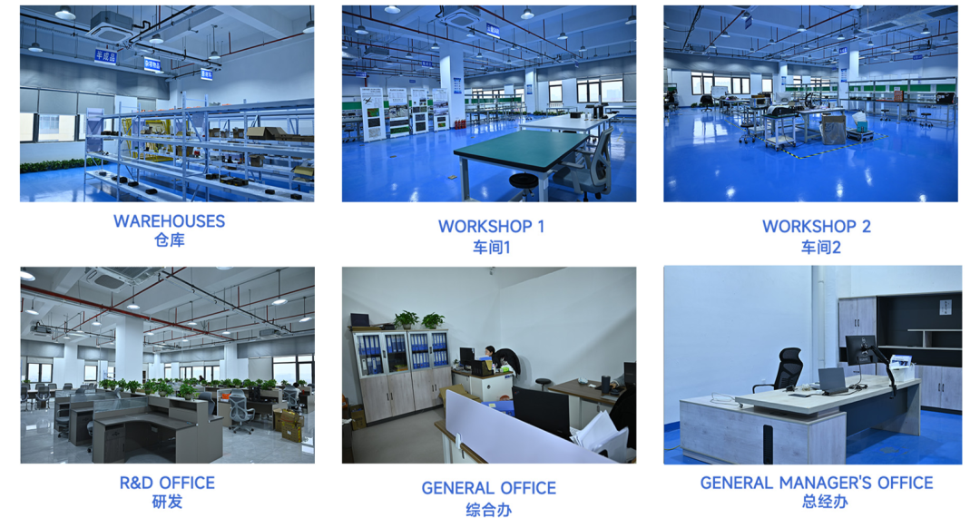
Suzhou Tianjing Yunhu Intelligent Technology Co., Ltd., founded in 2023 by a team that was among the earliest in China to engage in the professional R&D of miniature SAR, focuses on the research and application of miniature synthetic aperture radar equipment. Relying on digital radar technology, the company has independently developed two major series of miniature SAR products: Frequency Modulated Continuous Wave (FMCW) and Pulse, covering the entire X, Ku, K, Ka, C, W, L, and S bands. The product performance is comparable to international top-tier standards, with lightweight, high performance, multi-mode operation, low power consumption, and high cost-effectiveness as its core features, specifically tailored for low-altitude remote sensing by UAVs.
II. Four Major Product Series to Precisely Match Needs

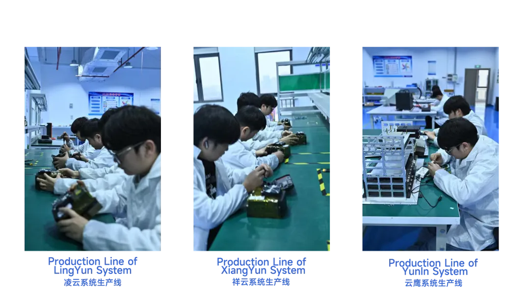
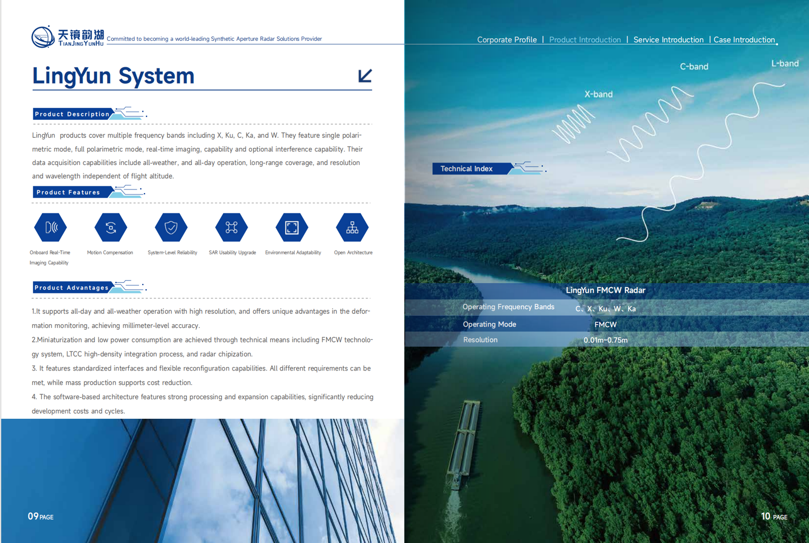
1. LingYun System – Frequency Modulated Continuous Wave Miniature SAR
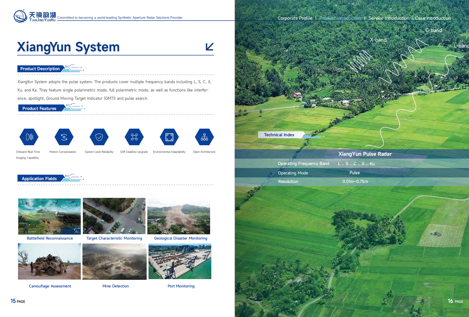
2. XiangYun System – Pulse Miniature SAR
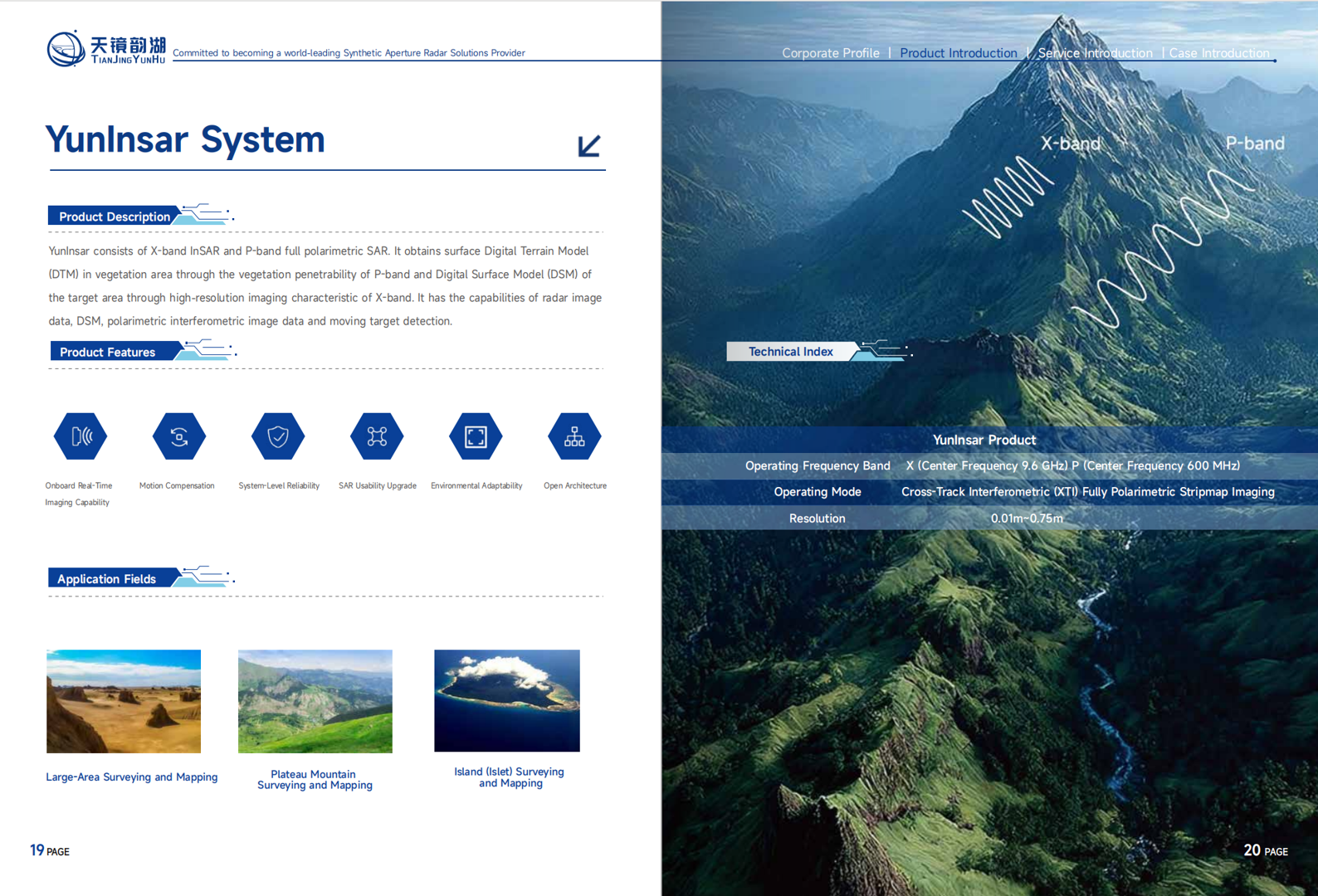
3.YunInsar Sustem – Miniature SAR for Surveying and Mapping
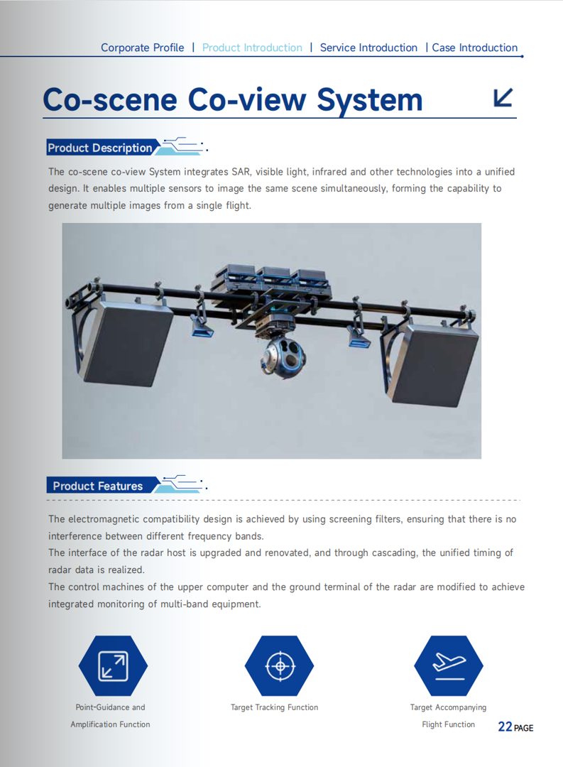
4.Co-scense Co-view  system– Multi-band Fusion System
III. Five Core Strengths Defining Industry Standards

**Full-Band Coverage: Comprehensive coverage across X, Ku, K, Ka, C, W, L, and S bands, capturing diverse scenarios and frequencies.

**Ultra-High Resolution: Up to 0.05 meters, clearly distinguishing minute targets and fine textures, providing users with high-quality data support.

**All-Weather Operation: Unaffected by clouds, rain, or fog, and unaffected by lighting conditions, stably outputting high-definition imagery day and night.

**Multi-Mode Intelligence: Flexible configuration options including striping, beamforming, interferometry, GMTI, and full polarization, allowing one hardware solution to meet diverse needs.

**End-to-End Data Services: A professional data team provides full support, from data acquisition and quantitative processing to industry application interpretation, offering a complete service so users don't need to worry about data processing challenges.


IV. Closed-Loop Service, Worry-Free Cooperation Throughout

Product System: Four major series and multiple models, from standard to lightweight versions, from single-frequency to dual-frequency, from conventional to phased array, providing a complete product matrix to meet diverse needs.

Technical Service: Relying on high-precision quantitative remote sensing algorithms, we provide a closed-loop service from data acquisition to application, quickly responding to user needs.

After-Sales Support: 24/7 response, with a professional technical team providing full support to ensure efficient project implementation.

V. Covering Multiple Industry Scenarios

Emergency Rescue | Geological Disaster Monitoring | Border Patrol | Water Conservancy and Riverbank Inspection | Power Line Inspection | Pipeline Inspection | Geographic Mapping | Camouflage Assessment | National Defense and Security | Marine Monitoring
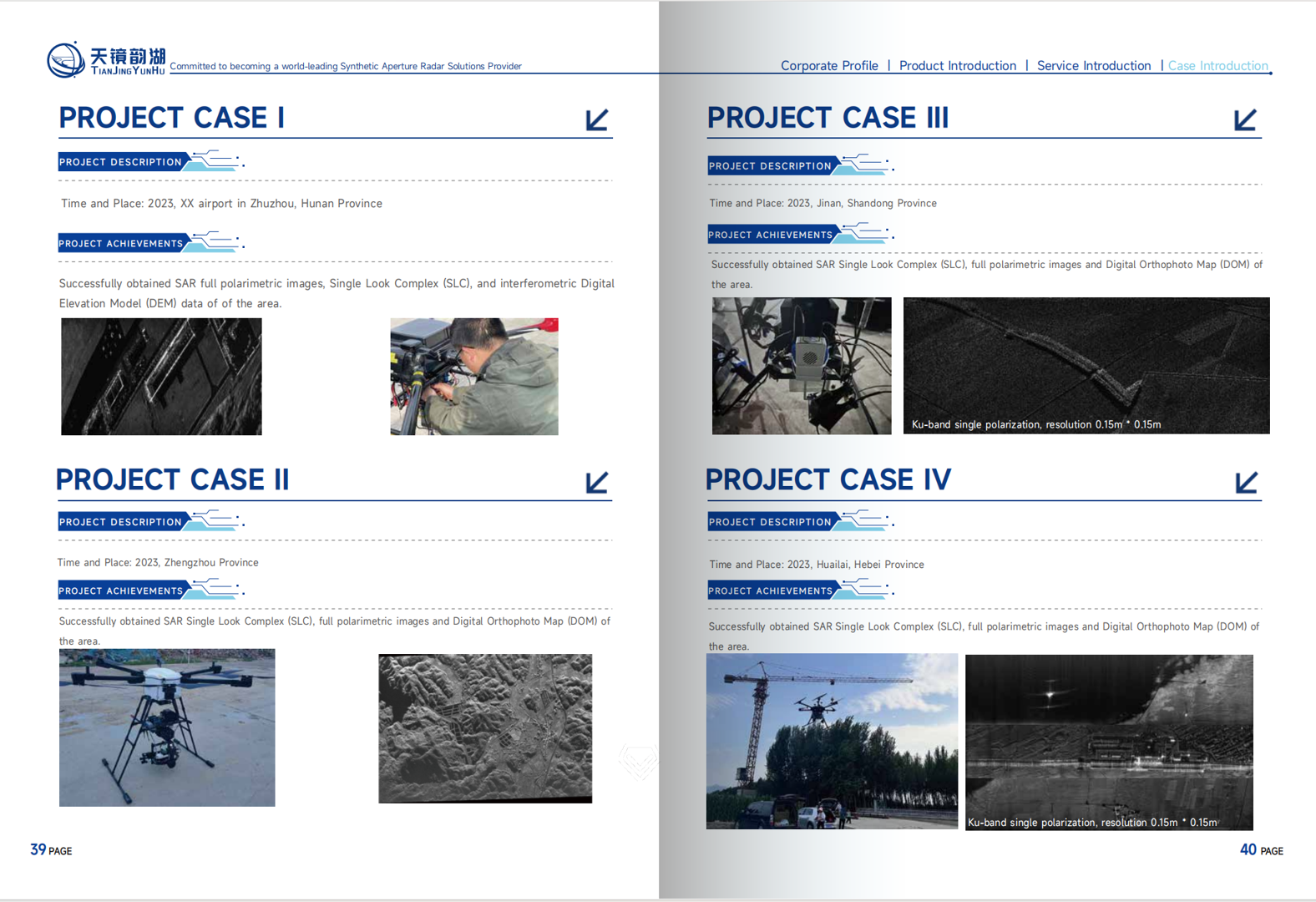
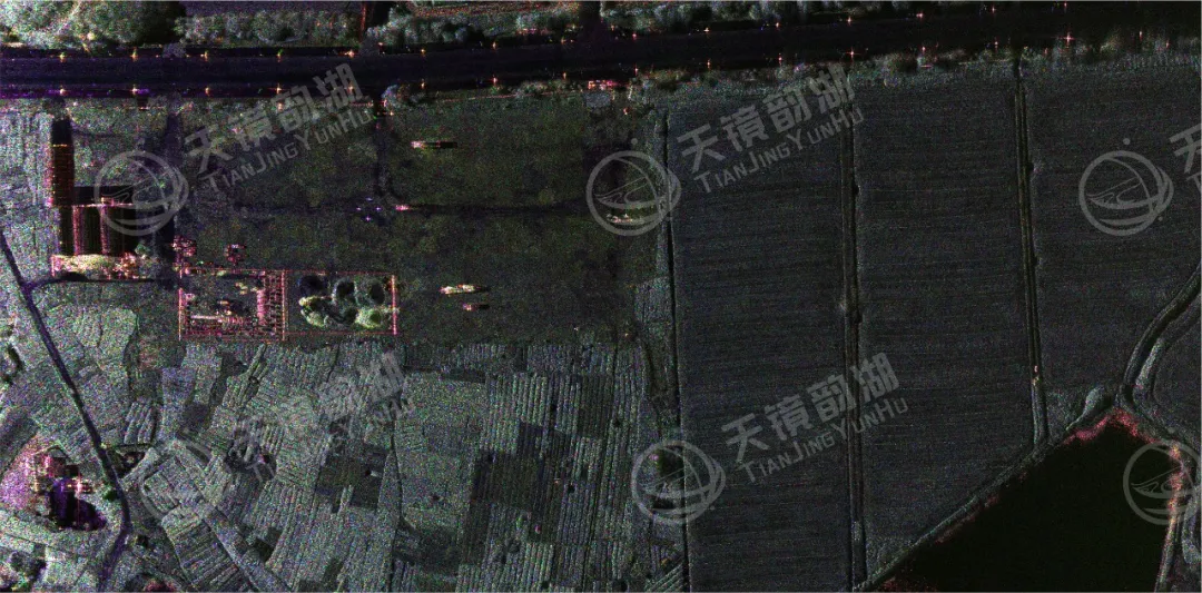
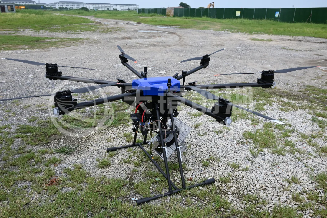
The Tianjing Yunhu series of miniature SARs enables microwaves to perceive the world, empowering a new era of all-weather intelligent sensing for all industries.
Related Information

Related Information
2026.08.28

Tianjing Yunhu | MiniSAR: Full Polarimetric Imaging Capability

In the field of remote sensing today, synthetic aperture radar (SAR), visible light, and infrared together form a multi-layered observation system. Visible light remote sensing is intuitive and clear, while infrared remote sensing excels at thermal sensing. However, both are passive detection methods, heavily reliant on sunlight or the target's own thermal radiation. Once they encounter cloud cover, nightfall, or rainy/foggy weather, their detection capabilities are significantly reduced or even completely lost.
2026.08.26

Tianjing Yunhu | P-band Airborne SAR Radar System

Low-frequency radars (such as P-band and L-band radars) can "see farther and see more clearly" because of their longer wavelengths, lower attenuation, and reduced sensitivity to stealth coatings. In modern air defense systems, they are key to anti-stealth radars. They can penetrate 1-meter-thick camouflage netting and 3-meter-thick bushes to identify hidden tanks and radar stations, and are less likely to trigger enemy warning systems, demonstrating significant advantages in covert detection.
2026.08.21

Tianjing Yunhu | Miniature SAR Vehicle Target Dataset

Synthetic Aperture Radar (SAR) target detection datasets are a core foundation for training and evaluating deep learning models. These datasets cover various target types, including ships, aircraft, vehicles, bridges, and oil tanks, and are applicable to multiple fields such as military reconnaissance, maritime monitoring, and traffic management. They not only provide high-resolution SAR images but also contain precise annotation information (category, location, size, etc.), ensuring improved algorithm performance.
2026.08.17

Tianjing Yunhu | Miniature SAR Equipped with Fixed-Wing UAV

Today's main focus is on the CW-25E VTOL fixed-wing UAV and the Tianjing Yunhu XiangYun System pulse MiniSAR.

The CW-25E is a pure electric VTOL fixed-wing UAV designed specifically for large-area missions. It has a fuselage length of 2.08 meters, a wingspan of 4.35 meters, and features a twin-boom fused inverted V-tail design, resulting in a compact structure and excellent aerodynamic performance.

The CW-25E has a maximum takeoff weight of 31.58 kg and a payload capacity of 6.6 kg, capable of simultaneously carrying various mission equipment such as SAR, lidar, and electro-optical pods. It boasts a maximum endurance of 150 to 240 minutes, a service ceiling of 6000 meters, a maximum takeoff altitude of 4000 meters, and wind resistance up to level 7. It can stably perform patrol missions in complex terrain and high-altitude areas.
2026.07.18

Tianjing Yunhu | Airborne SAR (Synthetic Aperture Radar) Calibration Capability

Airborne SAR (Synthetic Aperture Radar) calibration refers to the calibration of various parameters of an airborne SAR system using specific methods to eliminate systematic and environmental errors, thereby ensuring the quality of SAR images, positioning accuracy, and the accuracy of inversion parameters. Airborne SAR calibration is mainly divided into three categories: geometric calibration, radiometric calibration, and polarimetric calibration.
2026.07.13

UAV L-band Heavy Orbit Interferometric SAR System: Airborne Verification for Millimeter-Level Deformation Monitoring

Synthetic Aperture Radar Interferometry (InSAR) technology, with its all-weather, 24/7 capability and high sensitivity to surface deformation, has become an important tool for geological hazard monitoring, ground subsidence investigation, and infrastructure health diagnosis. Integrating InSAR technology onto unmanned aerial vehicle (UAV) platforms further overcomes the limitations of long satellite revisit cycles, insufficient maneuverability, and high costs associated with manned operations, providing a new approach for regional, high-frequency, and high-precision deformation monitoring. However, the small size and susceptibility of UAV platforms to airflow disturbances make it difficult to maintain consistent flight paths during repeated flights, posing a significant challenge to double-track interferometry processing.

Online Message

Company Address

Company Address

Room 801, Building 14, No. 135 Zhangji Road, Kunshan Development ZoneView the map
Emaile

Email

tjyh888@139.com
Postal Code

Postal Code

215300
Sales contact information

Sales contact information

  • Sales 1:18252999418 (same WeChat)
  • Sales 2:13126758269 (same WeChat/Whatsapp)
  • Sales 3:15862678208 (same WeChat)
  • Sales 4:15895462772 (same WeChat/Whatsapp)
验证码
Submit

Contact Us

关注我们
关注我们