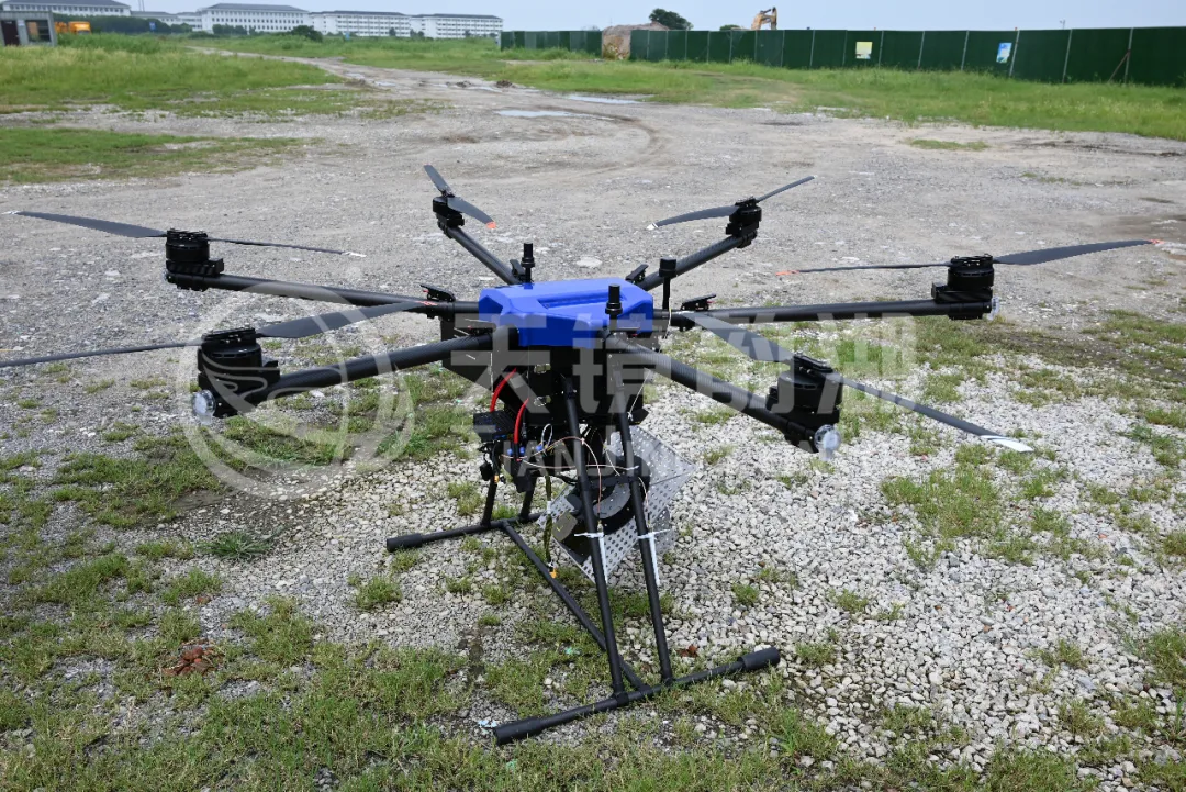
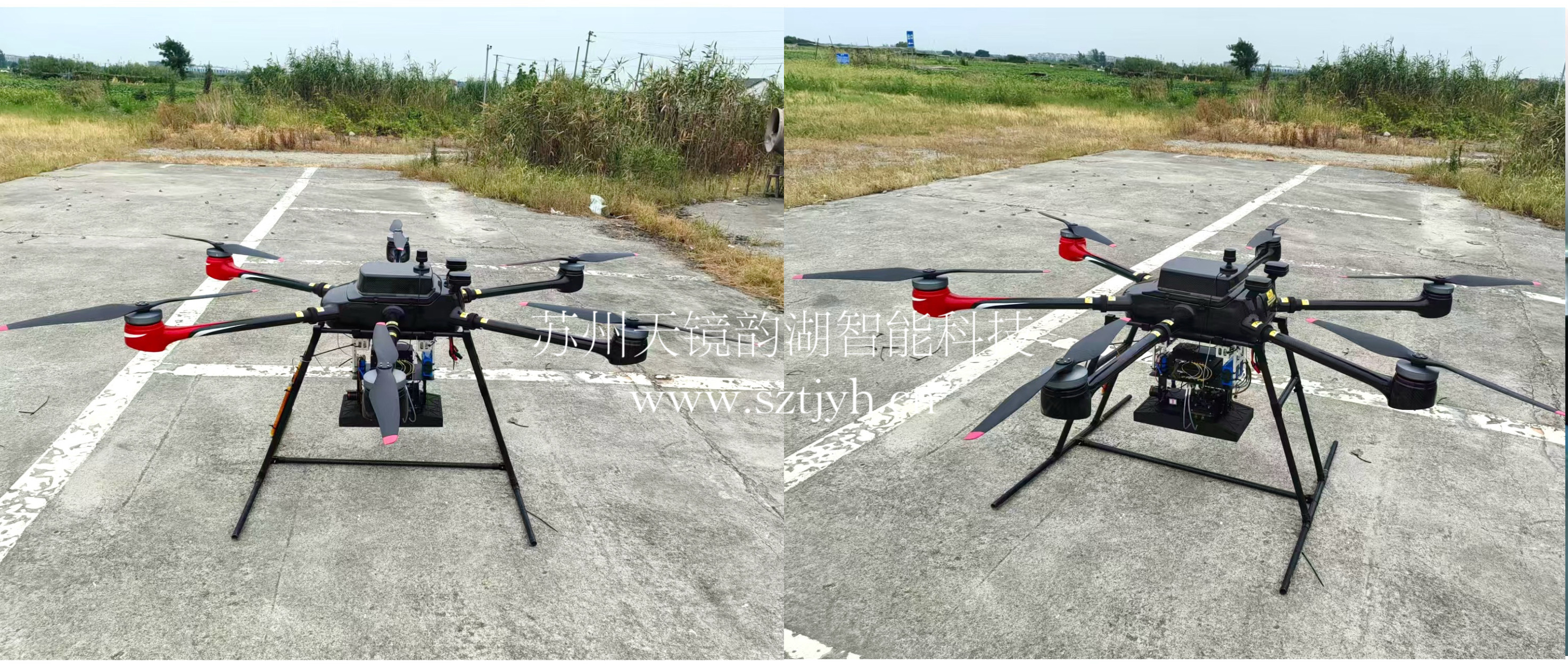
DJI M400 equipped with Tisnjing Yunhu LingYun weight-reduced miniature SAR unlocks a new experience in low-altitude imaging.
As a flagship industrial drone platform, the DJI M400 is capable of in-flight mapping using MiniSAR. Its core strength lies in its powerful payload and multi-payload compatibility design, which can adapt to mainstream MiniSAR payloads and complete all-weather, high-precision imaging and monitoring tasks.
I. Platform and Load Compatibility
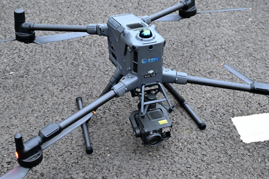
Payload and Load Capacity: The M400 has a maximum payload of 6 kg and can carry third-party payloads ≤6 kg via a third gimbal mount, fully meeting the payload requirements of mainstream miniature SARs (approximately 2.7–6 kg) for DJI.
Environment and Safety: Equipped with a ring-scanning LiDAR + millimeter-wave radar + full-color night vision, it achieves "electric line level" obstacle avoidance, operates in a wide temperature range of -20℃ to 50℃, and supports flight in complex environments such as rain, fog, and nighttime.
Endurance and Efficiency: With a payload, the forward flight time is approximately 59 minutes. Combined with O4 enhanced image transmission (up to 40 km), it can efficiently complete imaging tasks over medium to large areas.
II. Mapping Capabilities and Application Scenarios
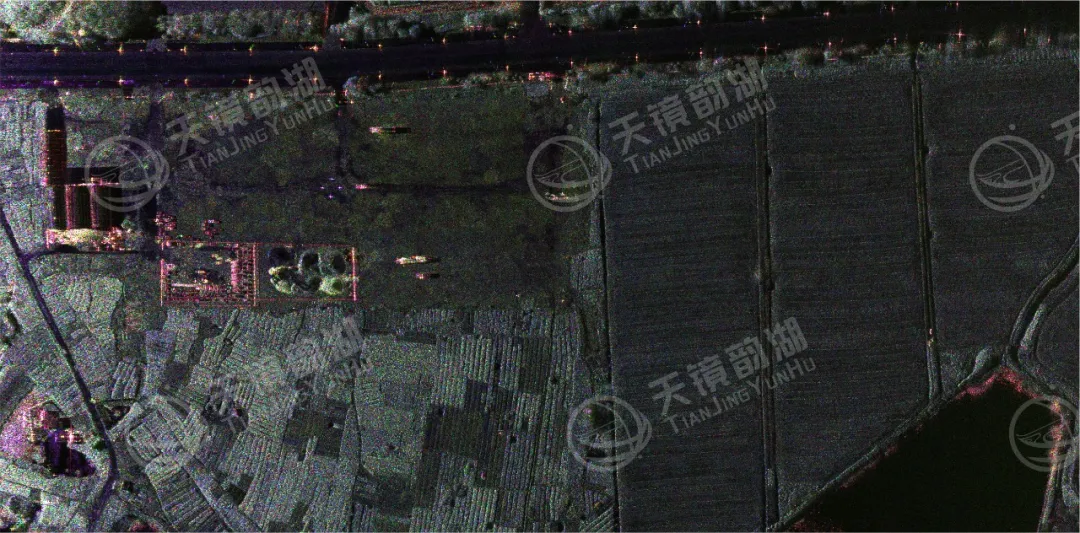
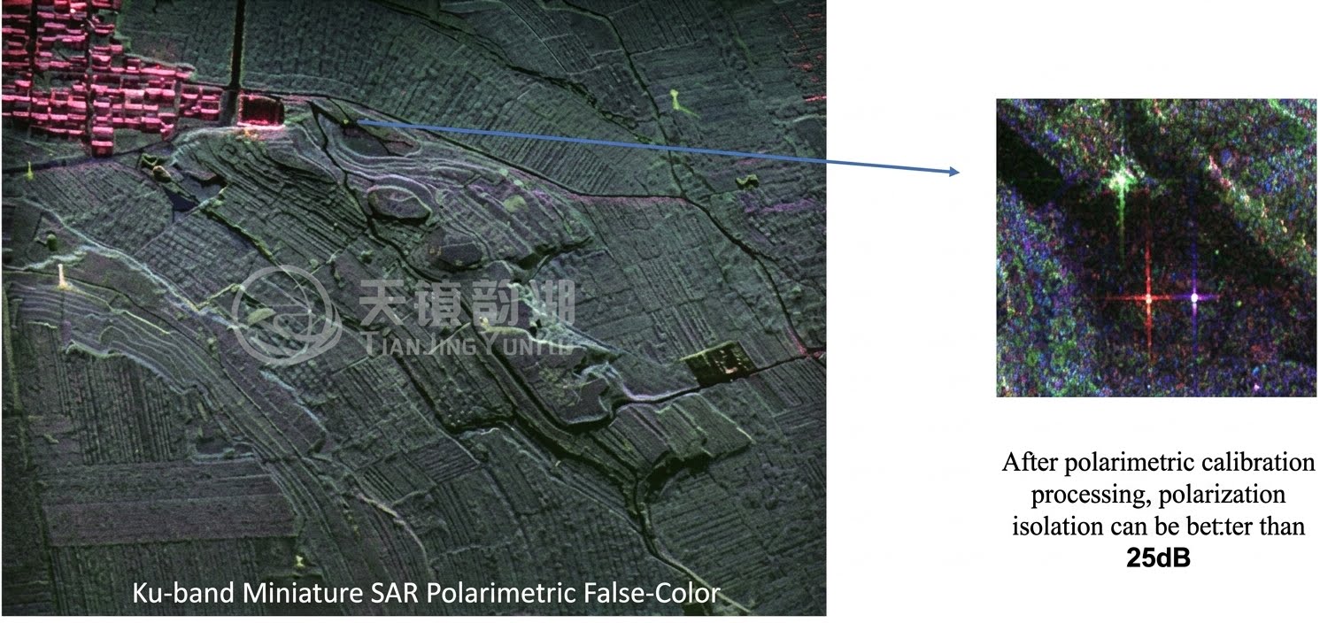
Ø Core Parameters: Mainstream miniature SAR paired with M400, X/Ku band resolution can reach 0.15–0.2 m, W band resolution can exceed 0.05 m, supporting strip, spotlight, interferometric (InSAR) and other modes to achieve real-time imaging and deformation monitoring.
III. Advantages of the combination (Why is the M400 + Tianjing Yunhu LY1B so strong?)
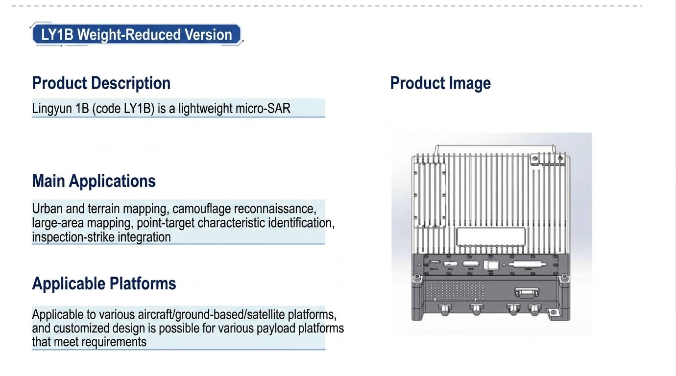
Extreme weight reduction and optimal battery life: The LY1B sets an industry benchmark for lightweight design at 2.7kg, while still offering over 38 minutes of flight time with the M400 payload. Single-squad coverage: approximately 3–5 km² (@0.2m resolution). The LY1B operates in all weather conditions, unaffected by rain, fog, haze, night, or sandstorms, penetrating camouflage, shallow vegetation, and thin cover to identify targets invisible to optical observation.
Ø High precision + high stability: M400 RTK cm-level positioning + LY1B 0.2m resolution, full polarization + real-time imaging, data is immediately available upon acquisition.
Ø Fast deployment and low cost: Portable by a single soldier, quick setup in 10 minutes. Compared to fixed-wing/large UAVs, it offers flexible takeoff and landing, simple maintenance, and low cost.
IV. Typical Application Scenarios
Emergency Mapping: Earthquake/Landslide/Flood, rapid mapping through clouds and fog
Mine Monitoring: Slope deformation, pile volume calculation, illegal mining identification
Power/Pipeline: Corridor inspection, foundation settlement, tree obstruction hazards
National Defense/Security: Camouflage identification, border patrol, target reconnaissance
Water Conservancy/Environmental Protection: River monitoring, wetland mapping, polluted water body identification
V. Summary
The Tianjing Yunhu LY1B lightweight version + M400 is currently the benchmark solution for lightweight UAV SAR. With its lightweight design and all-weather performance, it empowers efficient operations in multiple fields, becoming the preferred solution for professional surveying and monitoring:
2.7kg ultra-light payload + 38min+ flight time
0.2m resolution + full polarization + Real-time imaging
All-weather, all-time, high precision, high efficiency
Fully meets the needs of aerial mapping, monitoring, and reconnaissance in professional scenarios such as surveying, emergency response, mining, power, and national defense. Please contact us if needed.