

Airborne Synthetic Aperture Radar (SAR) is a system that combines an airborne platform with synthetic aperture radar technology, enabling all-day, all-weather ground imaging and observation. Compared with conventional visible-light imaging, radar is not restricted by day and night or weather conditions, greatly improving reconnaissance efficiency. For this reason, the share of radar in remote-sensing applications has been growing steadily.
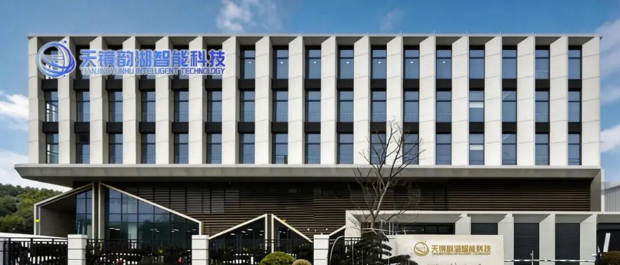
Suzhou Tianjing Yunhu Intelligent Technology Co., Ltd. focuses on the development of airborne SAR radar. The company was established on February 28, 2023 and has been certified as both a National High-Tech Enterprise and a National Sci-Tech Small and Medium-Sized Enterprise. Since its inception, the company has remained dedicated to the independent research, development and system integration of Synthetic Aperture Radar (SAR). Building on the founder’s years of in-depth experience in the radar technology field, the company has continued to invest in innovation and gradually built a radar product series covering multiple application scenarios, committed to delivering high-precision, high-reliability radar solutions to users.
At present, the airborne SAR radar based on differential interferometry (DInSAR) technology (the Yunyuan series) has been successfully developed and has become a standard product entering the market. Combined with the company team’s technical accumulation and project experience in airborne SAR, we have established our own core technical barriers in the R&D and manufacturing of localized (domestic) and miniaturized radar, giving us a significant cost advantage and rapid technology iteration capability in future commercial competition.
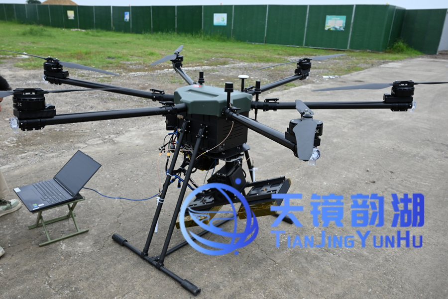
Tianjing Yunhu Successfully Validates the Interferometric SAR System (Yunyuan Series) in Kunshan
According to the SAR coherence analysis results, farmland and building areas exhibit high coherence (coefficient > 0.8), while water bodies and road areas show low coherence (coefficient < 0.4), mainly due to specular reflection on water surfaces and dynamic interference from vehicles on roads. Test validation indicates that the L-band has a weak decorrelation effect on low vegetation, and the company plans to conduct comparative experiments across other frequency bands in the future. In addition, validation through corner-reflector tests confirms that the system’s deformation-monitoring accuracy is better than 5 mm (with a corner-reflector placement error of approximately 2 mm), fully meeting the requirements of the vast majority of application scenarios.
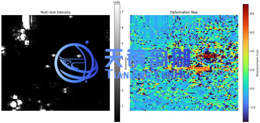
Deformation Analysis and Coherence Analysis
This system is a highly integrated package comprising an L-band radar, a high-precision inertial navigation system, a servo-stabilized turntable, and modules such as the RF antenna, data link and battery. The complete system weighs only 14 kg, with a power consumption as low as 160 W, and can be easily mounted on multi-rotor UAVs. The system has successfully completed multiple aerial survey validation missions, fully demonstrating its stability and reliability in real operating environments.
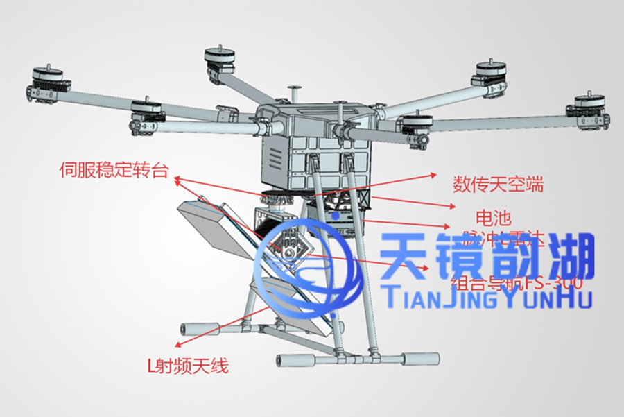
(Yunyuan Series) 3D Design Drawing
Its unique interferometric imaging capability acquires two coherent single-look complex (SLC) images of the same area from slightly different viewing angles, and derives ground elevation information from their interferometric phase, achieving millimeter-level accuracy. This system not only effectively reduces the operating cost for users, but also fills a market gap with a high-precision, high-reliability domestic solution, offering enormous substitution potential and commercialization prospects. It can be applied in emergency rescue, disaster assessment, geological-hazard slopes, dam inspection and many other fields, helping relevant organizations and departments make timely decisions on disaster early warning and assessment.
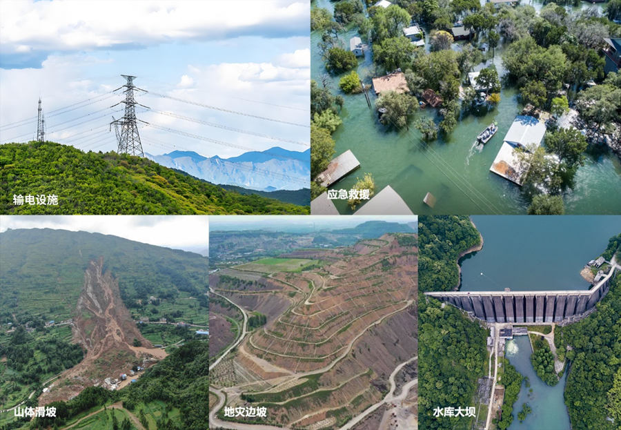
Application Domains
Typical application scenarios:
Geological Hazard Monitoring
· Landslide monitoring: identifies potential landslide bodies undergoing slow deformation; by analyzing deformation rates and acceleration trends, landslide risk can be assessed in a graded manner.
· Earthquake research: can be used to obtain co-seismic deformation fields, providing key constraint data for seismic source mechanism inversion and fault slip distribution model construction.
· Volcano and glacier monitoring: can be used to monitor surface deformation caused by volcanic activity, as well as the flow velocity and changes of glacier drift.
Infrastructure Monitoring
· Dams and reservoirs: enables continuous monitoring of dam bodies, reservoir-bank slopes and the surrounding reservoir area, obtaining the overall deformation field to assess structural health.
· Bridges and super-tall buildings: used to monitor deformation of large bridges (e.g. the Hong Kong–Zhuhai–Macao Bridge) and super-tall buildings.
· Power transmission facilities: can be used to monitor ground subsidence along high-voltage transmission towers and their corridors, as well as deformation of the surrounding environment.
Urban and Engineering Monitoring
· Underground engineering impact: monitors the impact of construction along metro lines, tunnels, deep foundation pits and other works on the surrounding environment.
· Mining area and tailings pond safety: monitors ground subsidence and collapse caused by mineral resource extraction, as well as the stability of tailings pond embankments, setting thresholds for risk early warning.
· Urban ground subsidence: performs high-precision monitoring over areas with numerous stable scatterers (such as buildings and roads), revealing subsidence centers, subsidence extent and development trends.
We believe that, with the widespread application of UAV platforms, miniaturized UAV-borne synthetic aperture radar will gradually become standard equipment for UAV observation, playing an increasingly important role in military and civil remote-sensing observation. The research on this system has preliminarily broken through a number of key challenges constraining the use of miniaturized UAV-borne differential interferometric SAR for surface deformation monitoring, and will strongly promote the practical application of UAV-borne DInSAR technology in the remote-sensing monitoring and early-warning field!








