

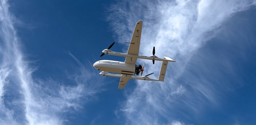
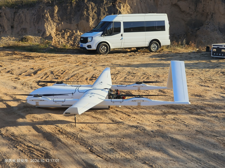
In October, the Loess Plateau hills and gullies stretch across Yan’an in northern Shaanxi. The flight team from Tianjing Yunhu arrived at the field operation site with airborne Synthetic Aperture Radar (SAR) equipment and long‑endurance fixed‑wing UAVs to kick off a new round of field remote‑sensing flight missions. For this assignment, a self‑developed airborne SAR system by Tianjing Yunhu was mounted on a vertical take‑off and landing (VTOL) fixed‑wing UAV platform for on‑site data acquisition.
SAR: Unconstrained by Environmental Conditions
Within the field of UAV‑based remote sensing, Synthetic Aperture Radar (SAR) technology has greatly expanded the operational boundaries of aerial remote sensing.
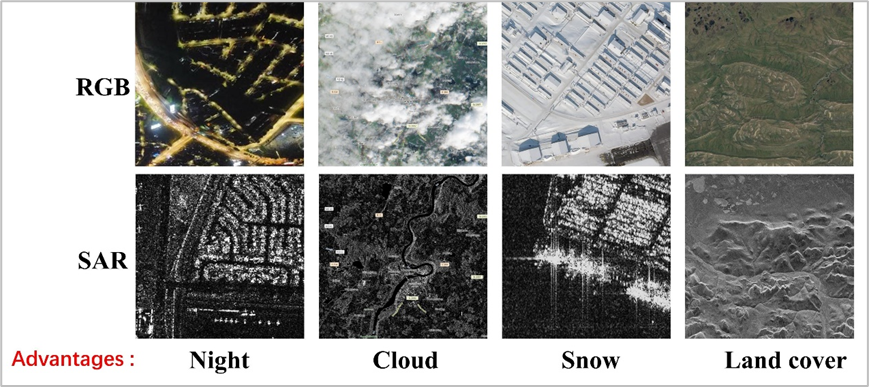
SAR is an active microwave remote‑sensing radar carried aboard aerial platforms. It works by actively transmitting microwave signals and receiving echoes reflected from ground targets to acquire high‑resolution Earth‑observation imagery. Unlike electro‑optical payloads, SAR imaging does not rely on external illumination and can operate through darkness, cloud and fog.
Visible‑light cameras capture ground imagery using natural or supplementary lighting; their imaging performance deteriorates severely at night or under cloud cover. By contrast, SAR actively emits electromagnetic waves and interprets signals reflected from surface features. This core characteristic grants SAR far superior environmental adaptability compared with conventional optical remote‑sensing equipment.
Advantages of SAR
Core Advantages of SAR
Thanks to its unique operating mechanism, SAR delivers three irreplaceable benefits for flight missions:
- Day‑and‑night continuous operation: SAR requires no sunlight for imaging. Data can be collected both in daylight and deep at night. For time‑critical, urgent projects, operational teams can arrange flights flexibly without being restricted by sunrise and sunset.
- All‑weather data acquisition: Microwave signals penetrate clouds, fog, rain and snow. Valid ground remote‑sensing data can be reliably obtained even under poor visibility and harsh weather. For time‑sensitive scenarios such as emergency rescue and dynamic monitoring, SAR overcomes weather limitations to ensure mission completion.
- Surface perception capability: Beyond standard surface imaging, SAR can capture shallow ground deformation under appropriate conditions. It fits a wide spectrum of applications including high‑precision topographic mapping, surface deformation monitoring, disaster impact assessment and agricultural‑resource remote sensing.
 Work site
Daily Work of Front‑line Pilots: Rigorous End‑to‑End Control
Field operations in Yan’an pose high demands for UAV platforms, radar payloads and operating personnel, given its loess‑covered terrain, criss‑crossing gullies and sharp day‑night temperature swings. Before take‑off, pilots double‑check flight routes, inspect wings and power systems, and verify payload status. During flight, they monitor real‑time downlinked data and adjust flight parameters dynamically according to wind speed and airflow. After landing, they conduct a full post‑mission review, sorting and archiving raw data and flight logs for every sortie.
A night‑time mission was scheduled for the same evening. Unaffected by darkness, SAR supports night‑time imaging, so the team carried out remote‑sensing flights after dark based on on‑site conditions.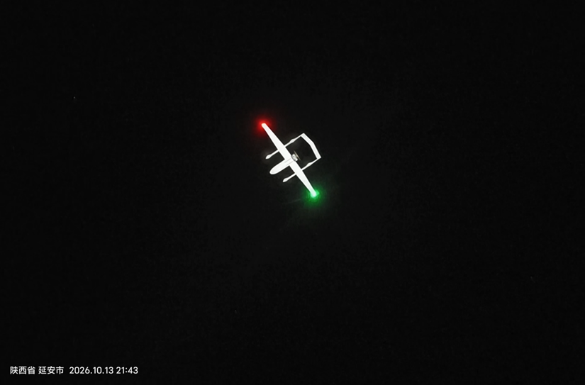
Night flight
Certified Pilots: Professionalism Reflected in Standardized Procedures
Tianjing Yunhu adheres firmly to one operational principle: all aerial remote‑sensing flights shall be performed exclusively by officially certified, qualified UAV pilots. On‑site, pilots complete comprehensive equipment checks; every procedure is strictly implemented with no shortcuts. Aerial fieldwork tolerates zero negligence. Professionalism is demonstrated through standardized step‑by‑step operations, not mere slogans.
In the pre‑project phase, we communicate closely with clients to clarify requirements, defining operational coverage, flight modes and data delivery specifications. Operations are carried out in compliance with aerial‑work regulations, with complete flight documentation retained. Upon mission completion, deliverables are provided objectively with factual feedback on data quality, free of exaggeration or ambiguity.
Flight scene
Project Delivery: Verifiable and Reliable Remote‑Sensing Data
Full flight logs and complete operational records are preserved for every sortie. Project outputs are fully traceable and reviewable to guarantee authentic and dependable delivered datasets. Focused on diverse real‑world scenarios, we can configure radar payloads for mission‑specific targets upon client request. We provide one‑stop full‑chain solutions covering “radar R&D, platform integration, flight operations, data processing and industry‑specific applications”. If you are interested in radar technology or seeking high‑performance radar solutions, please feel free to contact us!








