

In the field of UAV remote sensing monitoring, rain, fog, darkness, snow, and sandstorms have always been bottlenecks that traditional optical equipment cannot overcome. Emergency rescue operations suffer from poor visibility, mine monitoring is inaccurate, power line inspections are inefficient, and agricultural and forestry patrols rely on weather forecasts… Now, Suzhou Tianjing Yunhu Intelligent Technology Co., Ltd. brings its self-developed miniature airborne SAR solution, enabling monitoring to truly achieve all-weather, all-time, and all-scenario coverage.
I. Tianjing Yunhu Miniature SAR: Lightweight, High-Performance, and Adaptable to All Scenarios
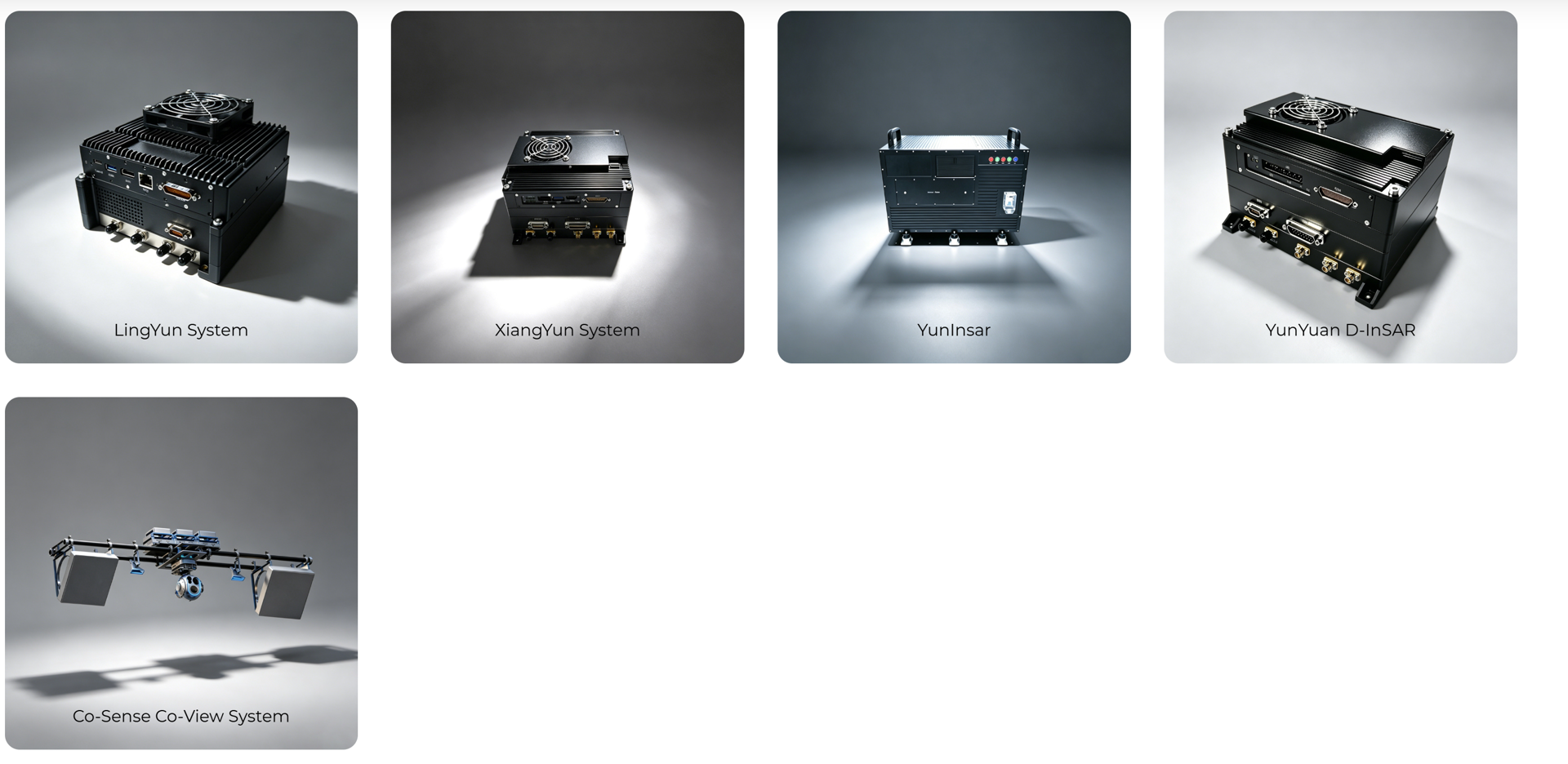
Tianjing Yunhu focuses on the R&D and application of miniature synthetic aperture radar (SAR). Founded by a senior domestic SAR professional team, it has deep expertise in digital radar technology and has independently developed two major series of miniature SAR products: Frequency Modulated Continuous Wave (FMCW) and Pulse SAR, covering the entire X, Ku, C, W, L, P, Ka, and K bands. The products are lightweight, high-performance, low-power, and highly integrated, fully meeting international standards. They are specifically designed for small and lightweight UAVs and low-altitude operation platforms:
All-weather, all-day operation: Stable operation, unaffected by darkness, rain, fog, or snow.
Ultra-high resolution: Better than 0.1 meters, with clearly discernible details.
Multi-mode imaging: Stripmap/spotlight/scan/fully polarized/GMTI, efficient phased array operation without a gimbal.
Intelligent collaboration: Equipped with professional display and control software, supporting automatic flight path planning, real-time image downlink, and coordinate extraction, enabling air-to-ground collaboration and efficient operation.
II. Real-world case studies: From mines to emergency response, validating value in real-world scenarios
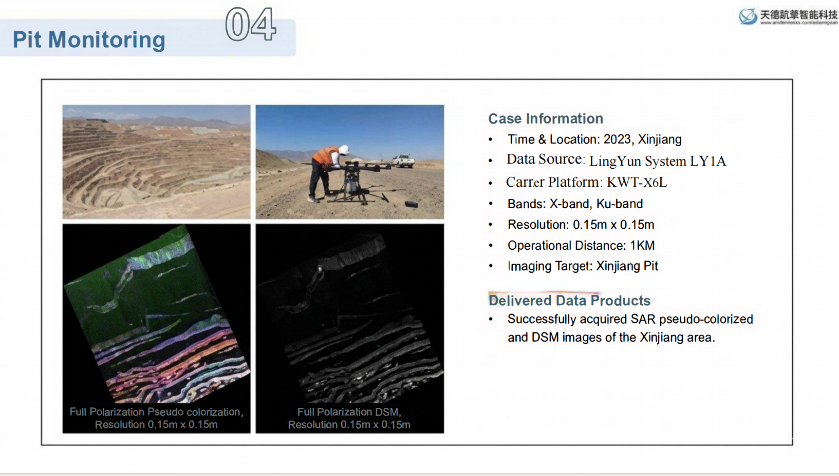
Case Study 1: Snow-Covered Slope Monitoring in a High-Altitude Open-Pit Mine
A high-altitude open-pit mine in Xinjiang experienced prolonged snow accumulation, rendering its optical equipment completely ineffective.
The Tianjing Yunhu miniature SAR system penetrated the snow, providing high-definition imaging at a resolution of 0.15m to accurately identify rock mass structures, offering crucial data for slope safety and disaster early warning.
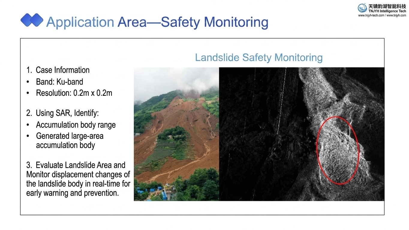
Case 2: Mountain Landslide/Geological Disaster Emergency Response
Landslides are frequent in the southwestern mountainous areas during the rainy season, and dense fog obscures visibility.
Miniature SAR continuously monitors mountain deformation day and night, penetrating rain and fog to quickly obtain disaster information, providing first-hand, accurate information for rescue decisions and road maintenance.
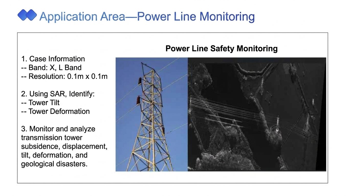
Case 3: 24/7 Inspection of Power Corridors
Inter-provincial transmission lines traverse mountains and forests, making traditional inspections difficult and hindering the detection of potential hazards.
SAR (Rapid Alert Testing) penetrates vegetation to accurately identify sag issues, tower foundation settlement, and icing risks, enabling year-round intelligent inspections and ensuring the safe and stable operation of the power grid.
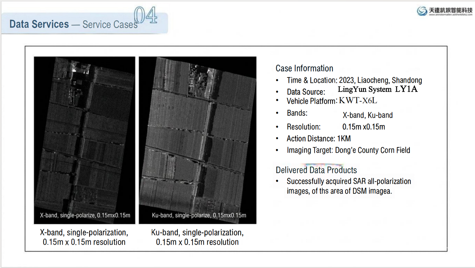
Case 4: Smart Agriculture and Forestry Precision Monitoring
Large-scale Farm Applications:
Soil moisture inversion to guide water-saving irrigation
Identification of crop growth, lodging, and pests and diseases for precise field-level management
Support for planting structure verification, farmland protection, and ecological patrols, providing a reliable data foundation for agricultural management and resource surveys.
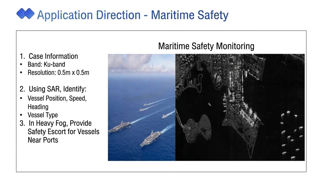
Case 5: Coast/Sea Surveillance
A coastal port area and shoreline management unit use Tianjing Yunhu Micro SAR to perform sea surface surveillance, ship detection, and shoreline change monitoring. It is not affected by night, dense fog, and wind and waves, and continuously obtains high-definition images to help marine safety management and ecological environment protection.
III. Full-Chain Service: From Equipment to Solutions, One-Stop Worry-Free Support
Tianjing Yunhu, with a customer-centric approach, provides full-cycle services from pre-sales to sales to after-sales:
l Professional needs assessment, customized solutions;
l On-site installation, commissioning, and training for rapid onboarding;
l 24/7 technical response, rapid troubleshooting;
l Support for in-depth customized development to meet the specific needs of various industries.
IV. Conclusion
Observing the myriad phenomena of the world through the eyes of SAR.
Suzhou Tianjing Yunhu's miniature SAR, fearless of rain, fog, day or night, uses domestically developed cutting-edge technology to safeguard national defense, emergency rescue, ecological protection, and the low-altitude economy!
— Suzhou Tianjing Yunhu Intelligent Technology Co., Ltd. —
Focusing on Miniature Airborne SAR | All-Weather Sensing Experts








