Tianjing Yunhu | Miniature SAR and DJI M400

Browse: 164 Time: 2026-08-13

Airborne synthetic aperture radar (SAR) has gradually become the "main force" in the field of low-altitude remote sensing due to its technical advantages of all-weather, all-time, and high resolution. It has performed particularly well in terms of real-time data, high-precision imaging, and dynamic and static target monitoring, providing new technical solutions for various application scenarios, especially in the fields of maritime surveillance, topographic mapping, power line inspection, and urban planning.
222.jpg

Miniature SAR System

Entering the 21st century, with the maturity of UAV technology, SAR payloads began to be widely integrated into UAV systems, enabling UAVs to possess all-weather, all-time detection capabilities. Among the most well-known are the US high-altitude, high-speed UAV series "Global Hawk" and the medium-to-high-altitude UAV series "Predator".

Following subsequent development, advancements in microelectronics and solid-state devices propelled SAR into the era of "miniaturization," leading to the emergence of small, lightweight SAR systems, also known as MiniSAR, with weights generally reduced to the kilogram level. For example, in 2004, Germany's EADS launched the world's first 4-kilogram FMCW MiSAR system, marking a breakthrough in miniaturization. In 2008, the US ImSAR's NanoSAR reduced its weight to below 2 kilograms, setting a record for single-channel Ku-band 0.3-meter resolution, and its modular design is compatible with tactical UAVs.

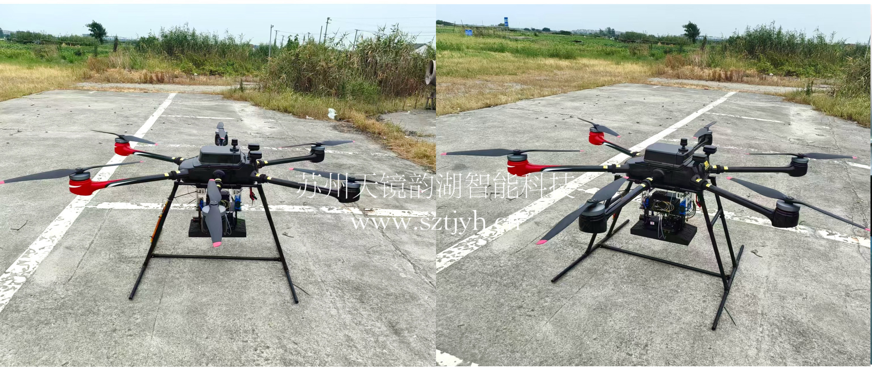
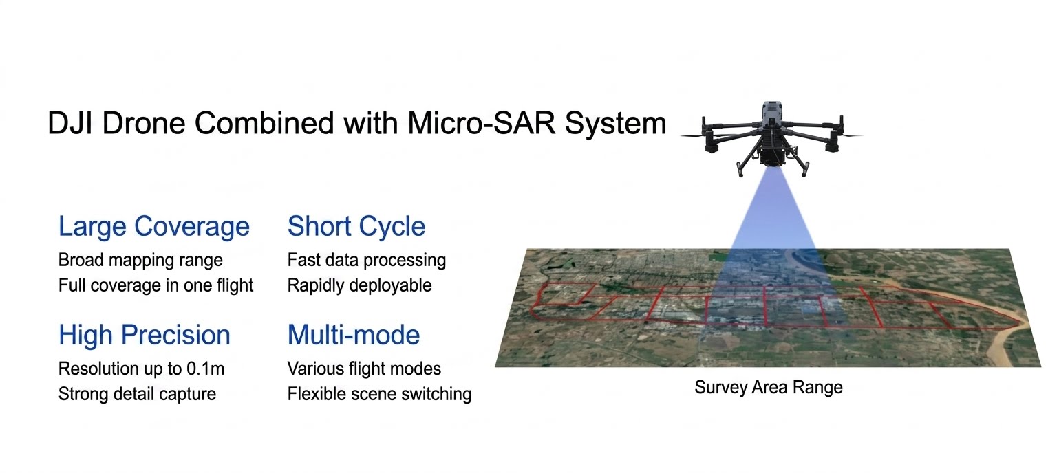
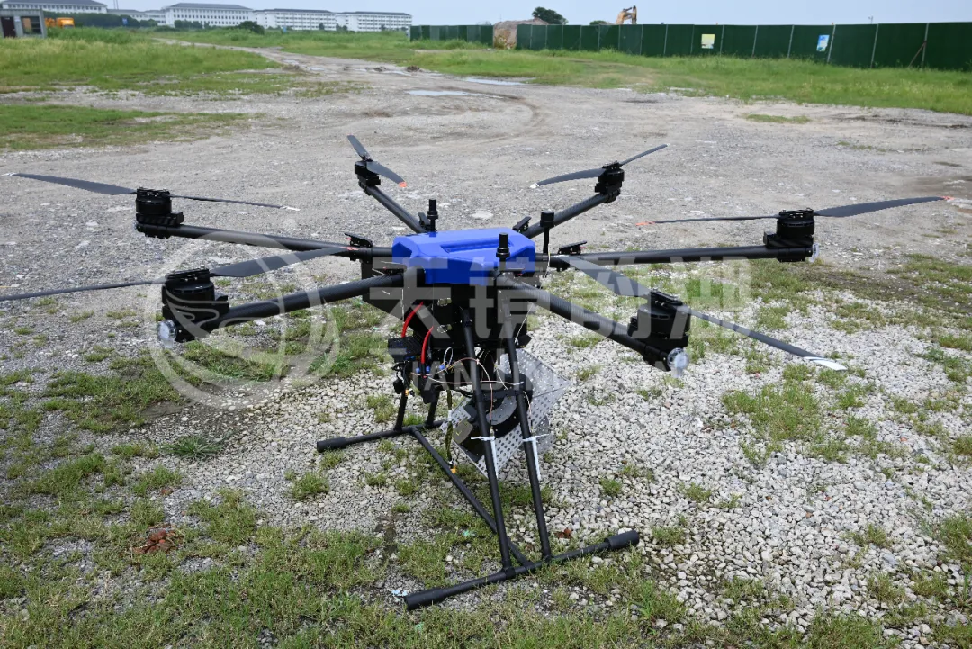
Based on this international trend, Tianjing Yunhu's airborne SAR has also entered a new stage of development focused on "miniaturization" and "systematization." The company has successfully developed two series and multiple types of miniature SAR products: frequency-modulated continuous wave and pulse SAR. Among them, the continuous wave radar weighs as low as 2 kg, and can be flexibly mounted on multi-rotor drone platforms such as the DJI M400. The miniature SAR is seamlessly integrated with drones through a quick-release structure, and is widely used in various fields. The application results are good, and we have cooperated with many universities, research institutes and industry companies to carry out numerous experiments in various application scenarios, with a customer satisfaction rate as high as 98%.

System Flight Video

Potential civilian applications primarily include:

  1. In disaster emergency response, it can penetrate clouds, fog, rain, and snow to quickly acquire high-definition images of disaster areas. Its interferometric technology can monitor millimeter-level surface deformation, providing early warnings of secondary disasters such as landslides and collapses. Its real-time imaging capability far surpasses that of spaceborne SAR, providing crucial support for on-site command.
  2. In marine observation, SAR is unaffected by adverse sea conditions, accurately identifying vessels, monitoring oil spills, and retrieving sea surface wind and wave information. Its real-time performance is superior to spaceborne platforms.
  3. In resource exploration, through multi-band penetration and polarization analysis (L, P, X, etc.), SAR can effectively detect underground veins, groundwater, and oil and gas structures. Compared to traditional drilling methods, it is not only cheaper but also more environmentally friendly.
  4. For subsidence monitoring, InSAR technology can capture minute deformations of buildings, bridges, and tunnels with millimeter-level precision, enabling early warnings of safety hazards in critical urban facilities. In agriculture, SAR utilizes the unique polarization scattering characteristics of crops to efficiently classify crops, monitor growth, and estimate yields.
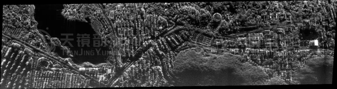
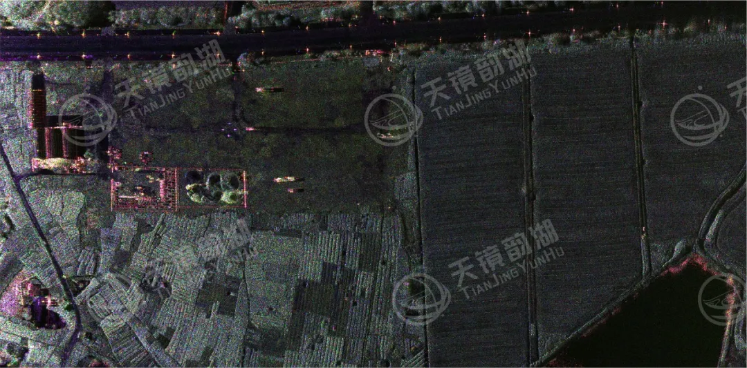
Single Polarimetric Imaging Results
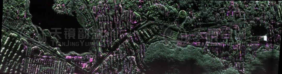
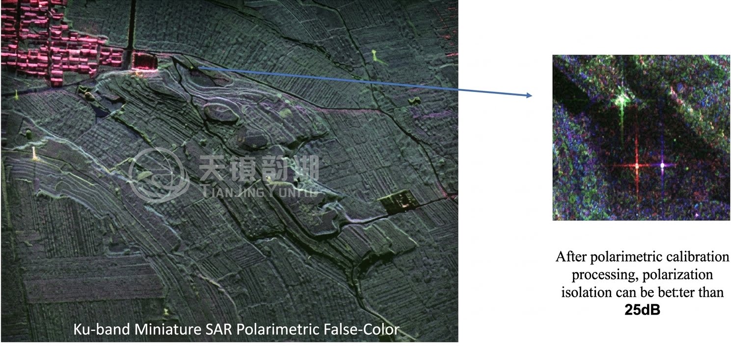
Fully Polarimetric Imaging Results

UAV-borne SAR is gradually becoming the mainstream in the market. Its miniaturization and cost reduction will drive the transformation of airborne SAR from high-end military equipment to mid-to-low-end military equipment and civilian devices, becoming the main driving force for the continued high-speed growth of the airborne SAR market in the coming years. Tianjing Yunhu will continue to improve its product portfolio, product quality, and service capabilities based on its previous achievements. We are committed to promoting the widespread adoption of domestically produced SAR, making synthetic aperture radar a truly accessible, efficient, and reliable tool for ground sensing! If you are looking for a miniaturized, lightweight, and rapidly integrateable airborne SAR deployment solution, please contact us for more product information and test data.
Related Information

Related Information
2026.08.28

Tianjing Yunhu | MiniSAR: Full Polarimetric Imaging Capability

In the field of remote sensing today, synthetic aperture radar (SAR), visible light, and infrared together form a multi-layered observation system. Visible light remote sensing is intuitive and clear, while infrared remote sensing excels at thermal sensing. However, both are passive detection methods, heavily reliant on sunlight or the target's own thermal radiation. Once they encounter cloud cover, nightfall, or rainy/foggy weather, their detection capabilities are significantly reduced or even completely lost.
2026.08.26

Tianjing Yunhu | P-band Airborne SAR Radar System

Low-frequency radars (such as P-band and L-band radars) can "see farther and see more clearly" because of their longer wavelengths, lower attenuation, and reduced sensitivity to stealth coatings. In modern air defense systems, they are key to anti-stealth radars. They can penetrate 1-meter-thick camouflage netting and 3-meter-thick bushes to identify hidden tanks and radar stations, and are less likely to trigger enemy warning systems, demonstrating significant advantages in covert detection.
2026.08.21

Tianjing Yunhu | Miniature SAR Vehicle Target Dataset

Synthetic Aperture Radar (SAR) target detection datasets are a core foundation for training and evaluating deep learning models. These datasets cover various target types, including ships, aircraft, vehicles, bridges, and oil tanks, and are applicable to multiple fields such as military reconnaissance, maritime monitoring, and traffic management. They not only provide high-resolution SAR images but also contain precise annotation information (category, location, size, etc.), ensuring improved algorithm performance.
2026.08.17

Tianjing Yunhu | Miniature SAR Equipped with Fixed-Wing UAV

Today's main focus is on the CW-25E VTOL fixed-wing UAV and the Tianjing Yunhu XiangYun System pulse MiniSAR.

The CW-25E is a pure electric VTOL fixed-wing UAV designed specifically for large-area missions. It has a fuselage length of 2.08 meters, a wingspan of 4.35 meters, and features a twin-boom fused inverted V-tail design, resulting in a compact structure and excellent aerodynamic performance.

The CW-25E has a maximum takeoff weight of 31.58 kg and a payload capacity of 6.6 kg, capable of simultaneously carrying various mission equipment such as SAR, lidar, and electro-optical pods. It boasts a maximum endurance of 150 to 240 minutes, a service ceiling of 6000 meters, a maximum takeoff altitude of 4000 meters, and wind resistance up to level 7. It can stably perform patrol missions in complex terrain and high-altitude areas.
2026.07.18

Tianjing Yunhu | Airborne SAR (Synthetic Aperture Radar) Calibration Capability

Airborne SAR (Synthetic Aperture Radar) calibration refers to the calibration of various parameters of an airborne SAR system using specific methods to eliminate systematic and environmental errors, thereby ensuring the quality of SAR images, positioning accuracy, and the accuracy of inversion parameters. Airborne SAR calibration is mainly divided into three categories: geometric calibration, radiometric calibration, and polarimetric calibration.
2026.07.13

UAV L-band Heavy Orbit Interferometric SAR System: Airborne Verification for Millimeter-Level Deformation Monitoring

Synthetic Aperture Radar Interferometry (InSAR) technology, with its all-weather, 24/7 capability and high sensitivity to surface deformation, has become an important tool for geological hazard monitoring, ground subsidence investigation, and infrastructure health diagnosis. Integrating InSAR technology onto unmanned aerial vehicle (UAV) platforms further overcomes the limitations of long satellite revisit cycles, insufficient maneuverability, and high costs associated with manned operations, providing a new approach for regional, high-frequency, and high-precision deformation monitoring. However, the small size and susceptibility of UAV platforms to airflow disturbances make it difficult to maintain consistent flight paths during repeated flights, posing a significant challenge to double-track interferometry processing.

Online Message

Company Address

Company Address

Room 801, Building 14, No. 135 Zhangji Road, Kunshan Development ZoneView the map
Emaile

Email

tjyh888@139.com
Postal Code

Postal Code

215300
Sales contact information

Sales contact information

  • Sales 1:18252999418 (same WeChat)
  • Sales 2:13126758269 (same WeChat/Whatsapp)
  • Sales 3:15862678208 (same WeChat)
  • Sales 4:15895462772 (same WeChat/Whatsapp)
验证码
Submit

Contact Us

关注我们
关注我们