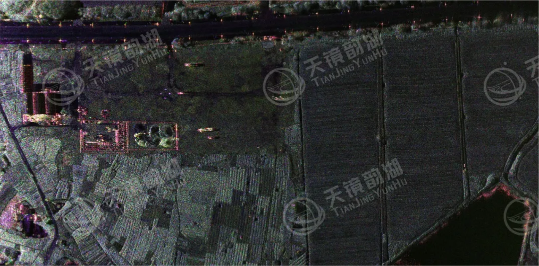
Airborne synthetic aperture radar (SAR) refers to radar mounted on an aircraft or drone that transmits microwave signals to the ground while in flight, then receives the reflected echoes and, after a series of calculations and processing, generates a clear "microwave photograph." Unlike ordinary optical cameras, SAR's biggest advantage is its all-weather, all-day capability; it can take pictures day and night, and is unaffected by wind or rain.
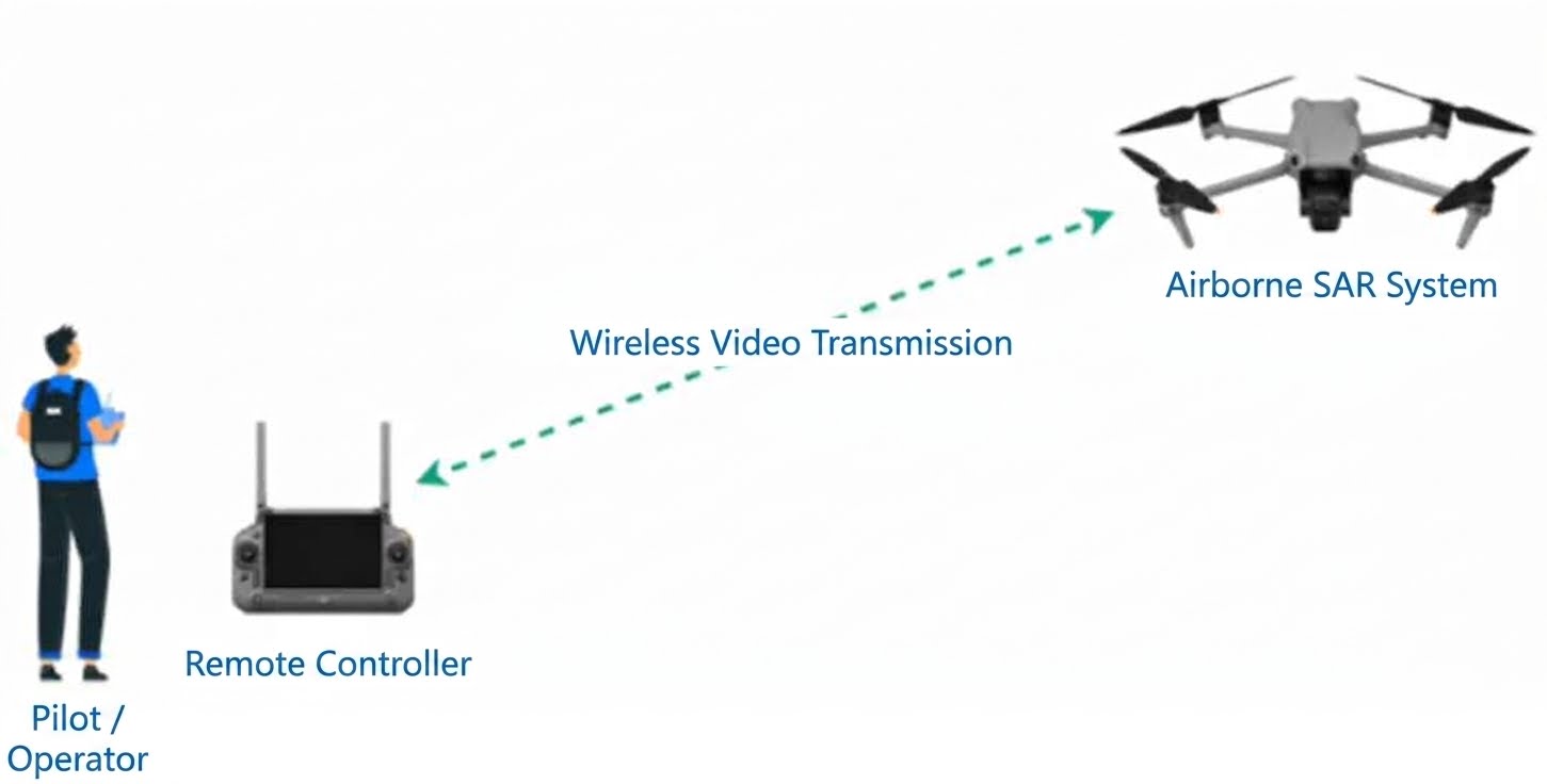
Aerial survey mission control
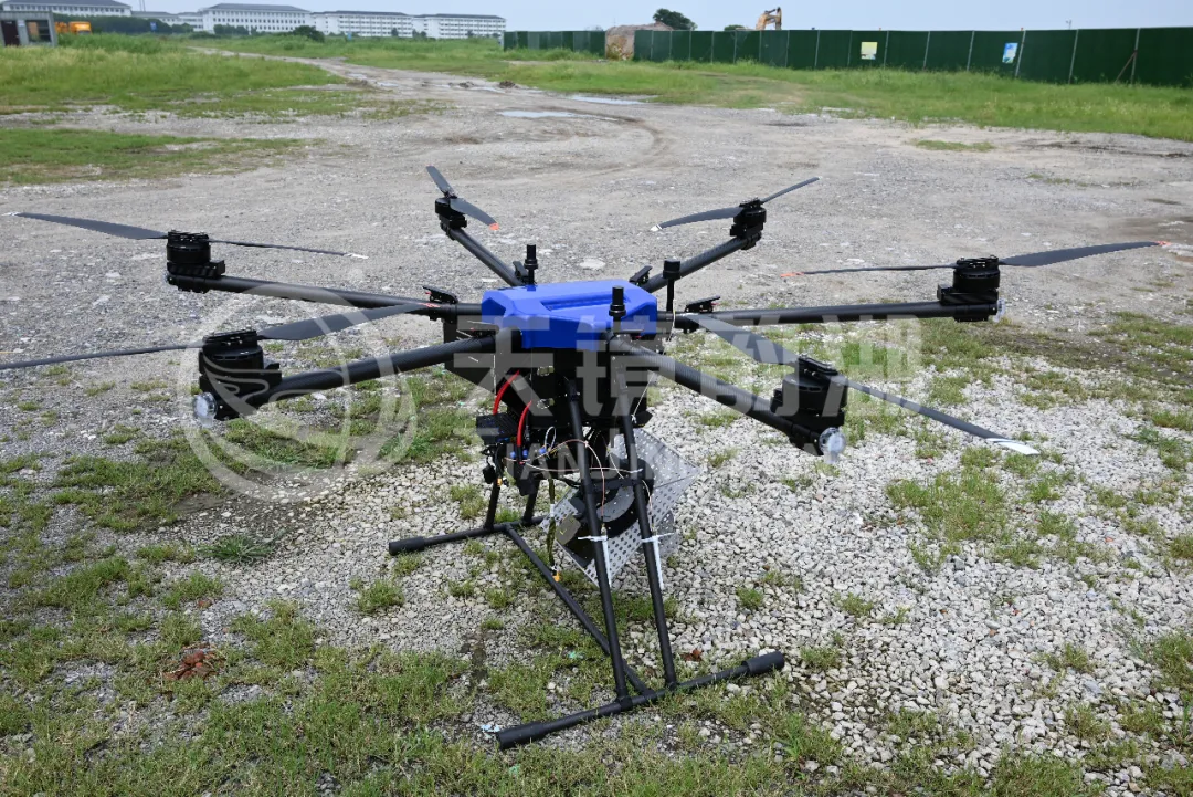
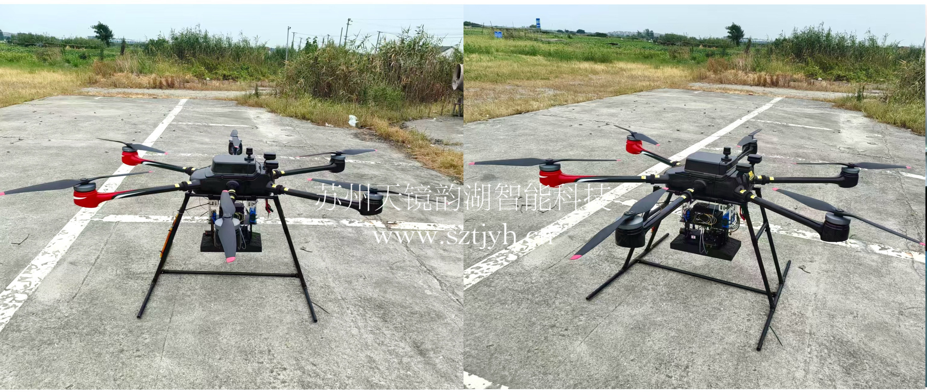
In July, Tianjing Yunhu completed a full aerial survey mission in the real airspace of Zhouzhuang area, Kunshan. The platform was a DJI M400 drone—this drone has a maximum payload of 6 kg and is 980 mm long and 760 mm wide when unfolded. Its radar system is an X-band frequency-modulated continuous wave miniature SAR radar, and the entire system was designed and installed on the belly of the drone's gimbal.
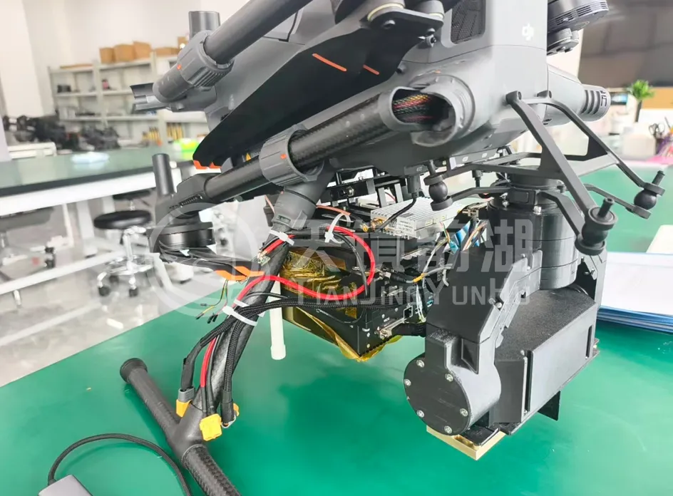
The mission objective was clear: to verify the radar's core performance indicators, including resolution, operating range, mapping bandwidth, and post-processing imaging.
Before the mission began, the entire process was streamlined: flight path planning, ground station setup, equipment power-on, static inspection, and takeoff. The drone flew across the target area at a horizontal speed of approximately 10 meters per second, the radar was simultaneously activated, and the real-time imaging interface began updating data. After the flight, the equipment was landed and allowed to stand for five minutes before the data was exported for post-processing.
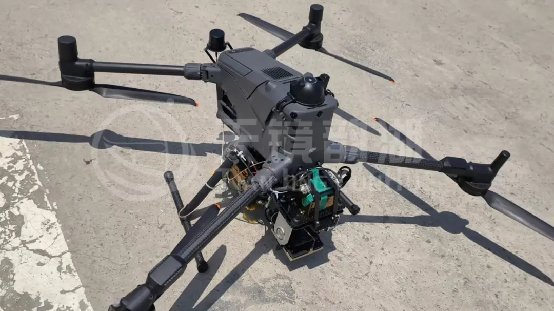
The field tests, conducted from July 4th to July 28th, included five flight tests. Each flight repeatedly verified the equipment's performance specifications.
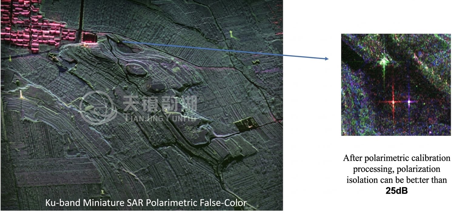
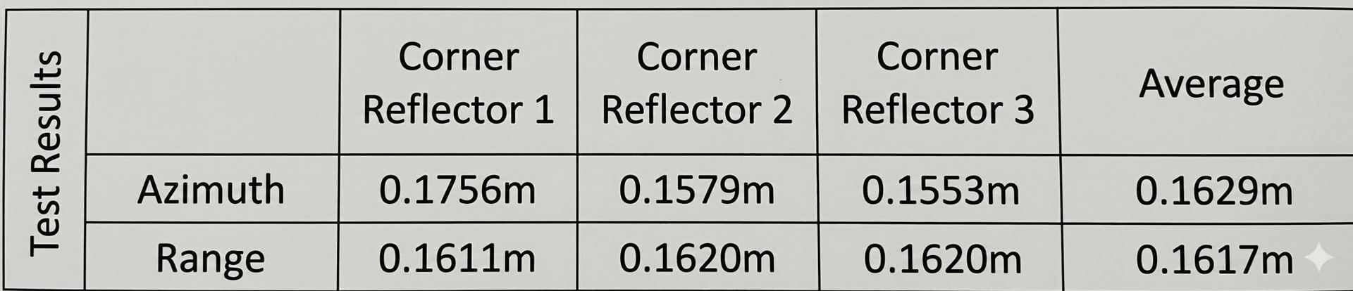
The required resolution was 0.2 meters x 0.2 meters—in other words, the radar should be able to clearly distinguish between two targets 20 centimeters apart on the ground. To verify this, the team deployed three corner reflectors in the target area. Corner reflectors are specialized metal devices used to calibrate radar; shaped like small triangular cones, they reflect radar signals back along their original path, forming a bright "dot" on the image.
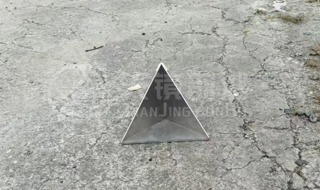
By analyzing the half-power beamwidth of these light spots, the actual resolution of the radar can be accurately calculated. The results from the five sets of flight data are quite consistent: the azimuth resolution averages around 0.16 meters, and the range resolution is also around 0.16 meters, all better than the target requirement of 0.2 meters.
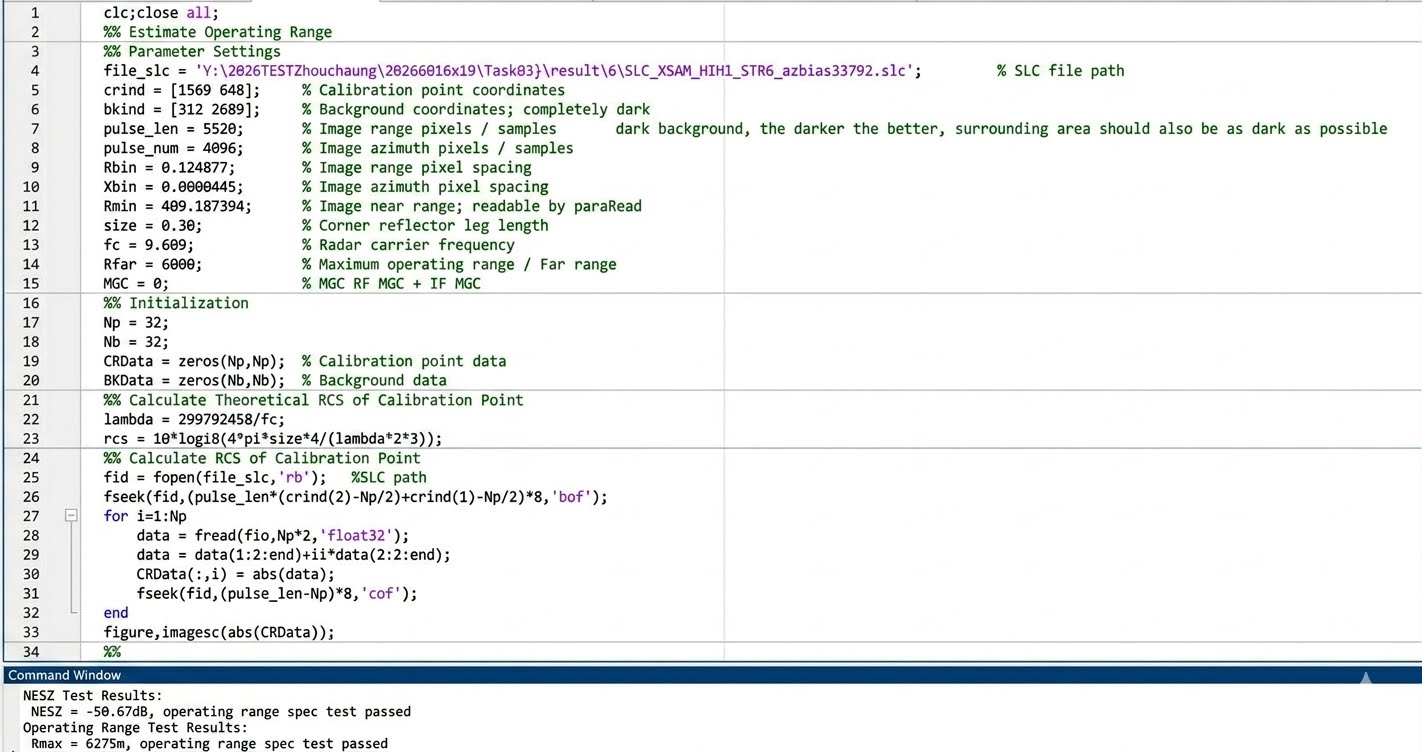
Regarding the effective range, the requirement is ≥6 kilometers. The team analyzed the signal-to-noise ratio of the corner reflectors and subtracted the range attenuation factor to calculate the radar's maximum effective range when the equivalent noise backscattering coefficient is -20dB. The calculated equivalent ranges for the three corner reflectors were 6275 meters, 6233 meters, and 6289 meters, with an average of 6266 meters—significantly exceeding the 6-kilometer threshold.
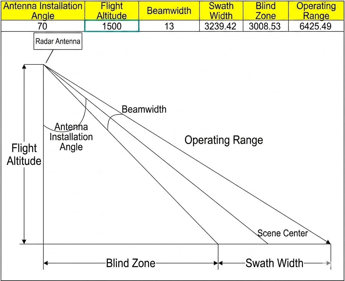
The target for the mapping bandwidth is ≥3 kilometers. Under the conditions of a flight altitude of 1500 meters, an antenna installation angle of 70°, and a beamwidth of 13°, the theoretically calculated ground distance is approximately 6248 meters, and the blind zone is approximately 3009 meters. Subtracting the two, the effective mapping bandwidth is approximately 3239 meters—which also exceeds the 3-kilometer target requirement.
In addition, the radar also completed verifications of its full polarization operating mode, acquiring HH, HV, VH, and VV polarization images simultaneously in a single flight; real-time imaging capabilities were also verified during flight.
This field test involved a total of five flights, dozens of data sets, and dozens of parameter adjustments. It recorded not only the performance data of a single radar, but also the team's repeated verification of their proficiency in operating the radar system in real airspace.
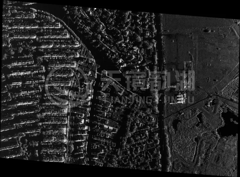
Starting with independent research and development of micro SAR technology, and progressing to deep integration with top domestic industrial UAV platforms, Tianjing Yunhu is proving through repeated flights that domestically produced micro SAR can not only fly, but also fly higher, see more clearly, and measure more accurately!
Data Source: Tianjing Yunhu M400 UAV-borne X-band SAR Equipment Test Report (July 2026)