


News and Resources
Company News
 Home
Home2026.09.02
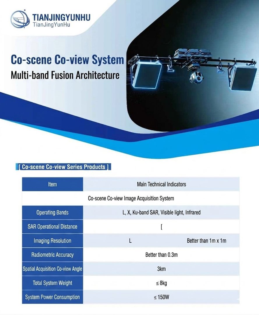
Tianjing Yunhu | Multi-source fusion system for lightweight SAR
Single sensors always have blind spots: optical cameras are almost "blind" in clouds, fog, and darkness; infrared thermal imaging, while penetrating the night, cannot identify color and texture details; SAR, though versatile in all weather conditions, lacks color information in its microwave images, making them difficult for ordinary people to interpret intuitively. Only when these three types of data come from the same time and the same scene, with temporal alignment eliminating positional deviations of dynamic targets and spatial overlap ensuring image registration accuracy, can target detection accuracy achieve a qualitative leap. However, in the past, acquiring these three types of data often required multiple flights, multiple sets of equipment, and multiple processing steps—time-consuming, labor-intensive, and costly. To address this pain point, Tianjing Yunhu has developed a multi-source imaging system integrating SAR, optics, and infrared, making "one flight, three perspectives" a reality.
2026.08.28
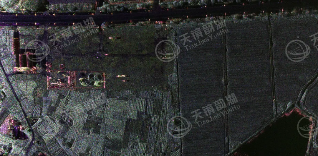
Tianjing Yunhu | MiniSAR: Full Polarimetric Imaging Capability
In the field of remote sensing today, synthetic aperture radar (SAR), visible light, and infrared together form a multi-layered observation system. Visible light remote sensing is intuitive and clear, while infrared remote sensing excels at thermal sensing. However, both are passive detection methods, heavily reliant on sunlight or the target's own thermal radiation. Once they encounter cloud cover, nightfall, or rainy/foggy weather, their detection capabilities are significantly reduced or even completely lost.
2026.08.26
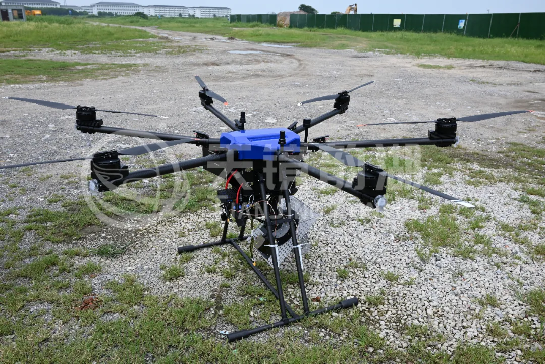
Tianjing Yunhu | P-band Airborne SAR Radar System
Low-frequency radars (such as P-band and L-band radars) can "see farther and see more clearly" because of their longer wavelengths, lower attenuation, and reduced sensitivity to stealth coatings. In modern air defense systems, they are key to anti-stealth radars. They can penetrate 1-meter-thick camouflage netting and 3-meter-thick bushes to identify hidden tanks and radar stations, and are less likely to trigger enemy warning systems, demonstrating significant advantages in covert detection.
2026.08.21
Tianjing Yunhu | Miniature SAR Vehicle Target Dataset
Synthetic Aperture Radar (SAR) target detection datasets are a core foundation for training and evaluating deep learning models. These datasets cover various target types, including ships, aircraft, vehicles, bridges, and oil tanks, and are applicable to multiple fields such as military reconnaissance, maritime monitoring, and traffic management. They not only provide high-resolution SAR images but also contain precise annotation information (category, location, size, etc.), ensuring improved algorithm performance.

2026.08.19
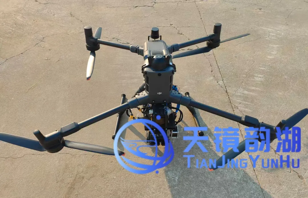
Tianjing Yunhu | Miniature SAR x DJI M400: Redefining Lightweight Remote Sensing
Synthetic Aperture Radar (SAR) is an advanced radar technology capable of penetrating darkness and fog to acquire high-resolution images of the Earth's surface. It transmits pulse signals via airborne or ground-based platforms and analyzes the reflected phase and amplitude information to construct detailed ground images. SAR is widely used in remote sensing mapping, geological exploration, disaster monitoring, and national defense.
2026.08.17
Tianjing Yunhu | Miniature SAR Equipped with Fixed-Wing UAV
Today's main focus is on the CW-25E VTOL fixed-wing UAV and the Tianjing Yunhu XiangYun System pulse MiniSAR.
The CW-25E is a pure electric VTOL fixed-wing UAV designed specifically for large-area missions. It has a fuselage length of 2.08 meters, a wingspan of 4.35 meters, and features a twin-boom fused inverted V-tail design, resulting in a compact structure and excellent aerodynamic performance.
The CW-25E has a maximum takeoff weight of 31.58 kg and a payload capacity of 6.6 kg, capable of simultaneously carrying various mission equipment such as SAR, lidar, and electro-optical pods. It boasts a maximum endurance of 150 to 240 minutes, a service ceiling of 6000 meters, a maximum takeoff altitude of 4000 meters, and wind resistance up to level 7. It can stably perform patrol missions in complex terrain and high-altitude areas.
The CW-25E is a pure electric VTOL fixed-wing UAV designed specifically for large-area missions. It has a fuselage length of 2.08 meters, a wingspan of 4.35 meters, and features a twin-boom fused inverted V-tail design, resulting in a compact structure and excellent aerodynamic performance.
The CW-25E has a maximum takeoff weight of 31.58 kg and a payload capacity of 6.6 kg, capable of simultaneously carrying various mission equipment such as SAR, lidar, and electro-optical pods. It boasts a maximum endurance of 150 to 240 minutes, a service ceiling of 6000 meters, a maximum takeoff altitude of 4000 meters, and wind resistance up to level 7. It can stably perform patrol missions in complex terrain and high-altitude areas.



