

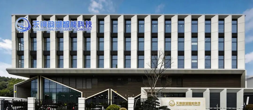
Suzhou Tianjing Yunhu Intelligent Technology Co., Ltd. was founded in 2023, initiated by one of the earliest domestic teams specializing in synthetic aperture radar (SAR) R&D. The company is dedicated to the research, development, manufacturing, sales, service, and technical promotion of synthetic aperture radar systems, with the vision of becoming a world-leading provider of SAR equipment and information services.
Company Strengths:
The core team originates from the Aerospace Information Research Institute, Chinese Academy of Sciences, with years of R&D experience;
We operate a professional flight team holding all legal qualifications required for commercial flight operations;
We provide a full-chain solution covering “radar R&D + platform integration + flight operations + data processing + industry applications.”
Product Features:
The airborne miniature synthetic aperture radar (MiniSAR) series from Suzhou Tianjing Yunhu Intelligent Technology Co., Ltd. offers all-weather, all-time, long-range, high-resolution, and multi-mode capabilities. The system adopts Frequency Modulated Continuous Wave (FMCW) or pulse modulation, featuring low cost, lightweight design, and high efficiency. It supports multiple technical modes including real-time imaging, Ground Moving Target Indication (GMTI), active phased array, and Differential Interferometric SAR (DInSAR), with resolution reaching centimeter level. The series can be mounted on a variety of flight platforms such as multirotor UAVs, vertical take-off and landing (VTOL) fixed-wing UAVs, helicopters, and manned aircraft, and shows broad application prospects in both civilian and military domains.
Product Portfolio Overview:
Lingyun Series:
This is a standard-configured radar based on Frequency Modulated Continuous Wave (FMCW) technology. It supports both single-polarization and full-polarization modes, as well as stripmap scanning and real-time imaging. Weighing only 4.5 kg, it is perfectly adaptable to a wide range of flight platforms and provides all-weather, all-time remote sensing acquisition capability. The lightweight version weighs just 2.7 kg or even less, with notable advantages of low cost, compact size, low power consumption, and light weight, making it suitable for deployment on various fixed-wing, multirotor, and small UAV platforms.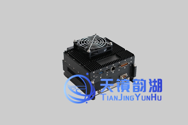
Lingyun Series Product Image
Xiangyun Series:
This is a standard-configured radar based on pulse Doppler (PDW) technology. The system offers multiple operating modes and frequency bands to meet diverse customer requirements. It supports a variety of technical modes including real-time imaging, Ground Moving Target Indication (GMTI), active phased array, and Differential Interferometric SAR (DInSAR), with resolution reaching centimeter level. With comprehensive functionality, outstanding performance, and a lightweight design, it can be installed on various small UAV platforms such as fixed-wing, multirotor, and helicopter UAVs, and is widely used in geological exploration, agricultural monitoring, ocean monitoring, military reconnaissance, and other fields.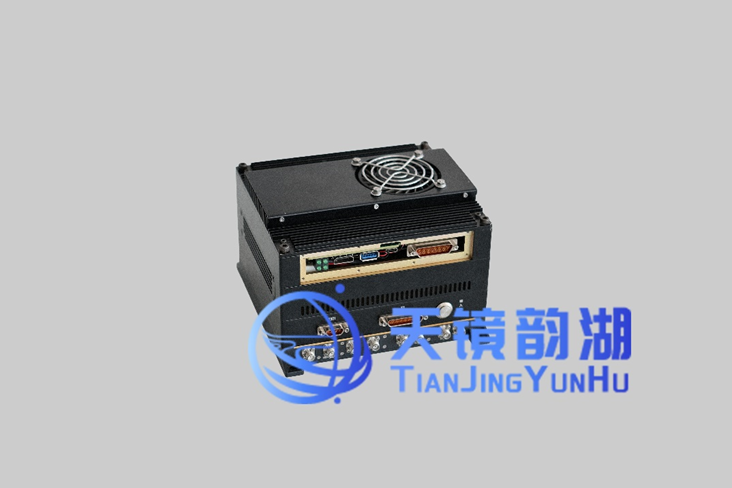
Xiangyun Series Product Image
Yunyuan Series:
This system is designed to meet deformation-monitoring needs across a variety of industries. Operating in the L-band, the system integrates a high-precision fiber-optic inertial navigation system, a high-performance servo-stabilized platform, and Differential Interferometric SAR (DInSAR) processing technology. It is compatible with professional software workflows such as GAMMA. It can precisely detect millimeter-level micro-deformations of ground surfaces, buildings, bridges, and other targets, and generate high-precision deformation maps, providing strong technical support for geological disaster early warning, infrastructure monitoring, and related fields.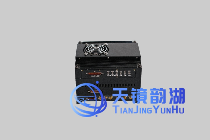
Yunyuan Series Product Image
Yunying Series:
This system comprises an X-band InSAR and a P-band fully polarimetric SAR, adopting left-looking and right-looking antenna pod configurations. Bilateral-looking polarimetric imaging is achieved through electronic switching. The P-band can penetrate vegetation to acquire bare-earth Digital Elevation Models (DEM), while the X-band delivers high-resolution Digital Surface Models (DSM) of the target area. The two bands complement each other, providing all-time, all-weather high-resolution radar image data, digital surface models, and polarimetric interferometric SAR image data. Using these datasets, the position information of targets can be accurately inverted.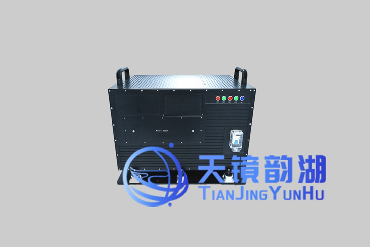
Yunying Series Product Image
Co-View System:
This system ingeniously integrates SAR, visible-light, infrared, and multiple other imaging technologies, enabling multiple sensors to simultaneously image the same scene and delivering a “one flight, multiple images” capability. The improved imaging efficiency allows flexible deployment across a variety of scenarios. By leveraging the unique imaging mechanisms of different technologies and combining the registered images, we obtain more comprehensive image information and more accurate analytical results.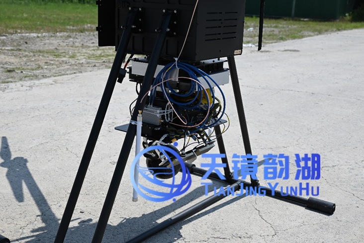
Co-View System Product Image
Data Flight Services:
Tianjing Yunhu provides one-stop data flight services covering airspace application, route planning, on-site operations, and end-to-end data processing and delivery. We operate a certified professional flight team and compliant dedicated airfields, and can deploy multirotor, VTOL fixed-wing, and other platforms to conduct routine operations in complex environments. From field acquisition to in-office processing, we provide closed-loop, end-to-end support to rapidly deliver high-precision, high-reliability SAR imagery and decision-grade data to our customers.
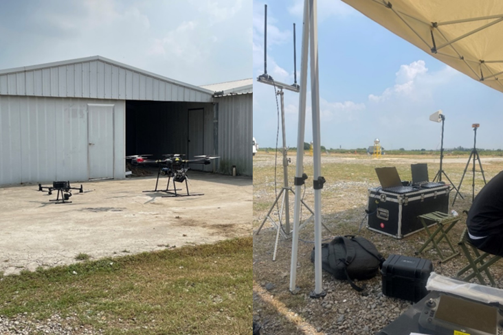
Flight Service On-site Image
To support the full-chain services described above, the company is currently equipped with multiple UAV models including the DJI M350, M400, DJI FlyCart 30, KWT X6L-15, Tianjin Huanyu 1800Pro, JOUAV CW-15, CW-25E, and CW-100. Leveraging this rich hardware matrix, we can mount radars on specific platforms around particular targets for flight operations in specific scenarios according to user needs, and provide targeted solutions covering pre-mission planning, route design, ground target site setup, image mosaicking and correction, and professional data processing. The company has established sound cooperative relationships with major research institutes, universities, industry enterprises, and various military services. We are committed to promoting domestic SAR from niche to widespread adoption, making synthetic aperture radar a truly accessible, efficient, and reliable earth-observation tool!








