

When typhoons, carrying torrential rain and strong winds, approach coastal areas, humanity's ability to monitor these massive natural phenomena remains severely challenged. Traditional optical satellites are largely ineffective against thick clouds and rain curtains, and weather radar's resolution is insufficient to capture the fine internal structure of typhoons. However, the emergence of Synthetic Aperture Radar (SAR), a "technological mini-giant," is opening a new window for typhoon monitoring with its unique advantages of all-weather, high-resolution operation. From typhoon center location to storm surge warnings, from path prediction to post-disaster relief, SAR technology is reshaping humanity's capacity to respond to typhoon disasters.
1. Overcoming the "Visual Blind Spot" in Meteorological Monitoring
Typhoons, as powerful cyclones occurring over tropical oceans, have long been hampered by the observational difficulties caused by severe weather conditions. Traditional optical remote sensing technologies rely on visible light imaging, which becomes almost completely ineffective in the dense cloud and rain conditions brought by typhoons. The lesson learned from the 2019 Australian bushfire relief efforts, where dense smoke prevented optical satellites from obtaining accurate disaster information, is equally applicable to typhoon monitoring—when the outer cloud system of a typhoon obscures the target area, both ground observation stations and optical satellites become "blind." Although weather radar can partially penetrate cloud layers, its limitations in antenna aperture and data processing capabilities make it difficult to provide high-resolution continuous monitoring data.
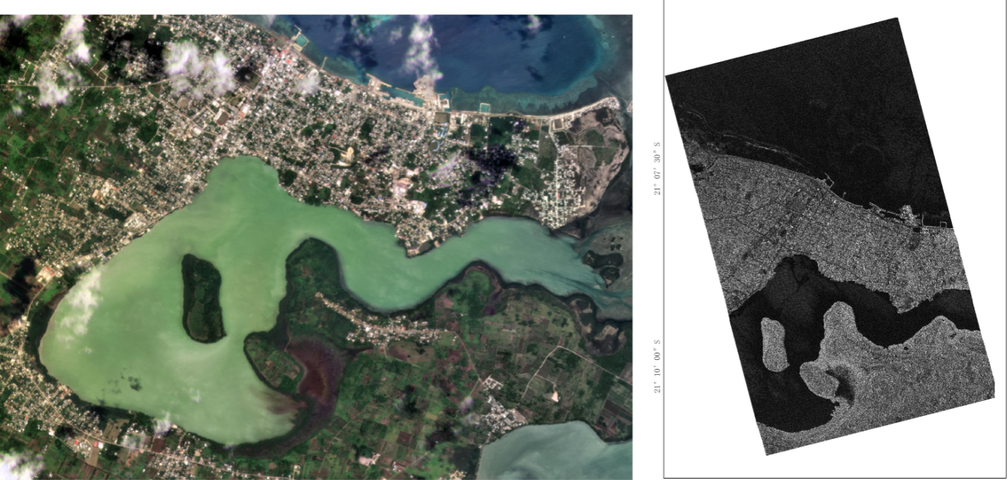
Optical and SAR imaging for post-disaster images
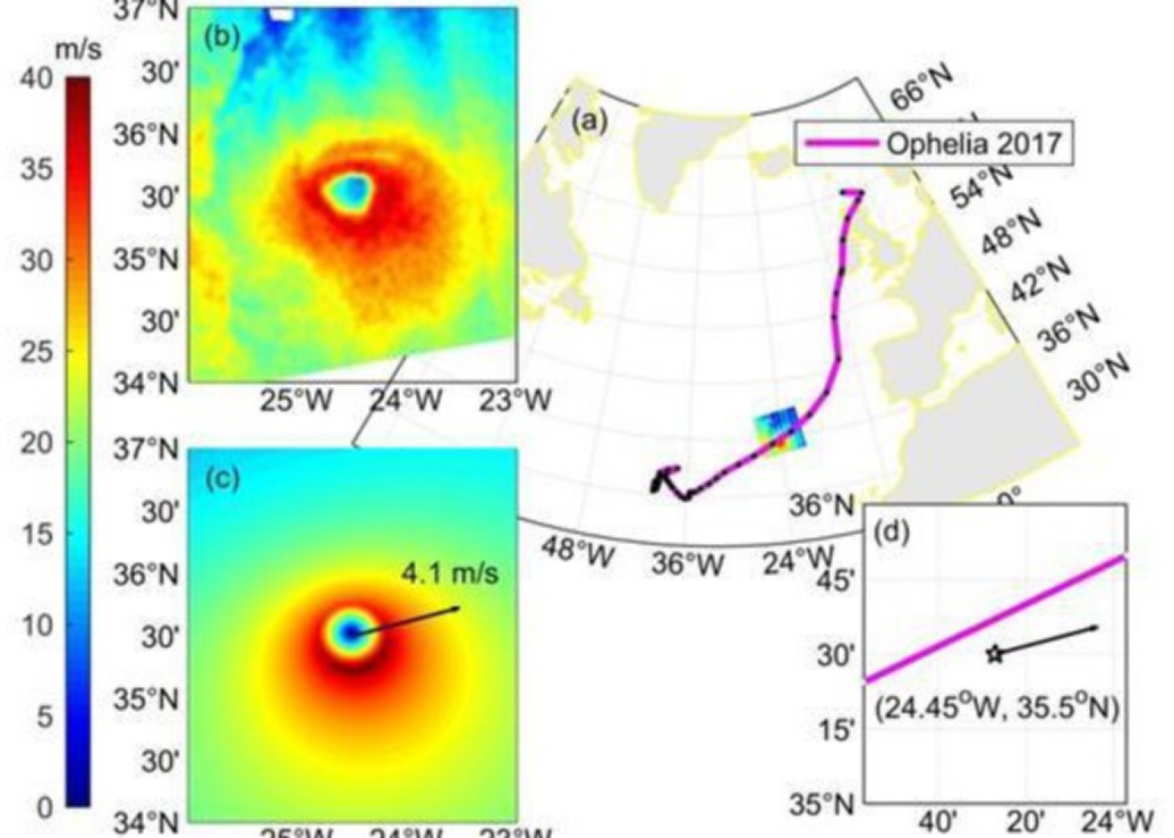
The advent of SAR technology fundamentally changed this situation. This microwave imaging-based remote sensing technology transmits microwave pulses to a target area and receives the reflected signals, using synthetic aperture technology to construct high-resolution images. Its working principle is unaffected by lighting or weather conditions. Microwave signals have extremely strong penetrating power, easily penetrating dense clouds, torrential rain, and dust storms brought by typhoons, essentially equipping meteorological monitoring personnel with "X-ray vision," allowing them to clearly "see" the ground and sea even under the worst weather conditions. A research team at Xiamen University used SAR satellite imagery to monitor Typhoon Noru in 2022 and Typhoon Doksuri in 2023. Their automatic estimation algorithm reduced the typhoon center positioning error to within 8 kilometers, fully demonstrating the reliability of the technology under severe weather conditions.
Furthermore, the high-resolution characteristics of miniature SAR allow it to capture subtle changes under the influence of typhoons. Using synthetic aperture radar (SAR) technology, this miniaturized device can achieve azimuth resolution comparable to large radars. The principle is to coherently process signals from multiple small antennas using the platform's movement trajectory, creating an effect equivalent to a large-aperture antenna. In typhoon monitoring, this means being able to discern the fine structure of sea surface wind fields, dynamic changes in coastlines, and the inundation boundaries of inland floods. When Typhoon Doksuri impacted my country's southeastern coast in 2023, a drone equipped with a miniature SAR successfully penetrated the rain curtain, transmitting high-resolution images of the storm surge inundation area in real time, providing crucial decision-making information for emergency response departments.
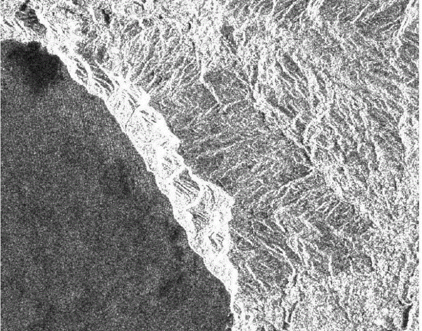
Real-time image of coastline
2. Empowering the Entire Chain from Early Warning to Rescue
Typhoon disaster response requires a complete closed loop of "monitoring-early warning-rescue," and miniature SAR technology, with its unique advantages, is playing a crucial role in each link of this chain. In the early stages of typhoon formation, miniature SAR systems mounted on small satellite constellations can achieve high-frequency monitoring, identifying early signs of tropical disturbances developing into typhoons by analyzing changes in sea surface microwave scattering characteristics. Compared to traditional satellites, small SAR satellites are lower in cost, more flexible in deployment, and can form a denser observation network, significantly improving the timeliness of typhoon formation early warnings.
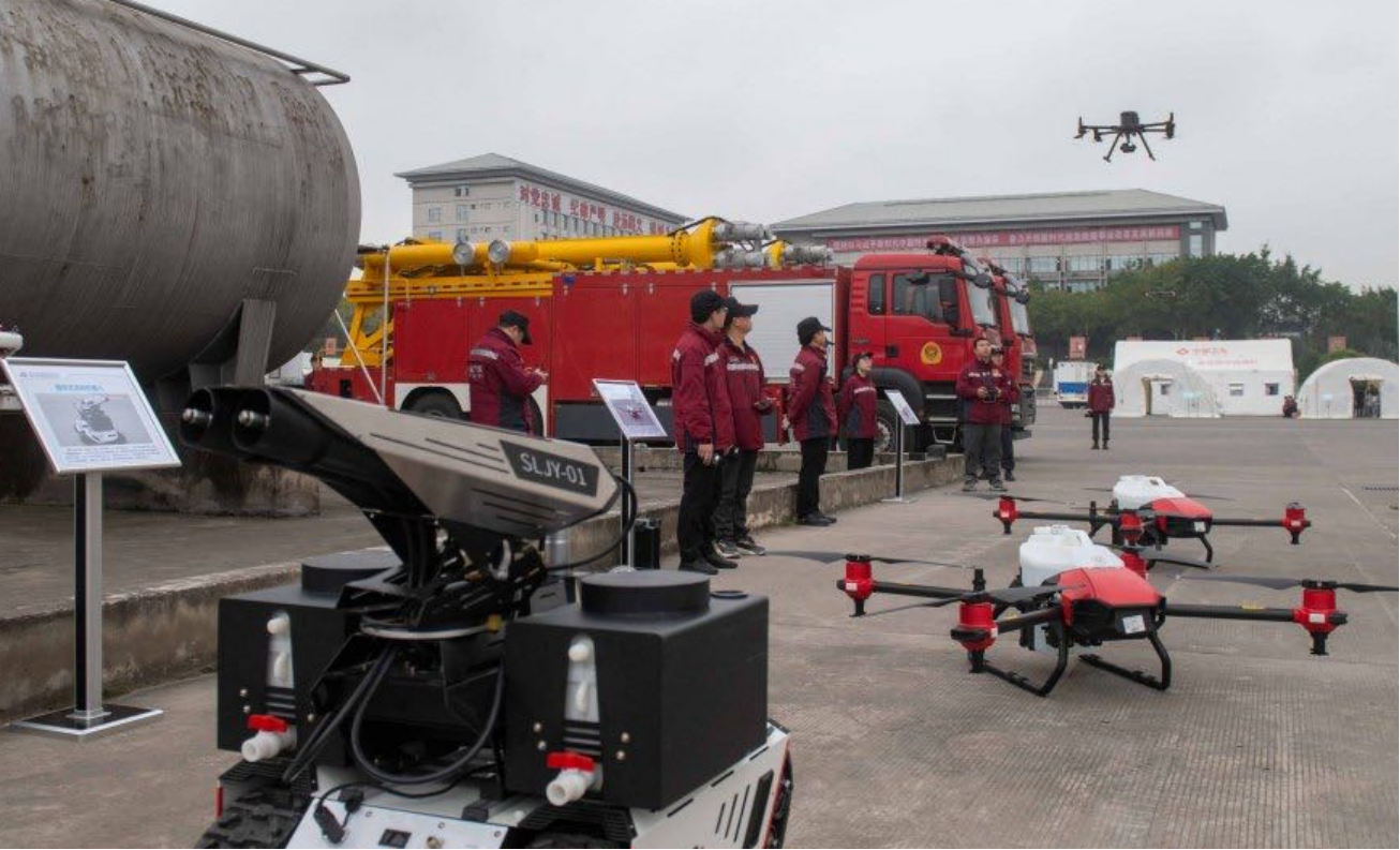
Staff use airborne SAR for disaster monitoring
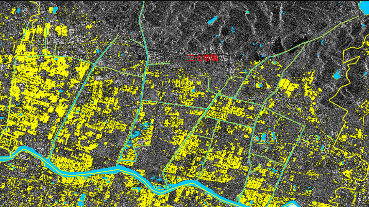
When a typhoon approaches land, the real-time monitoring capabilities of miniature SAR become a core support for storm surge early warning. Its imaging capabilities, penetrating clouds and rain, can continuously track changes in the coastline, accurately measuring the extent of storm surge inundation and the rate of water level change. During the severe floods in Thailand in 2011, miniature SAR, mounted on drones, overcame the obstacle of continuous rainfall, clearly showing flooded areas and road conditions, providing accurate data for rescue route planning and resource allocation. This demonstrates that dynamic inundation maps generated by combining miniature SAR data with Geographic Information Systems (GIS) have become an important basis for emergency evacuation decisions in coastal cities.
In disaster assessment and rescue operations after typhoon landfall, miniature SAR technology further demonstrates its value as an "emergency visionary." The rapid imaging capabilities, proven in earthquake disaster response, are also applicable to post-typhoon reconnaissance of ruins—miniature SAR mounted on drones can quickly scan disaster areas with power outages and communication disruptions, identifying the location of trapped people and the extent of road damage. Following Typhoon Koinu in 2023, researchers used miniature SAR image analysis to discover that many landslide sites missed by traditional optical remote sensing were clearly visible through microwave imaging. This data directly guided the precise deployment of rescue forces. This capability is particularly important in monitoring secondary disasters caused by typhoons, enabling the timely detection of dangerous areas hidden under clouds, rain, or rubble.
3. Conclusion
The continuous development of miniature SAR technology is quietly changing the way humans coexist with typhoons. When this "electronic eye" penetrates the fog of wind and rain, it not only brings more accurate typhoon warnings but also empowers humanity to take the initiative in the face of natural disasters. With continuous technological innovation, we have reason to believe that miniature SAR will become an important technological support for building a safer and more resilient coastal society, minimizing the losses caused by typhoon disasters and protecting the lives and property of more people. Furthermore, with the maturity of the technology, engineers have miniaturized traditional large-scale SAR systems, maintaining core performance while further reducing the cost of miniature SAR equipment, enabling faster and more routine deployment of typhoon SAR technology monitoring networks in coastal areas.








