

With the deepening of the Western Development Strategy, Sustainable Development Strategy, and Energy Resource Strategy, coupled with the implementation of major projects such as the National Western Mapping Project and the National Land Survey, my country's demand for SAR remote sensing data is becoming increasingly urgent. Especially in the field of disaster emergency monitoring, there is an urgent need to leverage the advantages of airborne SAR systems—their mobility, high resolution, and high precision—to enhance the nation's emergency response capabilities. Currently, airborne SAR mapping systems are capable of producing large-scale DEM, DOM, and land cover data products, and are widely used in topographic mapping, emergency response, resource surveys, major engineering monitoring, and national defense security.
Against this backdrop, the YunInSAR system launched by Tianjing Yunhu was developed. This system consists of X-band InSAR and P-band fully polarimetric SAR, employing a left- and right-looking antenna pod configuration, achieving dual-side-looking polarimetric imaging through switching. The P-band can penetrate vegetation to acquire the surface DOM, while the X-band acquires the target area's DSM at high resolution. The two complement each other and are widely used in topographic mapping, urban planning, scientific research, and national security, fully meeting the current urgent need for efficient, accurate, and all-weather Earth observation capabilities.
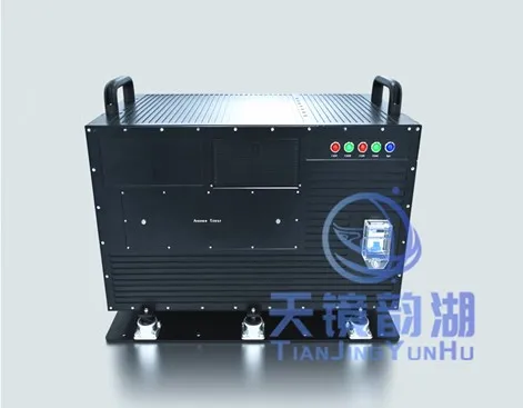
YunInSAR Product Image
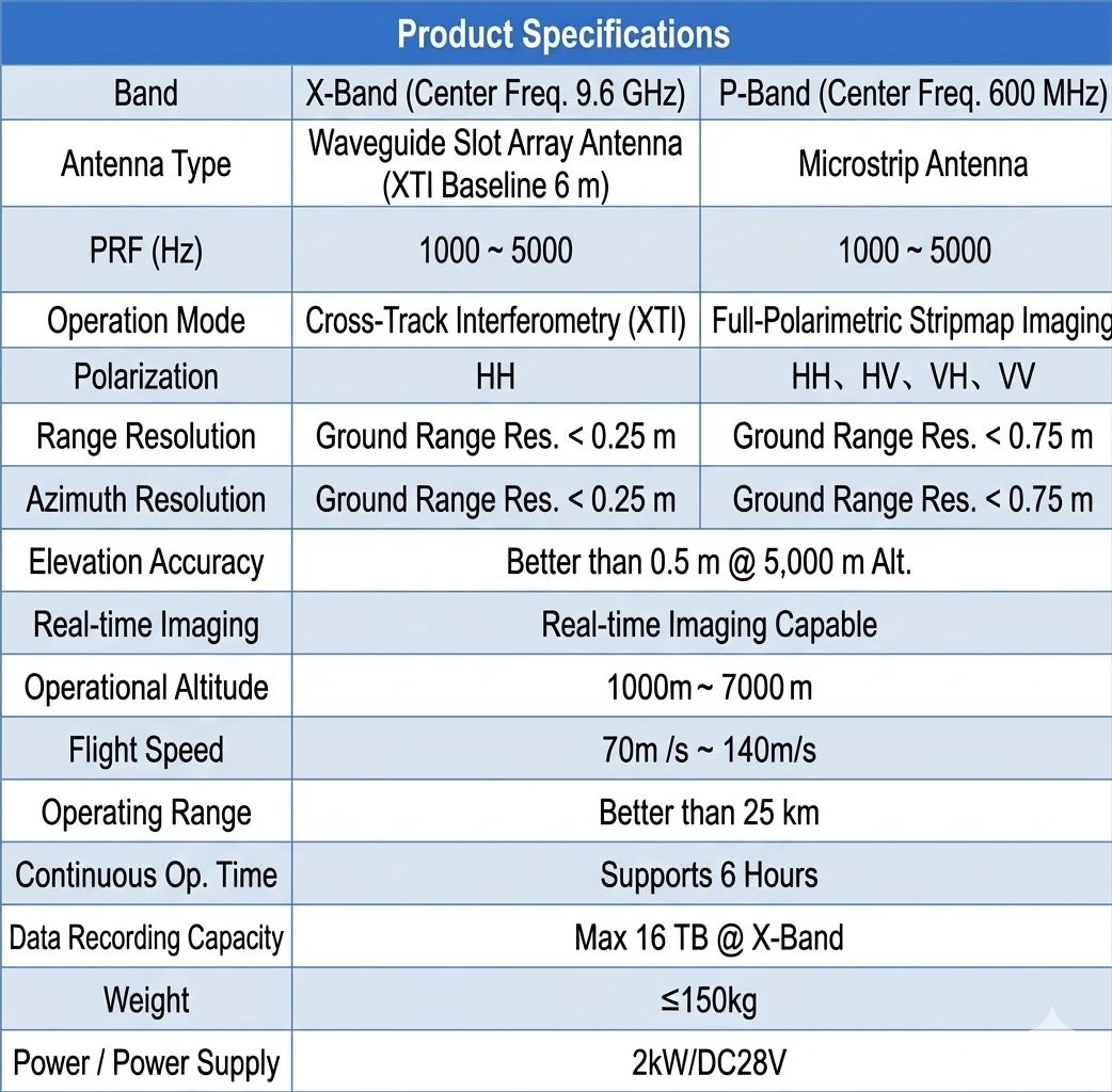
Product Specifications
The YunInSAR system is powered by a Cessna 10-15 seat manned single-engine turboprop aircraft, renowned for its versatility and reliability. It boasts a maximum cruising speed of approximately 341 km/h and a maximum range of about 1,700 km. It participated in aerial photography after the 2013 Gansu Dingxi earthquake, providing firsthand imagery for disaster relief. It can also efficiently perform aerial photography tasks for land registration, such as in Shanxi and Shaanxi provinces, where it has flown over 200 hours, photographing an area of nearly 30,000 square kilometers.
|
Cessna aircraft images |
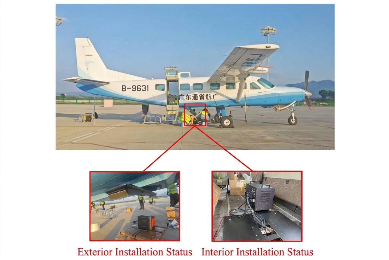 YunInsar System Installation Diagram |

High-resolution airborne dual-band interferometric synthetic aperture radar (IRSAR) is primarily used to acquire geometric and polarimetric information of ground features. It possesses the capability to provide high-resolution radar image data, digital surface models, and polarimetric interferometric radar image data around the clock and in all weather conditions. This image data can be used to accurately retrieve target location information. It boasts advantages such as high accuracy, rich information, intuitive and realistic visualization, and rapid data acquisition, and can be widely applied in fields such as topographic mapping, agricultural and forestry monitoring, facility inspection, and emergency management. Its advantages include:
1. Centimeter-level high resolution and high-efficiency data acquisition capabilities;
2. Support for simultaneous two-sided looking imaging in high-altitude flight;
3. The system supports outputting multiple types of high-quality image products, including single-polarization, fully polarized, DOM, and DSM;
4. Excellent platform versatility, adaptable to various fixed-wing UAVs and manned aircraft platforms;
5. Stable detection and tracking capabilities under operating conditions at altitudes of several kilometers;
6. Wide mapping band imaging capability, large single-shot coverage area, and high operational efficiency.
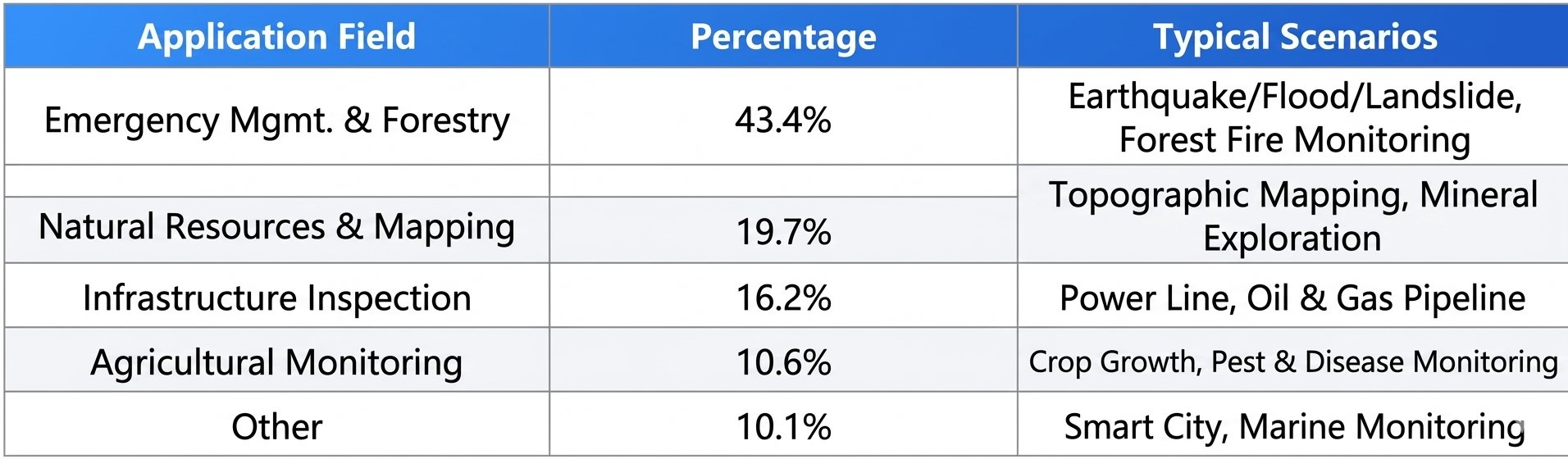
Application areas
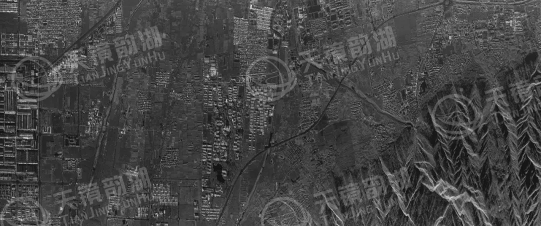
When X-band and P-band dual-band fully polarimetric synthetic aperture radars operate simultaneously, they can provide digital terrain models, high-resolution radar image data, and fully polarimetric radar data. These parameters can be used to invert the physical information of target composition and perform target classification. Below are 1:2000 large-scale X-band DSM imaging results and P-band fully polarimetric imaging results obtained by our company in a certain area. The aircraft was flying at an altitude of 5000 meters. This radar system can overcome the limitations of optical remote sensing, achieving all-weather, all-day observation and providing indispensable technical support for various fields.
|
X-band imaging results |
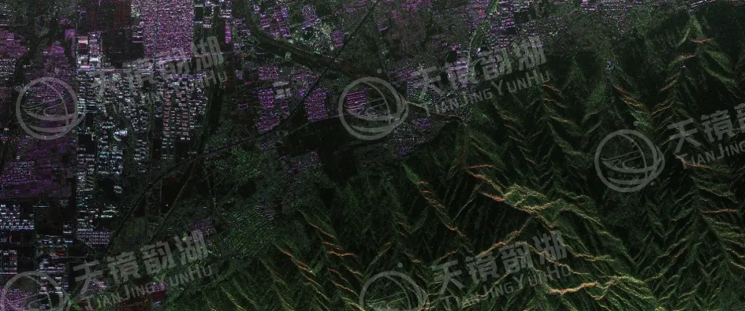 P-band imaging results |
We specialize in the research and development and solution provision of MiniSAR (Synthetic Aperture Radar) systems. From core algorithms to overall system integration, from lightweight design to multi-platform compatibility, we consistently adhere to independent innovation, striving to make miniSAR systems lighter, clearer, and more accurate. Our products have been widely applied in fields such as maritime monitoring, topographic mapping, disaster monitoring, and border patrol, accumulating tens of thousands of flights and serving numerous industry users and research institutions. With the vision of becoming a "globally leading provider of synthetic aperture radar solutions," we are committed to promoting the widespread adoption of domestically produced SAR technology, making synthetic aperture radar a truly accessible, efficient, and reliable tool for Earth observation!








