

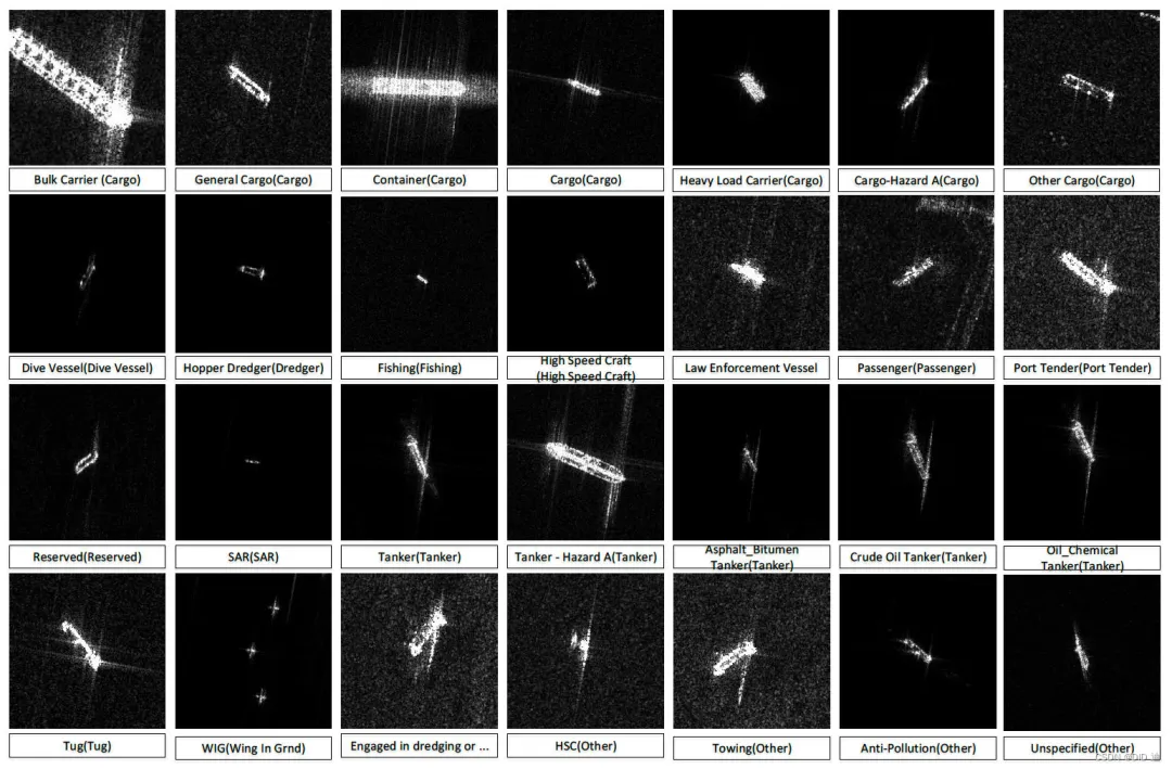
Our country possesses a vast maritime territory and abundant marine resources. Furthermore, its coastal areas are economically developed, and maritime transportation is crucial for economic growth. Therefore, maintaining initiative and control at sea, and accurately locating and identifying various maritime targets, is paramount. Ship target detection has significant military and civilian implications. Militarily, ship target detection enables automatic reconnaissance, automated analysis and processing of image data, real-time monitoring and warning, early warning of enemy ships, and enhanced situational awareness, thereby gaining tactical advantages. Civilianly, ship target detection allows for 24/7 monitoring and management of vessels entering and leaving ports, improving transportation efficiency, monitoring maritime traffic, combating illegal fishing, monitoring illegal oil dumping, and combating smuggling.
Currently, ship target detection data primarily originates from visible light, infrared, and SAR remote sensing methods. Compared to optical equipment, SAR offers significant advantages: it is not limited by season, weather, or lighting conditions, allowing for all-weather, 24/7 observation; it can penetrate clouds and fog for imaging; it possesses multi-polarization and multi-band information acquisition capabilities; based on the synthetic aperture principle, it can obtain high-resolution images, and the resolution continues to improve; the echo signal also contains rich target information such as amplitude and phase. With these outstanding advantages, SAR has become an indispensable monitoring tool in fields such as marine surveillance, maritime defense early warning, and maritime transport management.
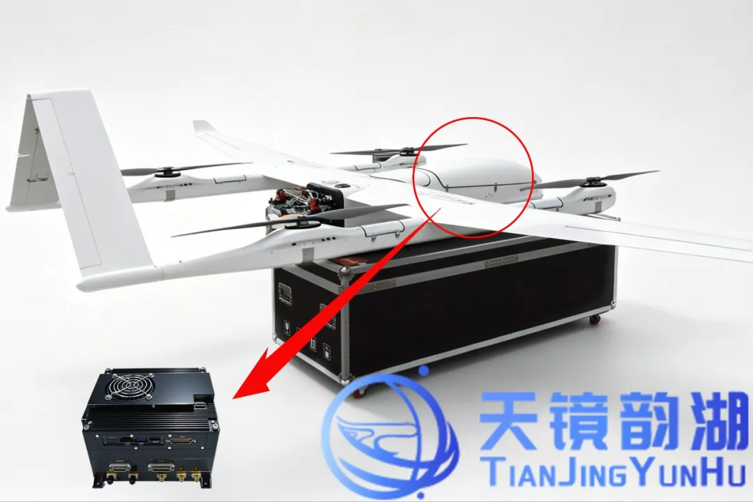
Tianjing Yunhu previously conducted flight tests for imaging naval targets in the Dongting Lake and Zhoushan Port areas. The project utilized the Zongheng CW-100 long-endurance unmanned aerial vehicle (UAV) equipped with a Ku-band miniature SAR system.
This UAV has a maximum payload of 25 kg, a 10-hour endurance, and is capable of vertical takeoff and landing (VTOL) and mobile takeoff and landing from ships. It can be integrated with various mission sensors, including integrated aperture radar, to meet the needs of large-area, long-range maritime reconnaissance. Its onboard Ku-band miniature SAR system uses a pulsed system with a resolution better than 0.1 m, supporting multiple operating modes such as strip, spotlight, and full polarization, providing strong support for high-resolution imaging and precise identification of naval targets in complex sea conditions.
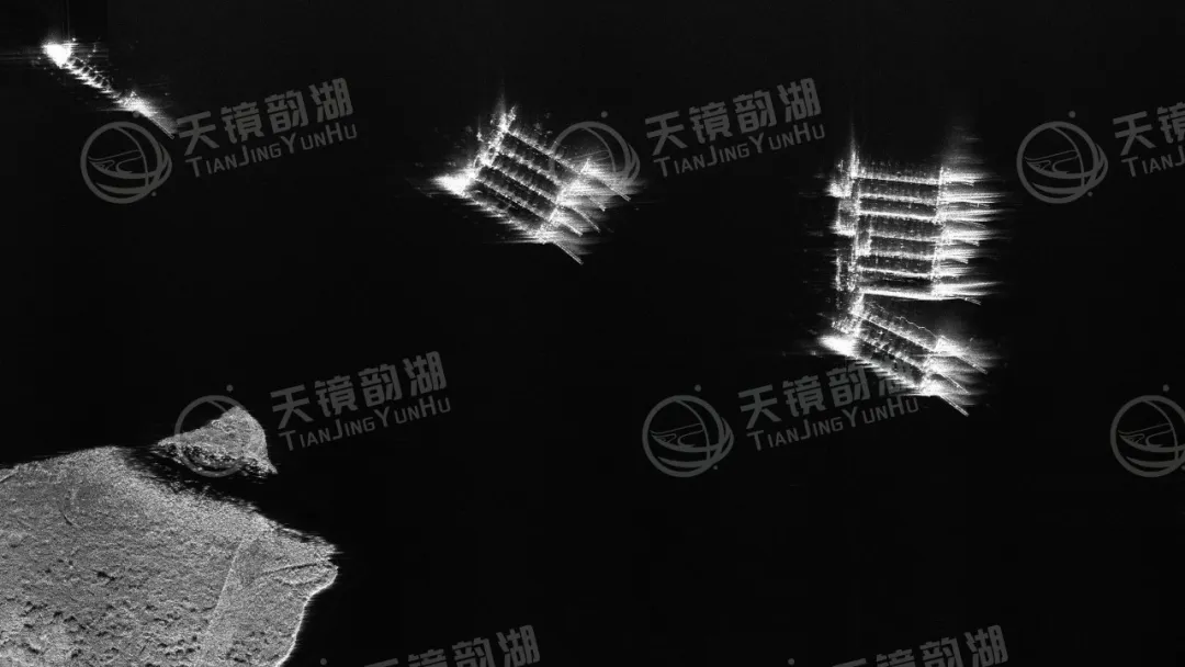
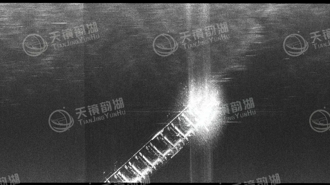
The Dongting Lake flight focused on detecting small and medium-sized vessels in the complex environment of inland waterways, verifying the system's target resolution capabilities in cluttered backgrounds and densely packed waterways. The Zhoushan Port flight, on the other hand, targeted large cargo ships and fishing vessels in open sea areas, testing the system's imaging quality and recognition accuracy for long-range, multi-type ship targets. Both experiments acquired high-resolution SAR images with clear ship outlines and distinct wake features, preliminarily verifying the technical feasibility of miniature SAR in ship target imaging and recognition, and accumulating experimental data for subsequent maritime monitoring and coastal defense early warning applications.
|
Image of boats on Dongting Lake |
Image of ships in Zhoushan Port |
Utilizing SAR for ship monitoring offers numerous significant advantages:
1. Detection, surveillance, and threat assessment of moving targets at sea;
2. ISAR can extract rich features of ships, such as length, outline, and superstructure;
3. Acquires ship position and speed information, and can also capture more details such as hull structure and navigation status, providing more comprehensive data support for ocean management;
4. Penetrates the limitations of weather conditions such as clouds, fog, and rain, achieving true all-weather operation. Monitoring of ships at sea is not affected by even severe weather;
5. Enables continuous dynamic monitoring of key vessels, constructing complete navigation trajectory maps, providing strong support for maritime traffic management and maritime safety supervision.
Tianjing Yunhu focuses on the research and development and solution provision of synthetic aperture radar systems. From core algorithms to overall system integration, from lightweight design to multi-platform adaptation, we consistently adhere to independent innovation, committed to making miniature SAR lighter, clearer, and more accurate. Our products have been widely used in various fields such as maritime monitoring, topographic mapping, disaster monitoring, and border patrol, accumulating tens of thousands of flights and serving numerous industry users and research institutions. With the vision of becoming a world-leading provider of synthetic aperture radar solutions, we are committed to promoting the development of domestically produced SAR from a niche market to a mainstream market, making synthetic aperture radar a truly accessible, efficient, and reliable tool for ground perception!








