

Synthetic Aperture Radar (SAR), as an active microwave imaging system, actively emits electromagnetic waves and receives echoes. It does not rely on any external light source, possessing true all-weather, all-day operation capability. It can penetrate atmospheric barriers such as clouds, rain, fog, and dust, which are insurmountable by optical and infrared sensors, achieving stable, high-resolution Earth observation. Using small unmanned aerial vehicles (UAVs) as SAR observation platforms, based on phase differential interferometry technology, rapid, flexible, and large-area deformation measurements can be achieved, demonstrating enormous application potential in various disaster monitoring and early warning fields.
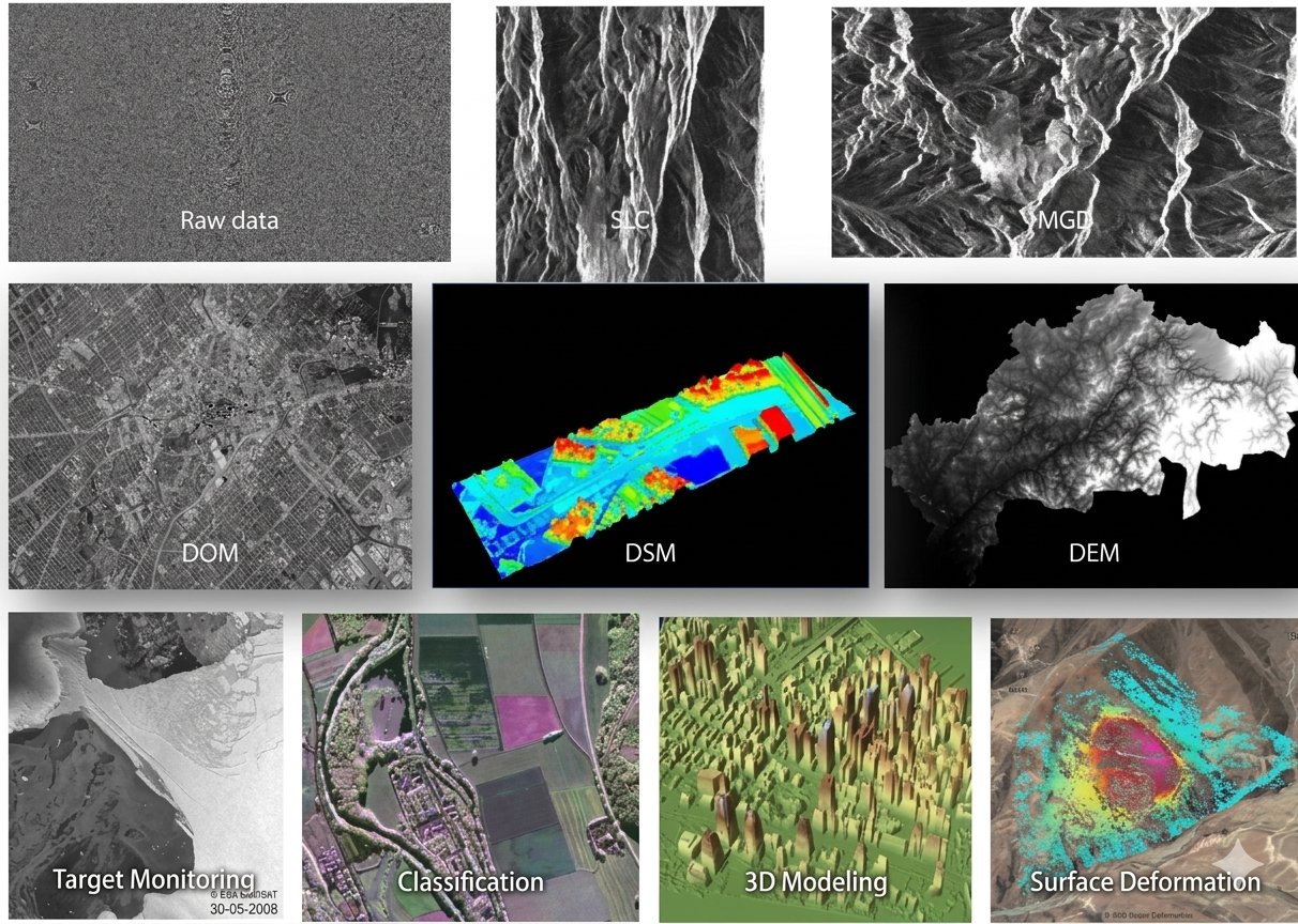 Tianjing Yunhu's independently developed (YunYuan SAR System) focuses on addressing the deformation monitoring needs across various industries. Operating in the L-band, the system integrates high-precision fiber optic inertial navigation, a high-performance servo stabilization platform, and utilizes differential interferometry (DInSAR) processing technology. This enables it to accurately detect millimeter-level minute deformations of targets such as the ground surface, buildings, and bridges, providing strong technical support for fields such as geological disaster early warning and infrastructure monitoring.
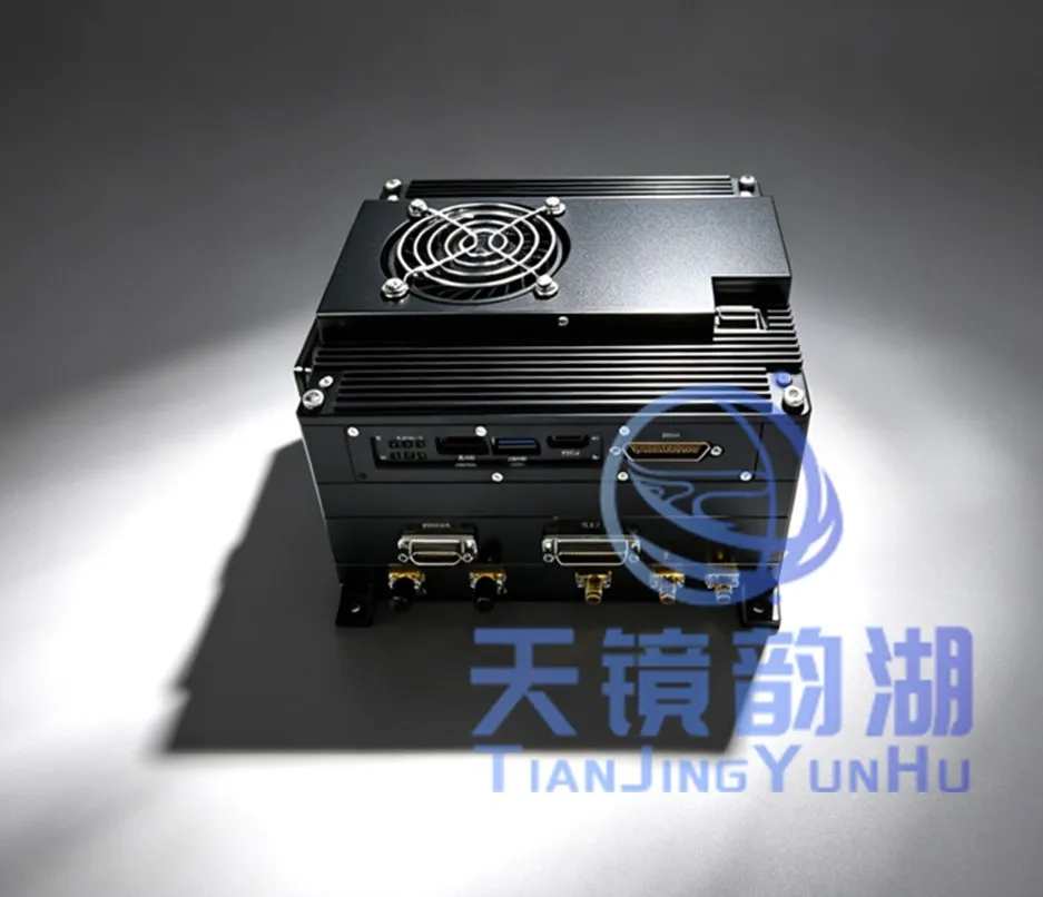
Image of the YunYuan SAR system
SAR Technology Characteristics:
1. All-weather, all-time observation: SAR technology is unaffected by weather, lighting conditions, or other natural factors, enabling all-weather, all-time observation—a capability lacking in traditional optical imagery.
2. High-resolution imaging: Through techniques such as synthetic aperture and pulse compression, SAR technology achieves high-resolution imaging of ground targets, providing precise data support for surveying and mapping.
3. Strong penetration: SAR technology possesses a certain degree of penetration capability, able to penetrate obstacles such as clouds, forests, and topsoil to obtain information about obscured ground features.
4. Interferometry: By recording the phase information of echoes, SAR sensors can perform differential interferometry (DInSAR) for monitoring surface deformation, etc.
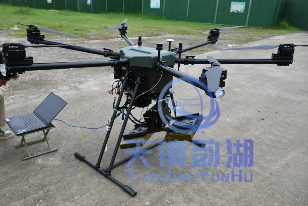
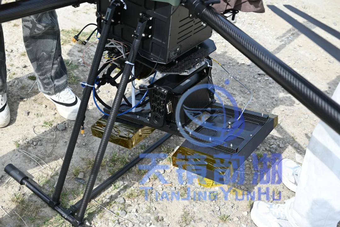
This differential interferometric deformation monitoring system can be flexibly mounted on various flight platforms, including multi-rotor UAVs, fixed-wing UAVs, and vertical takeoff and landing manned aircraft. The system adopts a quick-installation design, integrating the radar main unit, combined navigation, and antenna modules, eliminating the need for complex on-site debugging and significantly reducing operational preparation time. Whether it's emergency reconnaissance, geological disaster monitoring, or routine surveying and inspection, it can achieve rapid response and efficient operation.
 |
 |
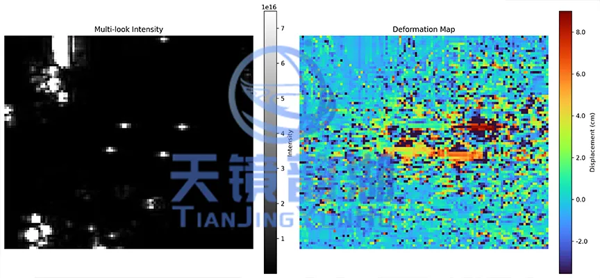
In actual flight tests, we used a Huanyu multi-rotor UAV equipped with RTK to achieve decimeter-level repeatability in track under level 2 wind conditions, ensuring the foundation for interferometry. First, high-precision trajectories were acquired through PPK post-processing, and then combined with imaging processing to generate single-polarization and fully polarized DOM images. Subsequently, GAMMA software was used to complete the standard interferometric process (precise registration, interferogram, baseline estimation, de-flattening, filtering, and phase-conversion deformation) to finally obtain the deformation field. Coherence analysis showed that the coherence coefficient was greater than 0.8 in farmland and building areas, less than 0.4 in water bodies due to specular reflection, and low in the impact of vehicles on roads, verifying that this system can maintain good interferometric capabilities even in vegetated areas.
SAR Core Applications:
1. Landslides and Collapses: Enables long-term, continuous monitoring of large-scale mountainous areas, capturing slow creep and displacement of mountains, providing crucial data for early warning and risk assessment of landslide disasters.
2. Ground Subsidence and Collapse: Effectively monitors regional ground subsidence caused by groundwater over-extraction, engineering construction, and surface collapse caused by mining.
3. Earthquakes and Volcanic Activity: Can be used to obtain coseismic deformation fields to study earthquake mechanisms; it can also monitor subtle surface deformation in volcanic areas to assist in assessing their activity.
4. Environmental and Coastal Monitoring: Can be used to monitor glacial drift, foundation settlement in reclaimed land areas, and assess the stability of permafrost and coastal zones.
5. Urban Infrastructure Monitoring: Monitors the stability of high-rise buildings, large stadiums, deep foundation pits, and other facilities. It can also be used to monitor surface deformation along long-distance water/oil and gas pipelines.








