
Tianjing Yunhu | Synthetic Aperture Radar (SAR) L-band Applied to Pipeline Leak Detection

Browse: 116 Time: 2026-02-06

L-band radars, with their core characteristics of strong long-range detection, good anti-interference, excellent penetration, and all-weather adaptability, are used in a wide range of fields, including military, civilian remote sensing, aviation and maritime, and meteorology.
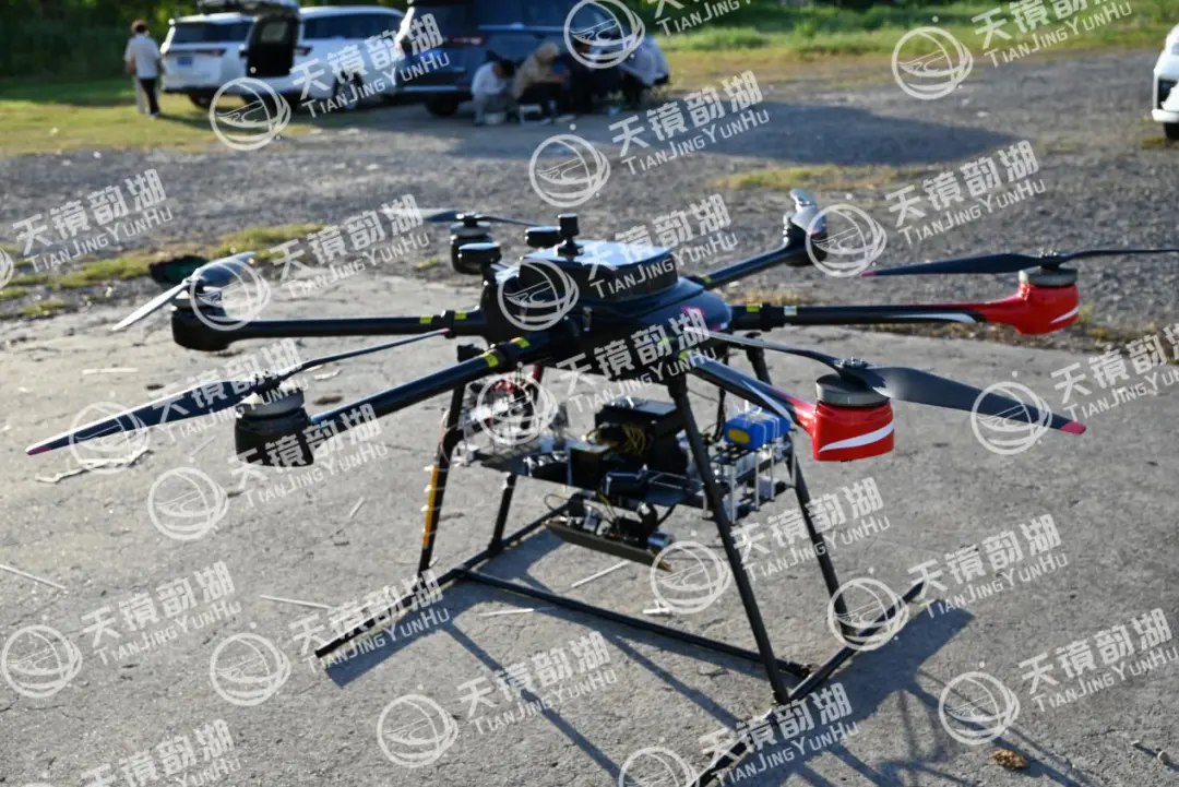
I. Why can SAR, especially the L-band, be used for leak detection?

Traditional leak detection relies on manual inspections, pressure monitoring, or infrared detection. SAR, however, provides a large-scale, all-weather, high-precision solution for monitoring surface deformation. Its physical basis for pipeline leak detection is:

Leaks cause surface deformation: Whether it's an oil, natural gas, or water pipeline, a high-pressure leak will erode and infiltrate the surrounding soil, causing millimeter-level or even centimeter-level micro-heavysmears or subsidence on the surface.

Radar interferometry technology: Synthetic aperture radar repeatedly images the same area via satellite or aircraft. By utilizing the phase difference between the two echo signals, it can accurately measure the minute deformation of the surface along the radar's line of sight during the two imaging periods. This is differential interferometric SAR technology.

II. Special advantages of the L-band

Strong penetration: The longer wavelength (15-30 cm) provides good penetration through vegetation canopies and dry surface cover, enabling the detection of deformation signals lightly covered by vegetation or beneath the surface soil.

Weak decoherence: Compared to the shorter wavelength C/X bands, L-band signals maintain coherence over longer time intervals, making them suitable for long-term time-series analysis. This is crucial for monitoring early signs of slowly developing leaks or assessing long-term impacts.

Sensitive to soil moisture: Leaks cause a sharp increase in soil moisture content, and changes in the soil dielectric constant significantly affect the backscattered signal of L-band radar, which is itself a leak indication signal.
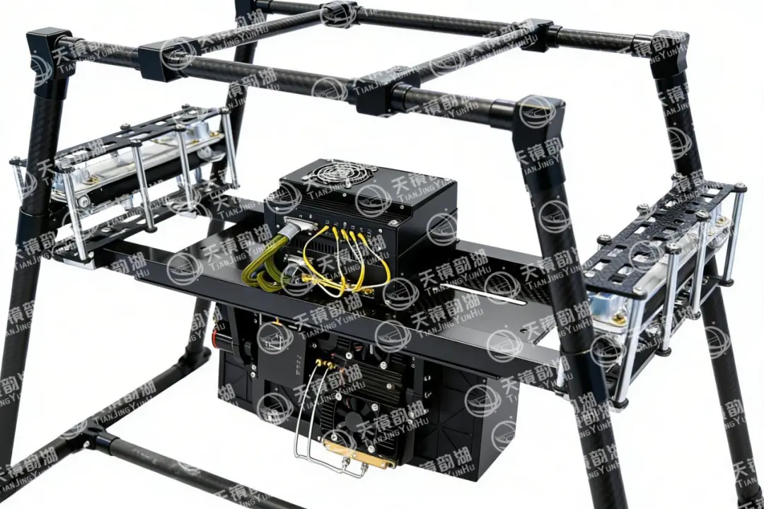
III. Application Advantages

Wide-area Coverage and Efficiency: A single scan can cover hundreds of kilometers of pipeline, making it particularly suitable for areas difficult to access manually, such as deserts, permafrost, and mountains, achieving a leap from "line" to "area" monitoring.

High Sensitivity and Foresight: Capable of detecting millimeter-level deformation, it may discover slowly developing underground hazards (such as small leaks or soil loosening) before a leak causes a major accident or obvious signs appear on the surface.

All-Weather and All-Time: Unaffected by sunlight or cloud cover, it can image at night, providing a stable and continuous data stream.

Historical Retrospective Capability: Archived data can be used for retrospective analysis, investigating historical leaks or assessing long-term geological hazard risks along the pipeline (such as the impact of landslides and subsidence on the pipeline).

IV. Airborne Miniature SAR System

Suzhou Tianjing Yunhu Intelligent Technology Co., Ltd. (hereinafter referred to as Tianjing Yunhu) is committed to becoming a leading global synthetic aperture radar solution provider, offering users customized radar equipment, SAR data acquisition services, and radar data products. With years of R&D experience and professional technical accumulation, Tianjing Yunhu has launched SAR products with multiple bands and various capabilities, including frequency-modulated continuous wave and pulse systems. Currently, Tianjing Yunhu provides coverage across multiple bands such as X, Ku, K, Ka, C, W, and L. Its product systems support single-polarization, full-polarization, strip, spotlight, interferometric, and single-pulse search modes, and feature real-time imaging, GMTI, and deformation monitoring. Tianjing Yunhu SAR products can be deployed on multi-rotor/fixed-wing UAVs, manned aircraft, satellites, and vehicle-mounted platforms.


Related Information

Related Information
2026.08.28

Tianjing Yunhu | MiniSAR: Full Polarimetric Imaging Capability

In the field of remote sensing today, synthetic aperture radar (SAR), visible light, and infrared together form a multi-layered observation system. Visible light remote sensing is intuitive and clear, while infrared remote sensing excels at thermal sensing. However, both are passive detection methods, heavily reliant on sunlight or the target's own thermal radiation. Once they encounter cloud cover, nightfall, or rainy/foggy weather, their detection capabilities are significantly reduced or even completely lost.
2026.08.26

Tianjing Yunhu | P-band Airborne SAR Radar System

Low-frequency radars (such as P-band and L-band radars) can "see farther and see more clearly" because of their longer wavelengths, lower attenuation, and reduced sensitivity to stealth coatings. In modern air defense systems, they are key to anti-stealth radars. They can penetrate 1-meter-thick camouflage netting and 3-meter-thick bushes to identify hidden tanks and radar stations, and are less likely to trigger enemy warning systems, demonstrating significant advantages in covert detection.
2026.08.21

Tianjing Yunhu | Miniature SAR Vehicle Target Dataset

Synthetic Aperture Radar (SAR) target detection datasets are a core foundation for training and evaluating deep learning models. These datasets cover various target types, including ships, aircraft, vehicles, bridges, and oil tanks, and are applicable to multiple fields such as military reconnaissance, maritime monitoring, and traffic management. They not only provide high-resolution SAR images but also contain precise annotation information (category, location, size, etc.), ensuring improved algorithm performance.
2026.08.17

Tianjing Yunhu | Miniature SAR Equipped with Fixed-Wing UAV

Today's main focus is on the CW-25E VTOL fixed-wing UAV and the Tianjing Yunhu XiangYun System pulse MiniSAR.

The CW-25E is a pure electric VTOL fixed-wing UAV designed specifically for large-area missions. It has a fuselage length of 2.08 meters, a wingspan of 4.35 meters, and features a twin-boom fused inverted V-tail design, resulting in a compact structure and excellent aerodynamic performance.

The CW-25E has a maximum takeoff weight of 31.58 kg and a payload capacity of 6.6 kg, capable of simultaneously carrying various mission equipment such as SAR, lidar, and electro-optical pods. It boasts a maximum endurance of 150 to 240 minutes, a service ceiling of 6000 meters, a maximum takeoff altitude of 4000 meters, and wind resistance up to level 7. It can stably perform patrol missions in complex terrain and high-altitude areas.
2026.07.18

Tianjing Yunhu | Airborne SAR (Synthetic Aperture Radar) Calibration Capability

Airborne SAR (Synthetic Aperture Radar) calibration refers to the calibration of various parameters of an airborne SAR system using specific methods to eliminate systematic and environmental errors, thereby ensuring the quality of SAR images, positioning accuracy, and the accuracy of inversion parameters. Airborne SAR calibration is mainly divided into three categories: geometric calibration, radiometric calibration, and polarimetric calibration.
2026.07.13

UAV L-band Heavy Orbit Interferometric SAR System: Airborne Verification for Millimeter-Level Deformation Monitoring

Synthetic Aperture Radar Interferometry (InSAR) technology, with its all-weather, 24/7 capability and high sensitivity to surface deformation, has become an important tool for geological hazard monitoring, ground subsidence investigation, and infrastructure health diagnosis. Integrating InSAR technology onto unmanned aerial vehicle (UAV) platforms further overcomes the limitations of long satellite revisit cycles, insufficient maneuverability, and high costs associated with manned operations, providing a new approach for regional, high-frequency, and high-precision deformation monitoring. However, the small size and susceptibility of UAV platforms to airflow disturbances make it difficult to maintain consistent flight paths during repeated flights, posing a significant challenge to double-track interferometry processing.

Online Message

Company Address

Company Address

Room 801, Building 14, No. 135 Zhangji Road, Kunshan Development ZoneView the map
Emaile

Email

tjyh888@139.com
Postal Code

Postal Code

215300
Sales contact information

Sales contact information

  • Sales 1:18252999418 (same WeChat)
  • Sales 2:13126758269 (same WeChat/Whatsapp)
  • Sales 3:15862678208 (same WeChat)
  • Sales 4:15895462772 (same WeChat/Whatsapp)
验证码
Submit

Contact Us

关注我们
关注我们




