

In modern warfare, there's a famous saying: "Artillery is the god of war." However, even the most powerful artillery is like "blind men touching an elephant" without precise intelligence guidance.
Traditional reconnaissance methods are often limited by darkness, fog, or terrain. But today, a technology called "Synthetic Aperture Radar (SAR)" is revolutionizing artillery reconnaissance. It allows satellites hundreds of kilometers in space to clearly see a tank on the ground, providing clear battlefield images even in cloudless daylight or stormy nights.
Today, we'll unveil the mystery of this "sky eye" reconnaissance soldier.
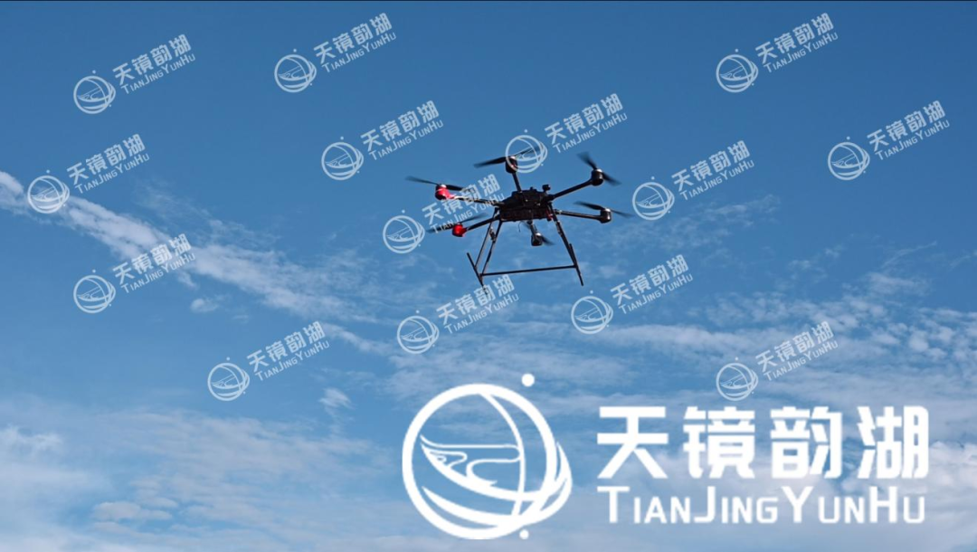
What is Miniature Airborne SAR? — A "Flashlight" in the Sky
Airborne synthetic aperture radar (SAR), simply put, is an active microwave imaging radar mounted on a satellite.
Unlike common optical satellites (which rely on sunlight reflection for imaging, similar to taking a picture), SAR radar has its own light source. It actively transmits microwave signals towards the ground and then receives the echoes reflected back from the ground, forming an image through complex signal processing.
Its core advantage lies in its "all-day, all-weather" capability:
Unaffected by darkness: It does not rely on sunlight and can work day and night.
Unaffected by fog: Microwaves can penetrate clouds, rain, fog, and even sandstorms.
Unaffected by terrain: Not limited by high mountains or deep valleys, it can cover a large area of the ground.
A new "external attachment" for artillery: What can SAR do?
For artillery, introducing miniature airborne SAR technology is not just about replacing a camera; it's an upgrade to the entire reconnaissance system. It primarily functions in the following four dimensions:
1. Detecting "Moving Prey" (Moving Target Detection)
In modern warfare, enemy missile vehicles and tanks often operate on a hit-and-run basis. Traditional satellites may only capture a single static image.
However, miniature airborne SAR combined with GMTI (Ground Moving Target Detection) technology can not only detect moving vehicles but also measure their speed. While low-speed target detection still faces challenges, the latest multi-channel technology can control speed measurement errors to an extremely small range, leaving enemy mobile equipment nowhere to hide.
2. Creating "Battlefield Maps" (Surveying and Geodesy)
Before artillery fires, it must know the precise coordinates of the position and the terrain undulations. Miniature airborne SAR, utilizing InSAR (Interferometric Surveying) technology, can generate high-precision digital elevation models (DEMs).
This is akin to performing a 3D scan of the battlefield. Artillery units can see the high ground and obstructions on a computer without being physically present, thus autonomously configuring and precisely locating their positions. 3. Assessing "Results" (Damage Assessment)
After a fire strike, the commander's primary concern is "Did we hit the target?"
Miniature airborne SAR can visually demonstrate the target's damage by comparing images before and after the strike (change detection), and even using 3D imaging technology.
4. Real-time "Battlefield Surveillance" (Wide-Area Reconnaissance)
SAR enables real-time dynamic surveillance of a large-scale battlefield. It can penetrate camouflage nets and detect convoys hidden in forests, providing artillery with macroscopic battlefield situational awareness.
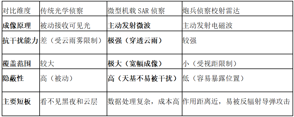
Technology Comparison: SAR Radar vs. Traditional Reconnaissance
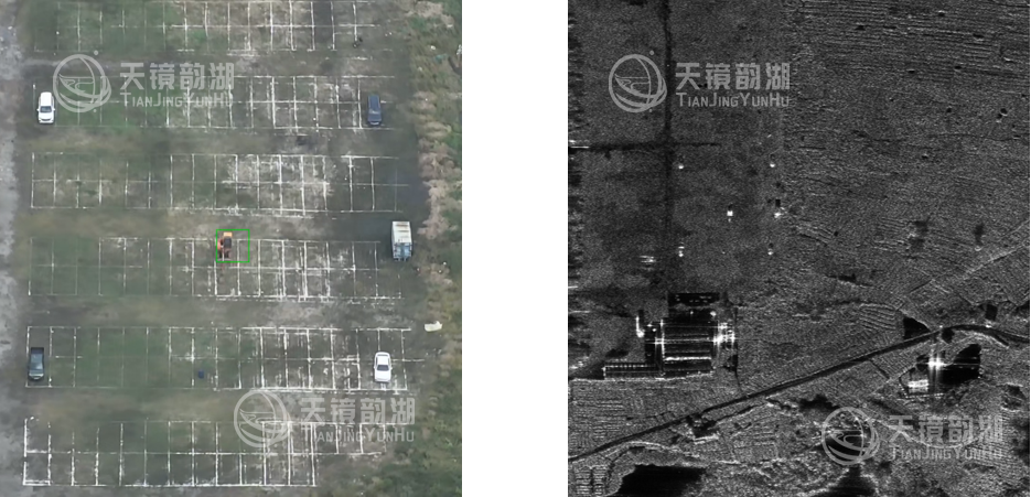
Comparison: Optical image vs. SAR image
To more intuitively understand the advantages of SAR, we will compare it with traditional methods:
Future Outlook: Smaller, Faster, Stronger
While miniature airborne SAR technology is powerful, it also faces challenges such as high cost and high power consumption.
However, we must always believe that the future trend is "miniature SAR networking." Just as mobile phones evolved from "brick" phones to smartphones, future miniature airborne SAR will become smaller and cheaper, becoming an indispensable sensor on every aircraft.
For artillery, this means:
1. Shorter revisit time: Reduced from hours to minutes, achieving true near-real-time reconnaissance.
2. Fewer blind spots: Multi-angle, multi-frequency joint observation renders any camouflage ineffective.
3. Enhanced autonomous combat capability: Frontline units can directly receive real-time imaging data, achieving "detect and destroy."
Conclusion
Miniature airborne SAR technology is pushing artillery reconnaissance to a new level. It is not only a technological innovation but also a transformation in tactical thinking. On the battlefields of the future, whoever can more efficiently utilize this flexible and free "eagle eye" will gain the upper hand in firepower confrontations, truly achieving "detection equals strike, strike equals destruction."
Airborne Miniature SAR System
Suzhou Tianjing Yunhu Intelligent Technology Co., Ltd. (hereinafter referred to as Tianjing Yunhu) is committed to becoming a leading global provider of synthetic aperture radar (SAR) solutions, offering users customized radar equipment, SAR data acquisition services, and radar data products. Leveraging years of R&D experience and professional technical accumulation, Tianjing Yunhu has launched SAR products with multiple bands and various capabilities, including frequency-modulated continuous wave (FM) and pulse systems. Currently, Tianjing Yunhu has coverage across multiple bands, including X, Ku, K, Ka, C, W, and L, and its product systems support single-polarization, full-polarization, strip, spotlight, interferometric, and single-pulse search modes. The products feature real-time imaging, GMTI, and deformation monitoring functions. Tianjing Yunhu SAR products can be mounted on multi-rotor/fixed-wing UAVs, manned aircraft, satellites, and vehicle-mounted platforms.








